MyTopo
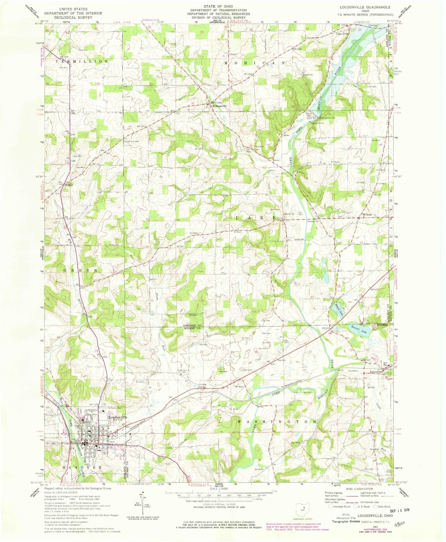
Classic USGS Loudonville Ohio 7.5'x7.5' Topo Map
Couldn't load pickup availability
Historical USGS topographic quad map of Loudonville in the state of Ohio. Map scale may vary for some years, but is generally around 1:24,000. Print size is approximately 24" x 27"
This quadrangle is in the following counties: Ashland, Holmes, Wayne.
The map contains contour lines, roads, rivers, towns, and lakes. Printed on high-quality waterproof paper with UV fade-resistant inks, and shipped rolled.
Contains the following named places: Bald Knob, Big Run School, Blue Ridge School, Bonnett Lake, Budd Elementary School, County Line Cemetery, Crab Run, Emrick School, Kettering Hospital Heliport, Lake Fork, Lakefork Post Office, Lakeville, Lakeville Elementary School, Loudonville, Loudonville Cemetery, Loudonville Church of the Nazarene, Loudonville Fire Department, Loudonville High School, Loudonville Police Department, Loudonville Post Office, McKay, McKay Cemetery, McKay Post Office, McMullen Elementary School, McZena, McZena Post Office, Mohicanville, Mohicanville Cemetery, Mohicanville Dam, Mohicanville Reservoir, Nesta Airport, Old Sixteen Cemetery, Pioneer Cemetery, Plum Run, Plum Run Cemetery, Ridge School, Round Lake, Saint Peters Catholic Church, Saint Peters Cemetery, Synagogue Cemetery, Tea Hills Organic Farm, Township of Lake, Township of Washington, Village of Loudonville, ZIP Codes: 44638, 44842