
MyTopo
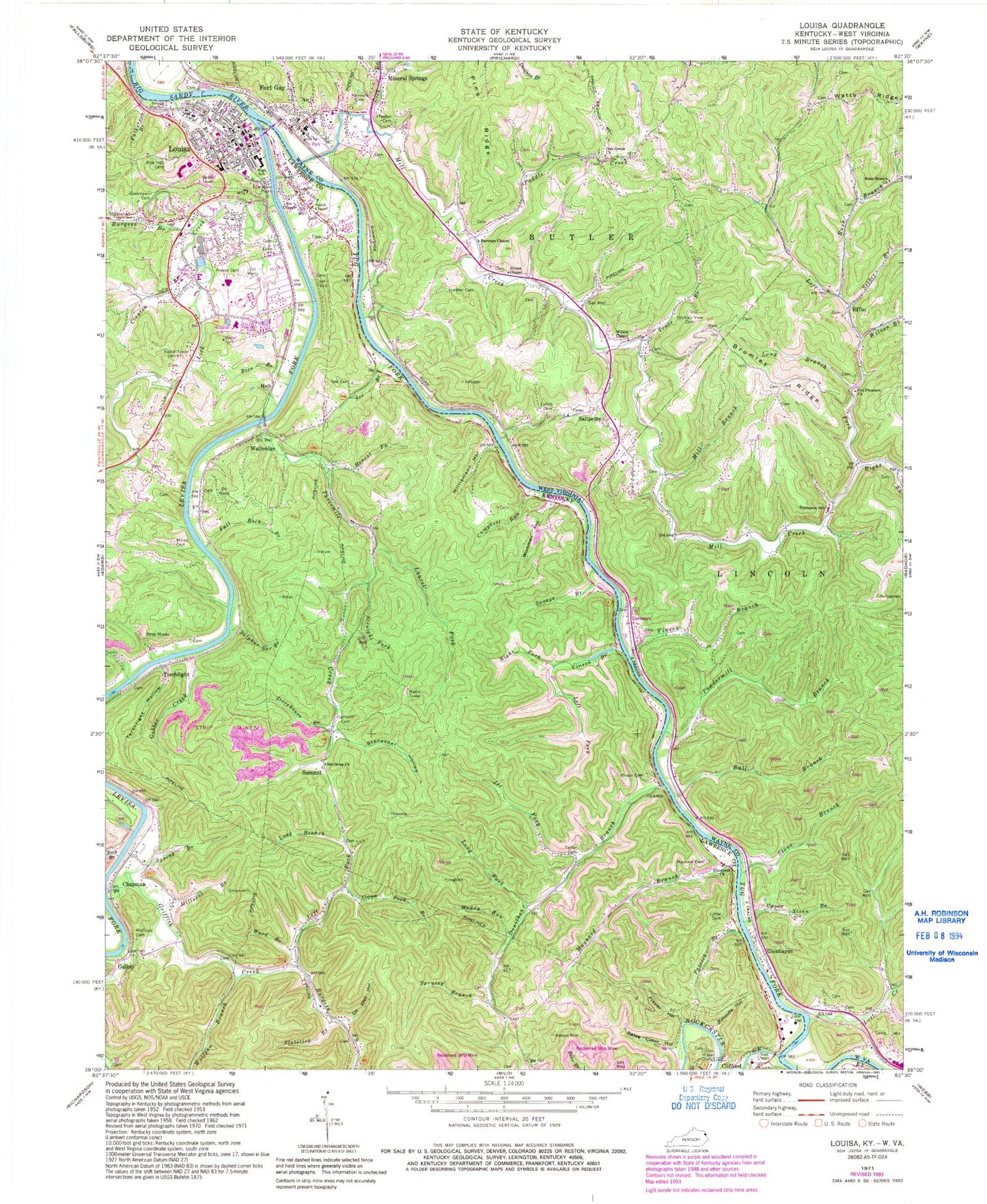
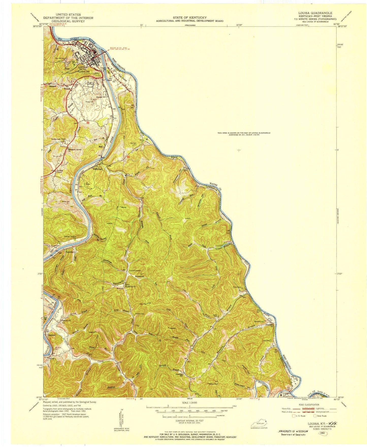
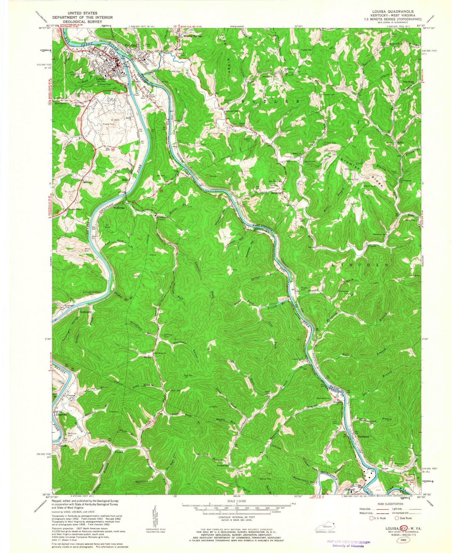
Classic USGS Louisa Kentucky 7.5'x7.5' Topo Map
Couldn't load pickup availability
Historical USGS topographic quad map of Louisa in the states of Kentucky, West Virginia. Typical map scale is 1:24,000, but may vary for certain years, if available. Print size: 24" x 27"
This quadrangle is in the following counties: Lawrence, Wayne.
The map contains contour lines, roads, rivers, towns, and lakes. Printed on high-quality waterproof paper with UV fade-resistant inks, and shipped rolled.
Contains the following named places: Contrary Branch, Bates Cabin Hollow, Burgess Branch, Burgess Fork, Campbell Run, Cartmill Cemetery, Chapman, Clayton Branch, Cynthia Chapel, Donithan Branch, Elizabeth Church, Elouise United Baptist Church, Fall Rock Branch, Frazier Hollow, Fulkerson Branch, Gobber Creek, Greenlawn Cemetery, Griffin Creek, Honest Fork, Joe Fork, Laurel Fork, Left Fork Griffin Creek, Left Fork Vinson Branch, Levisa Fork, Lick Creek, Little Cemetery, Long Branch, Long Fork, Louisa, Maynard Branch, Maynard Cemetery, McClure Cemetery, Miller Cemetery, Millseat Branch, Muddy Run, Northrup Church, Oil Well Hollow, Patrick Branch, Pine Hill Cemetery, Preece Cemetery, Ratcliffe Hollow, Rice Branch, Right Fork Vinson Branch, Rockcastle Creek, Savage Branch, See Branch, See Chapel, Slatelick Branch, Spring Branch, Sprucey Branch, Stonecoal Hollow, Storehouse Branch, Straight Fork, Sulphur Spring Branch, Taylor Cemetery, The Point, Threemile Creek, Torchlight Hollow, Town Branch, Vinson Branch, Vinson Cemetery, Ward Branch, Williamson Hollow, Wolfpen Branch, Workman Hollow, Zock Branch, Clifford, Gallup, Holt, Summit, Torchlight, Walbridge, Owen Peck Branch, See Cemetery, WVKY-AM (Louisa), Smoky Valley (historical), Field Branch, Gavitts Branch, Drinking Branch, Castle Hollow, Eloise Railroad Station (historical), Gallup-Chapman United Methodist Church, Donathon (historical), Clifford Post Office (historical), Donathon Post Office (historical), Gallup Post Office, Vinson Post Office (historical), Walbridge Post Office (historical), Emerson - Stratton Cemetery, Franklin Cemetery, Miller Cemetery, Donathon Church (historical), Elizabeth Jarrell Church (historical), Summit Church (historical), US Lock Number 1 on the Levisa Fork (historical), US Lock Number 1 Tug River (historical), Chapman Railroad Station (historical), Falls of Tug, Frazier Bottom, Gallop Railroad Station (historical), Pecks Railroad Station (historical), Summit Railroad Station (historical), Maynard Post Office (historical), Clifford School, Donathon School (historical), Gallop School (historical), Lower Lick Creek School (historical), Summit School (historical), Tourch Light School (historical), Walbridge School (historical), City of Louisa, Louisa Fire Department Station 2, Louisa Fire Station 1, Three Rivers Medical Center, Louisa Police Department, Lawrence County Sheriff's Office, Louisa Post Office, Bartram Chapel, Bromley Ridge, Bull Branch, Fairview Cemetery, Frasher Cemetery, Frasher Cemetery, Glenhayes, Hickory View Cemetery, Left Fork Mill Creek, Lick Branch, Long Branch, Lost Creek, Lower Right Fork, Lynch Cemetery, Mill Branch, Mill Creek, Oak Grove Church, Old Pleasant Church, Paddle Creek, Peters Chapel, Pine Ridge, Powdermill Branch, Pratt Branch, Right Fork Mill Creek, Rush Branch, Rush Branch Church, Selbee Branch, Stone Branch, Thompson School (historical), Trace Branch, Tug Fork, Upper Stone Branch, Wilson Branch, Wilson Chapel, Effie, Fort Gay, Mineral Springs, Saltpetre, Fort Gay Post Office, Fort Gay Elementary School, Fort Gay PK - 8 School, Tolsia High School, Louisa and Fort Gay Bridge, Lock and Dam 3, Town of Fort Gay, Fort Gay Volunteer Fire Department, Fort Gay Public Library, Fort Gay Police Department, Contrary Branch, Bates Cabin Hollow, Burgess Branch, Burgess Fork, Campbell Run, Cartmill Cemetery, Chapman, Clayton Branch, Cynthia Chapel, Donithan Branch, Elizabeth Church, Elouise United Baptist Church, Fall Rock Branch, Frazier Hollow, Fulkerson Branch, Gobber Creek, Greenlawn Cemetery, Griffin Creek, Honest Fork, Joe Fork, Laurel Fork, Left Fork Griffin Creek, Left Fork Vinson Branch, Levisa Fork, Lick Creek, Little Cemetery, Long Branch, Long Fork, Louisa, Maynard Branch, Maynard Cemetery, McClure Cemetery, Miller Cemetery, Millseat Branch, Muddy Run, Northrup Church, Oil Well Hollow, Patrick Branch, Pine Hill Cemetery, Preece Cemetery, Ratcliffe Hollow, Rice Branch, Right Fork Vinson Branch, Rockcastle Creek, Savage Branch, See Branch, See Chapel, Slatelick Branch, Spring Branch, Sprucey Branch, Stonecoal Hollow, Storehouse Branch, Straight Fork, Sulphur Spring Branch, Taylor Cemetery, The Point, Threemile Creek, Torchlight Hollow, Town Branch, Vinson Branch, Vinson Cemetery, Ward Branch, Williamson Hollow, Wolfpen Branch, Workman Hollow, Zock Branch, Clifford, Gallup, Holt, Summit, Torchlight