MyTopo
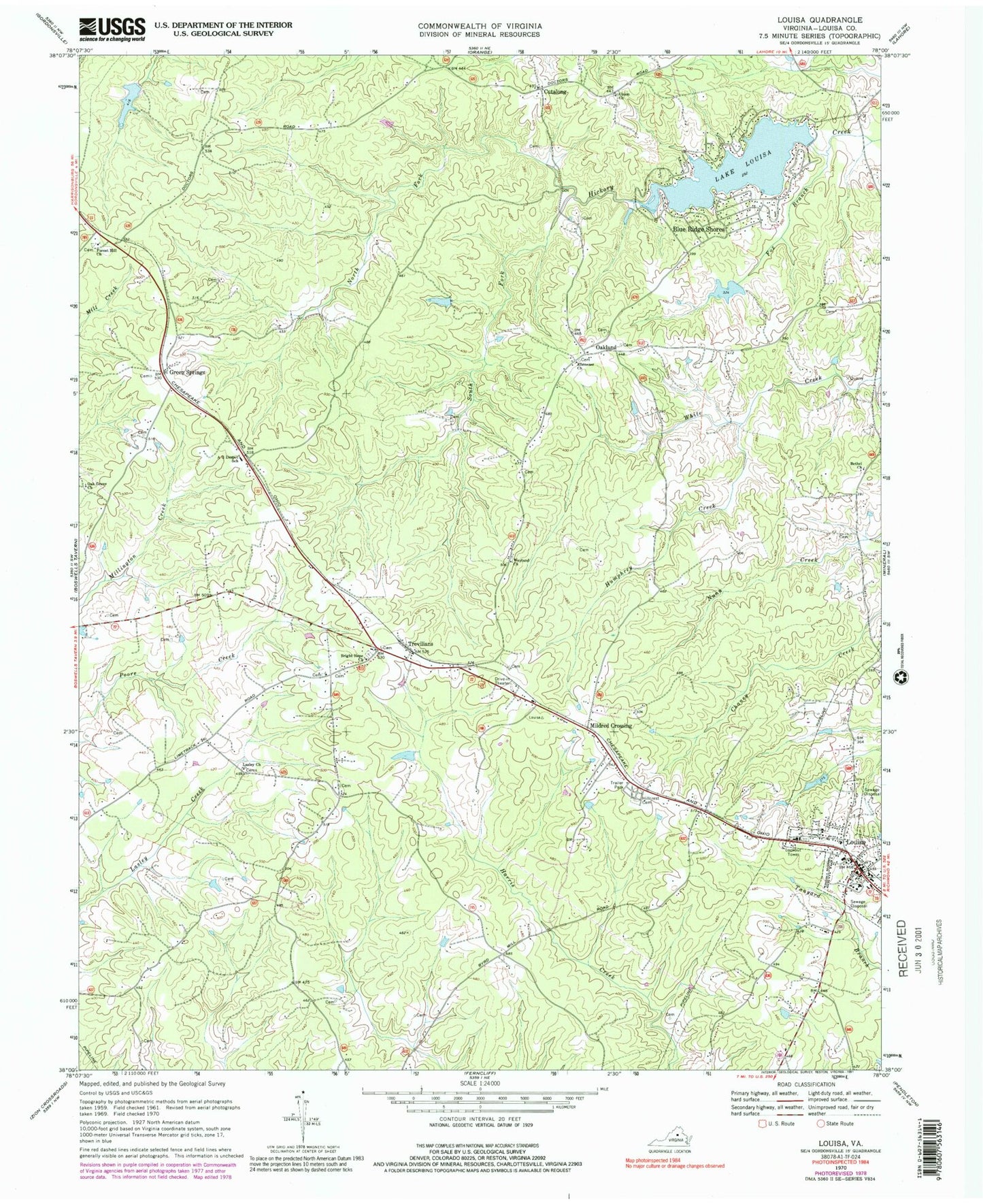
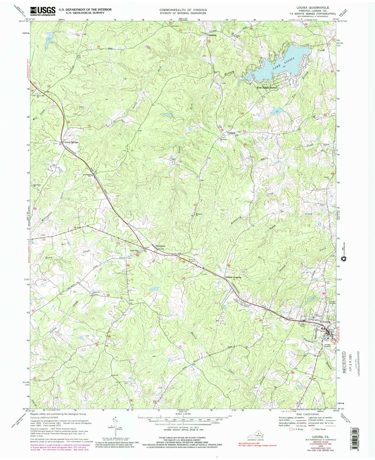
Classic USGS Louisa Virginia 7.5'x7.5' Topo Map
Couldn't load pickup availability
Historical USGS topographic quad map of Louisa in the state of Virginia. Map scale may vary for some years, but is generally around 1:24,000. Print size is approximately 24" x 27"
This quadrangle is in the following counties: Louisa.
The map contains contour lines, roads, rivers, towns, and lakes. Printed on high-quality waterproof paper with UV fade-resistant inks, and shipped rolled.
Contains the following named places: A G Despot School, Bethel Church, Blue Ridge Shores, Blue Ridge Shores Census Designated Place, Bright Hope Church, Cutalong, Ebenezer Church, Forest Hill Church, Fox Branch, Green Springs, Green Springs Depot Post Office, Hillcrest Cemetery, Humphrey Creek, Kents Mill, Lake Louisa, Lake Louisa Dam, Lasley, Lasley Church, Louisa, Louisa County Courthouse, Louisa County Department of Fire and Emergency Services, Louisa County Sheriff's Office, Louisa District, Louisa Post Office, Meyerton Dam, Meyerton Lake, Mildred Crossing, North Fork Hickory Creek, Oak Grove Church, Oakland, Oakland Cemetery, Oakland Post Office, Ponda Roche Dam, Ponda Roche Lake, Small Country Lake, Small Dam, South Fork Hickory Creek, Talleys Store, Taylor Cemetery, Trevilians, Trevilians Elementary School, Trevilians Post Office, Trevilians Volunteer Fire Department Company 6, Trevillians Volunteer Fire / Rescue Department, Union Church, Weyland Church, WLSA-FM (Louisa), ZIP Code: 23093