MyTopo
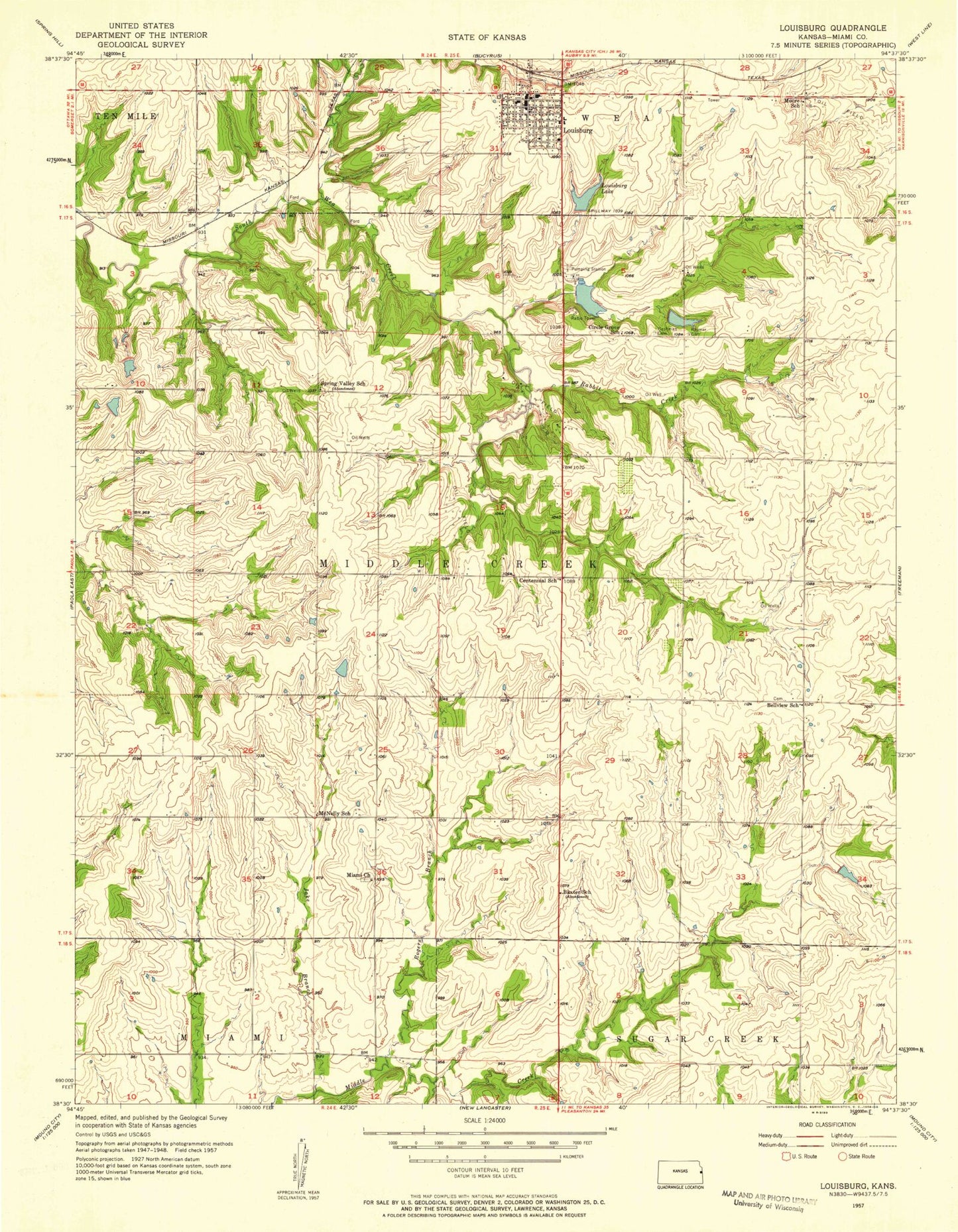
Classic USGS Louisburg Kansas 7.5'x7.5' Topo Map
Couldn't load pickup availability
Historical USGS topographic quad map of Louisburg in the state of Kansas. Map scale may vary for some years, but is generally around 1:24,000. Print size is approximately 24" x 27"
This quadrangle is in the following counties: Miami.
The map contains contour lines, roads, rivers, towns, and lakes. Printed on high-quality waterproof paper with UV fade-resistant inks, and shipped rolled.
Contains the following named places: Baxter School, Bellview School, Broadmoor Elementary School, Cashman Cemetery, Centennial School, Christ Our Savior Lutheran Church, Circle Grove Elementary School, City of Louisburg, Crosswind Airfield, First Baptist Church, First Christian Church, Fox Hall Community Building, Herman Cemetery, Immaculate Conception Catholic Church, Jake Branch, Louisburg, Louisburg Aquatic Center, Louisburg Cemetery, Louisburg Cemetery - New, Louisburg City Dam, Louisburg City Hall, Louisburg Fire Department, Louisburg High School, Louisburg Lake, Louisburg Library, Louisburg Middle School, Louisburg Municipal Wastewater Treatment Plant Number 1, Louisburg Police Department, Louisburg Post Office, Louisburg Unified School District Office, Louisburg United Methodist Church, Louisburg Wastewater Treatment Plant Number 2, McNelly School, Metcalf Ridge Country Course, Miami Cemetery, Miami Emergency Medical Services Station 2, Miami Presbyterian Church, Moore School, Peoria Street Learning Center, Rabbit Creek, Reed Cemetery, Rodgers Branch, Rutlader Outpost Camping Facility, Saint Mary's Cemetery, Settle Cemetery, Somerset Airport, Spring Valley School, Township of Middle Creek, Wilson - Raymer Cemetery, ZIP Code: 66053