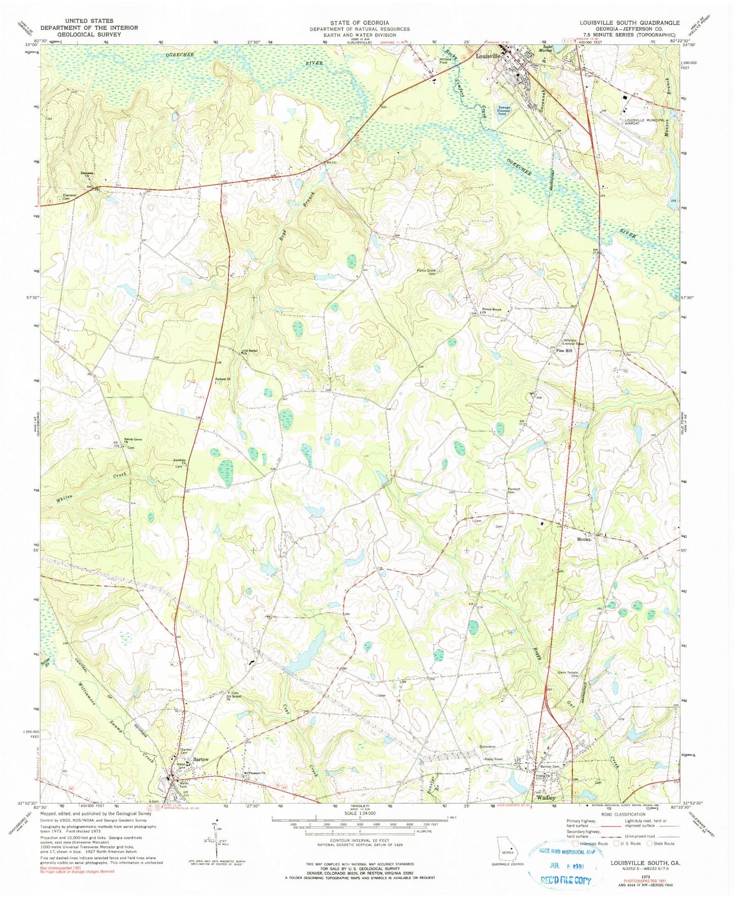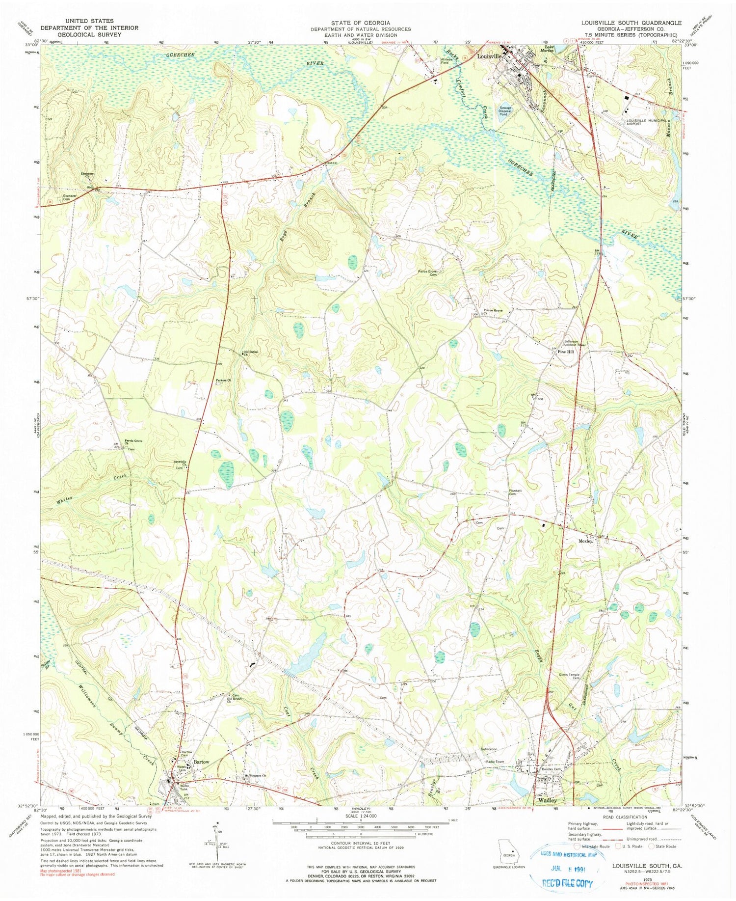
MyTopo
Classic USGS Louisville South Georgia 7.5'x7.5' Topo Map
Couldn't load pickup availability
Historical USGS topographic quad map of Louisville South in the state of Georgia. Map scale may vary for some years, but is generally around 1:24,000. Print size is approximately 24" x 27"
This quadrangle is in the following counties: Jefferson.
The map contains contour lines, roads, rivers, towns, and lakes. Printed on high-quality waterproof paper with UV fade-resistant inks, and shipped rolled.
Contains the following named places: Aldreds, Apostolic Church, Bartow, Bartow Church Cemetery, Bartow High School, Bartow Police Department, Bartow Post Office, Bartow Volunteer Fire Department, Battle Pond, Battle Pond Dam, Bentley Cemetery, Boyd Branch, City of Louisville, Cobb Lake, Cobb Lake Dam, Ebenezer Cemetery, Ebenezer Church, Glenn Temple Cemetery, Jefferson County Courthouse, Jefferson County Training School, Jefferson Lookout Tower, Kelly Lake, Kelly Lake Dam, Lewis Grove School, Louisville Municipal Airport, Louisville Volunteer Fire Department, Manson Branch, McNeely Lake, McNeely Lake Dam, Mount Pleasant Church, Moxley, Moxley Church Cemetery, Moxley Junior High School, Old Bethel Church, Old Bethel Church Cemetery, Parkers Chapel Church Cemetery, Parkers Church, Pervis Grove Church, Pierce Grove Cemetery, Pierce Grove Church, Pierce Grove Church Cemetery, Pine Hill, Plunkett Cemetery, Rocky Comfort Creek, Salter Branch, Savannah Branch, Smith Lake, Smith Lake Dam, Thomas Lake, Thomas Lake Dam, Town of Bartow, Trinity Church, Weeks Lake, Weeks Lake Dam