MyTopo
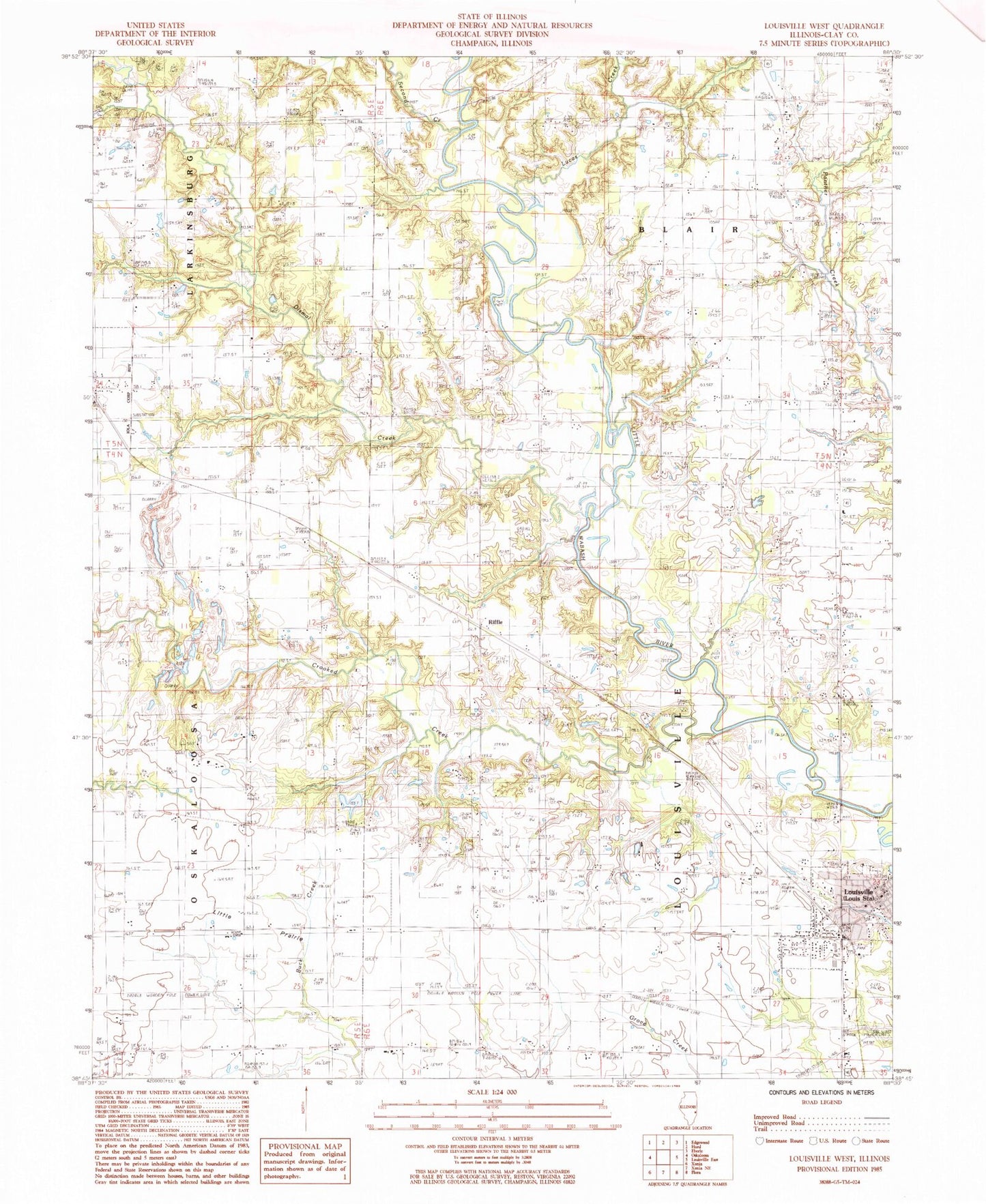
Classic USGS Louisville West Illinois 7.5'x7.5' Topo Map
Couldn't load pickup availability
Historical USGS topographic quad map of Louisville West in the state of Illinois. Map scale may vary for some years, but is generally around 1:24,000. Print size is approximately 24" x 27"
This quadrangle is in the following counties: Clay.
The map contains contour lines, roads, rivers, towns, and lakes. Printed on high-quality waterproof paper with UV fade-resistant inks, and shipped rolled.
Contains the following named places: Bethel Church, Burge Cemetery, Christian Home Cemetery, Christian Home Church, Clay County Courthouse, Crooked Creek, Dismal Creek, Fender School, Little Prairie, Little Prairie Church, Locust Grove School, Louisville, Louisville City Hall, Louisville Post Office, Lucas Creek, Maple Grove School, Newton Chapel, Newton Chapel Cemetery, North Clay Community High School, North Clay Elementary-Junior High School, North Clay Fire Protection District, Old Louisville Cemetery, Old Union Cemetery, Old Union Church, Orchard Hill Cemetery, Oskaloosa Oil Field, Red Brush Cemetery, Red Brush Church, Riffle, Riffle Cemetery, Rogers Cemetery, Speaks Cemetery, Tolliver Cemetery, Township of Blair, Township of Louisville, Village of Louisville, Wabash Church, Woods Cemetery