MyTopo
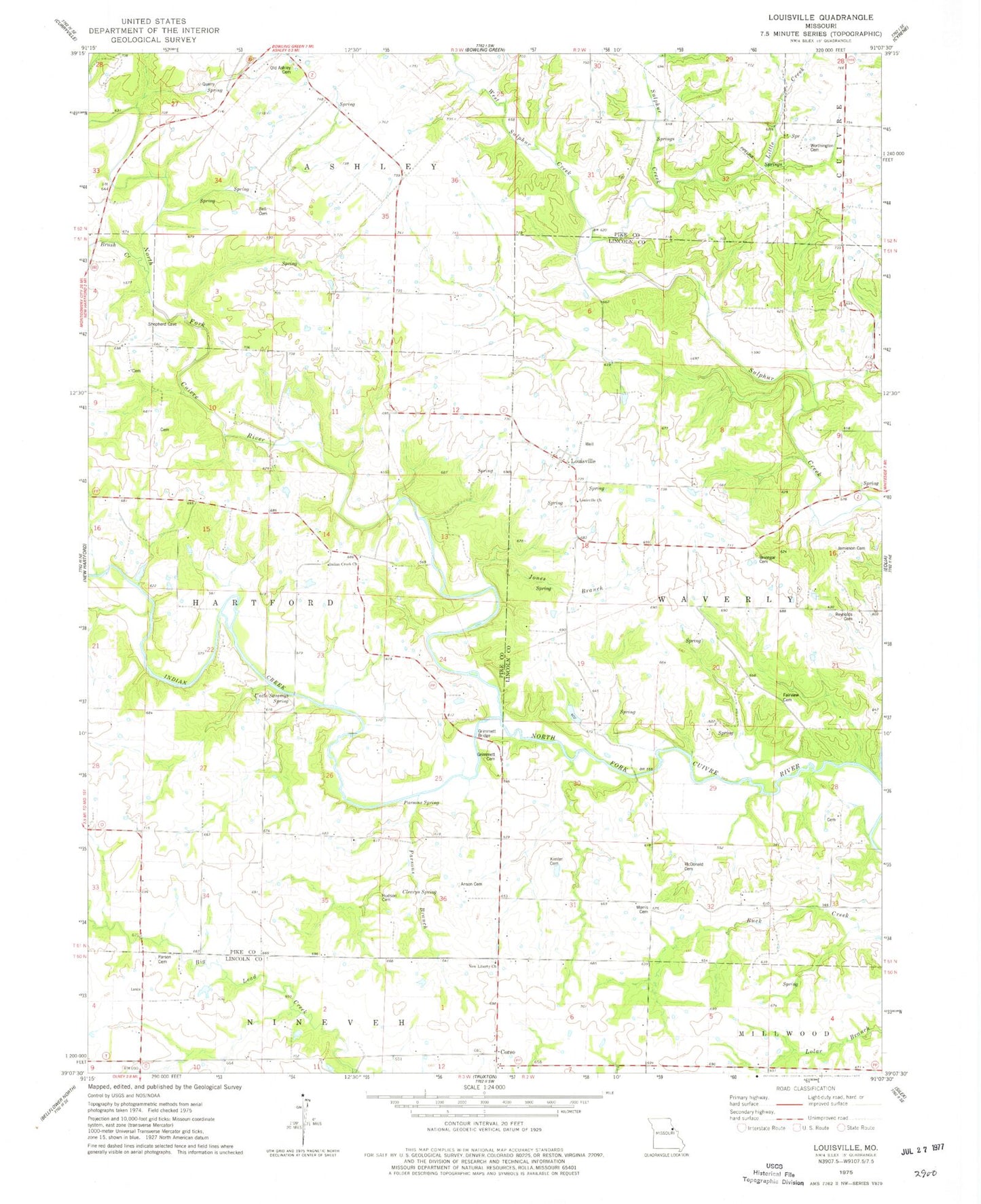
Classic USGS Louisville Missouri 7.5'x7.5' Topo Map
Couldn't load pickup availability
Historical USGS topographic quad map of Louisville in the state of Missouri. Map scale may vary for some years, but is generally around 1:24,000. Print size is approximately 24" x 27"
This quadrangle is in the following counties: Lincoln, Pike.
The map contains contour lines, roads, rivers, towns, and lakes. Printed on high-quality waterproof paper with UV fade-resistant inks, and shipped rolled.
Contains the following named places: Anson Cemetery, Bell Cemetery, Bilbro School, Brinegar Cemetery, Brush Creek, Butler School, Copper Spring School, Corso, Coxs Mill, Fairview Cemetery, Fairview Church, Grimmett Bridge, Grimmett Cemetery, Henton School, Hildrey, Hildrey Post Office, Hudson Cemetery, Indian Creek, Indian Creek Church, Indian Creek School, Jamieson Cemetery, Jones Branch, Kimler Cemetery, Little Creek, Louisville, Louisville Cemetery, Louisville Church, Louisville School, McDonald Cemetery, Morris Cemetery, Morris Ford Bridge, New Liberty Church, Old Ashley Cemetery, Parson Cemetery, Parsons Branch, Parsons Spring, Pleasant Grove School, Reliable Chemical Company Lake, Reliable Chemical Company Lake Dam, Reynolds Cemetery, Robinson School, Township of Waverly, Uncle Sammys Spring, West Sulphur Creek, Worthington Cemetery