MyTopo
Classic USGS Love Point Maryland 7.5'x7.5' Topo Map
Regular price
$16.95
Regular price
Sale price
$16.95
Unit price
per
Couldn't load pickup availability
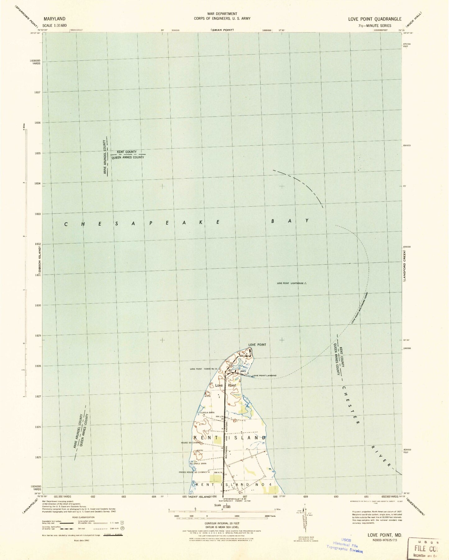
Historical USGS topographic quad map of Love Point in the state of Maryland. Map scale may vary for some years, but is generally around 1:24,000. Print size is approximately 24" x 27"
This quadrangle is in the following counties: Anne Arundel, Kent, Queen Anne's.
The map contains contour lines, roads, rivers, towns, and lakes. Printed on high-quality waterproof paper with UV fade-resistant inks, and shipped rolled.
Contains the following named places: Bridge View, Camp Saint Martin, Chester River, Chester River Landing, District 5 Edesville, Love Point, Love Point Landing, Love Point Lighthouse, Lower Five Fathoms Buoy, Mylanders Airstrip, Sleamb Wharf