MyTopo
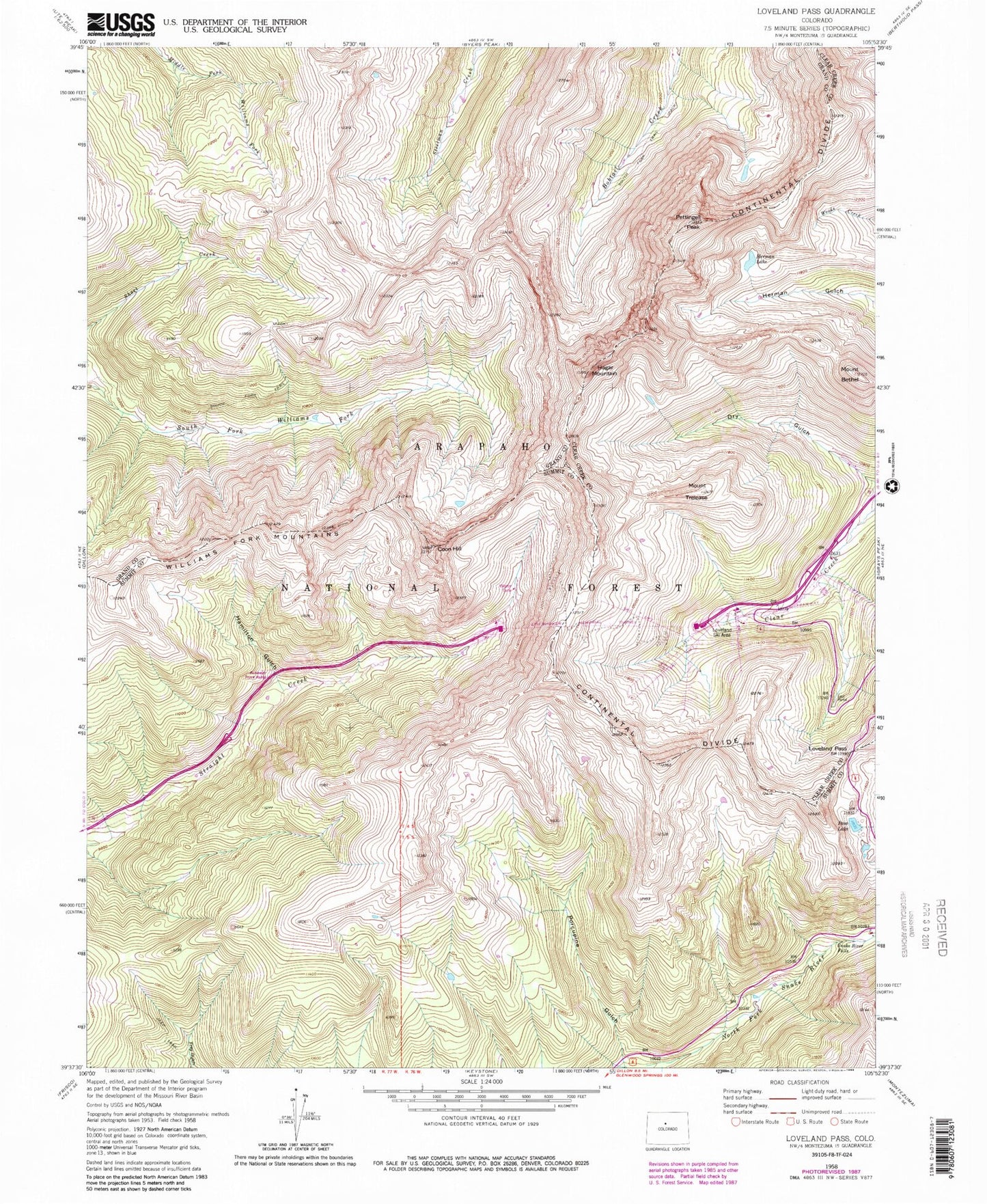
Classic USGS Loveland Pass Colorado 7.5'x7.5' Topo Map
Couldn't load pickup availability
Historical USGS topographic quad map of Loveland Pass in the state of Colorado. Typical map scale is 1:24,000, but may vary for certain years, if available. Print size: 24" x 27"
This quadrangle is in the following counties: Clear Creek, Grand, Summit.
The map contains contour lines, roads, rivers, towns, and lakes. Printed on high-quality waterproof paper with UV fade-resistant inks, and shipped rolled.
Contains the following named places: Loveland Ski Area, Williams Fork Mountains, South Fork Trail, Porcupine Gulch, Snake River Falls, Pass Lake, Loveland Pass, Mount Trelease, Coon Hill, Eisenhower Memorial Tunnel, Hamilton Gulch, Hagar Mountain, Pettingell Peak, Herman Lake, Platte Park, Mercy Hospital, No Name Gulch, Pass Lake Picnic Area, Eisenhower Tunnel Point of Interest, Mount Bethel, La Plata Mine, Franklin Mine, Eisenhower Tunnel Colorado Department of Transportation Fire Department