MyTopo
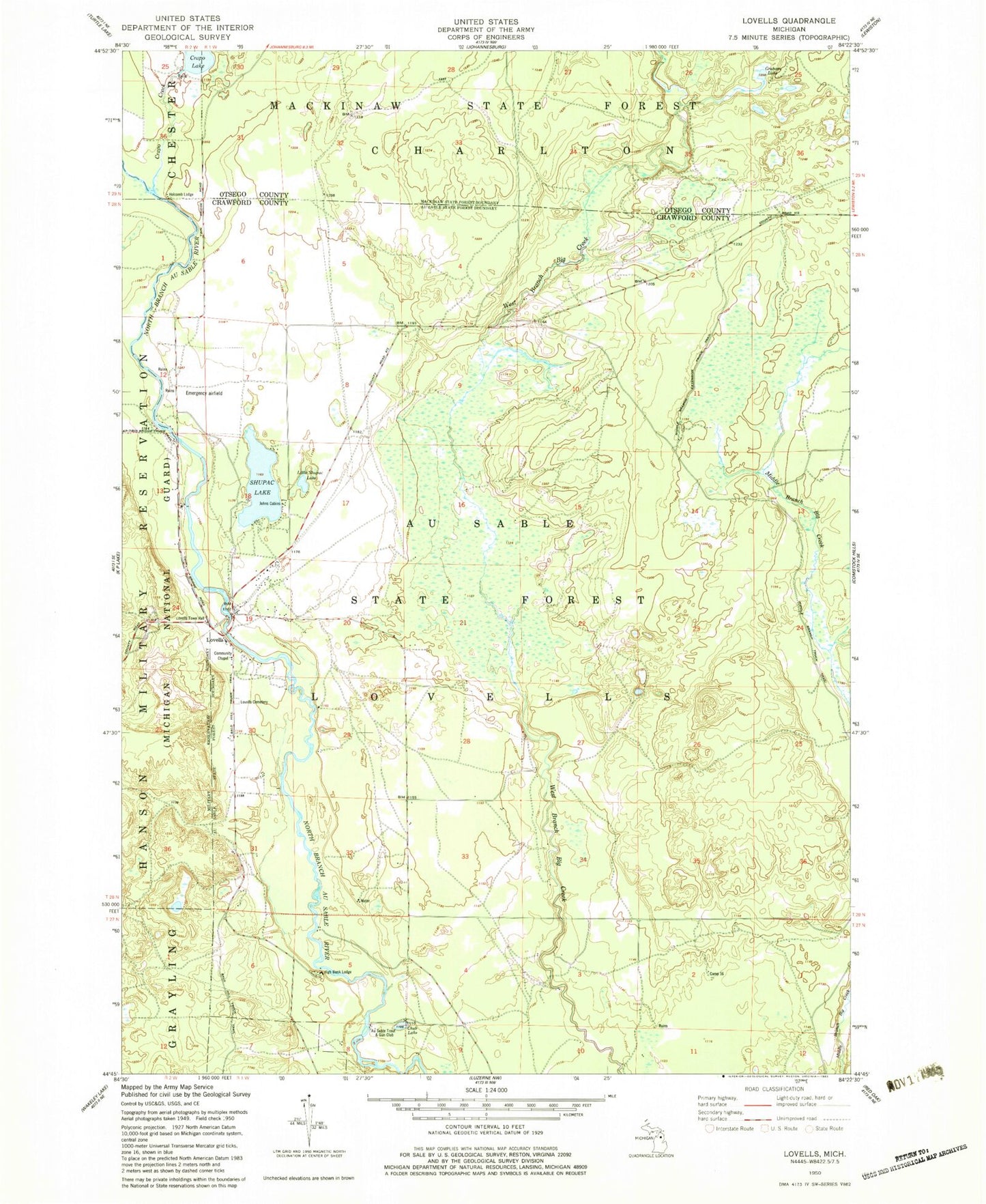
Classic USGS Lovells Michigan 7.5'x7.5' Topo Map
Couldn't load pickup availability
Historical USGS topographic quad map of Lovells in the state of Michigan. Map scale may vary for some years, but is generally around 1:24,000. Print size is approximately 24" x 27"
This quadrangle is in the following counties: Crawford, Otsego.
The map contains contour lines, roads, rivers, towns, and lakes. Printed on high-quality waterproof paper with UV fade-resistant inks, and shipped rolled.
Contains the following named places: Au Sable Trout and Gun Club, Camp 16, Chub Lake, Crapo Creek, Douglas House Historical Marker, Graham Lake, High Bank Lodge, Holcomb Lodge, Johns Cabins, Little Shupac Lake, Lovells, Lovells Cemetery, Lovells Community Chapel, Lovells Post Office, Lovells Station, Lovells Town Hall, Lovells Township Volunteer Fire Department, Shupac Lake, Shupac Lake State Forest Campground, Thomas E Douglas Historical Marker, Township of Lovells