MyTopo
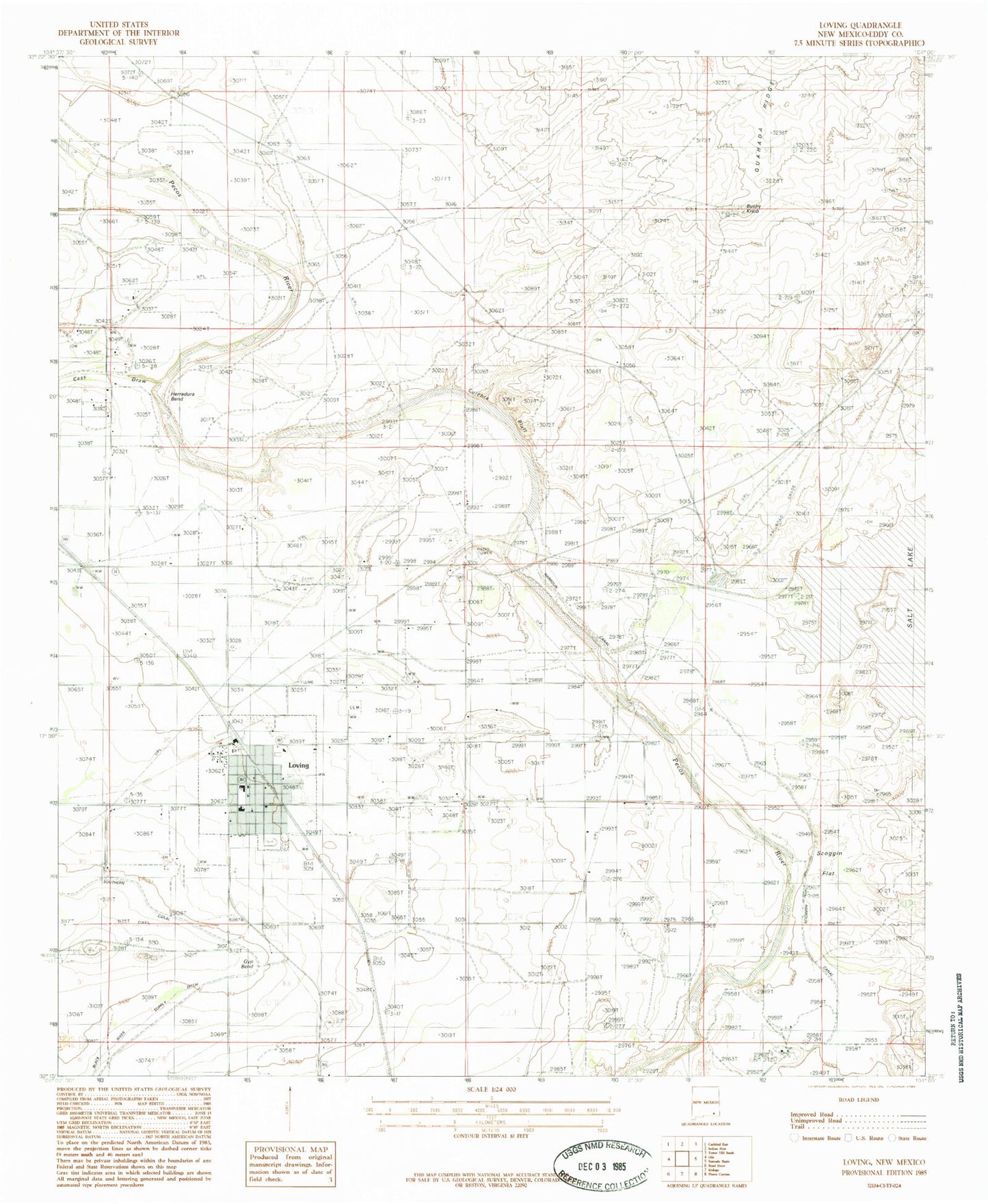
Classic USGS Loving New Mexico 7.5'x7.5' Topo Map
Couldn't load pickup availability
Historical USGS topographic quad map of Loving in the state of New Mexico. Map scale may vary for some years, but is generally around 1:24,000. Print size is approximately 24" x 27"
This quadrangle is in the following counties: Eddy.
The map contains contour lines, roads, rivers, towns, and lakes. Printed on high-quality waterproof paper with UV fade-resistant inks, and shipped rolled.
Contains the following named places: Bushy Knob, Cass Draw, Culebra Bluff, Dickson Farm, First Assembly of God Church, First Baptist Church, Flotation Plant, Goodnight-Loving Trail Historical Marker, Gyp Bend, Harroun Dam, Harroun Ditch, Harroun Diversion Dam, Harroun School, Herradura Bend, Loving, Loving Cemetery, Loving Elementary School, Loving Health Clinic, Loving High School, Loving Middle School, Loving Post Office, Loving Village Police Department, Loving Volunteer Fire Department and Emergency Medical Services, Loving Weather Station, Lovings Bend Park, Potash Bullwheel Historic Site, Scoggin Flat, Southern Canal, Tempe Costa Church, United States Potash Company Refinery, Village of Loving