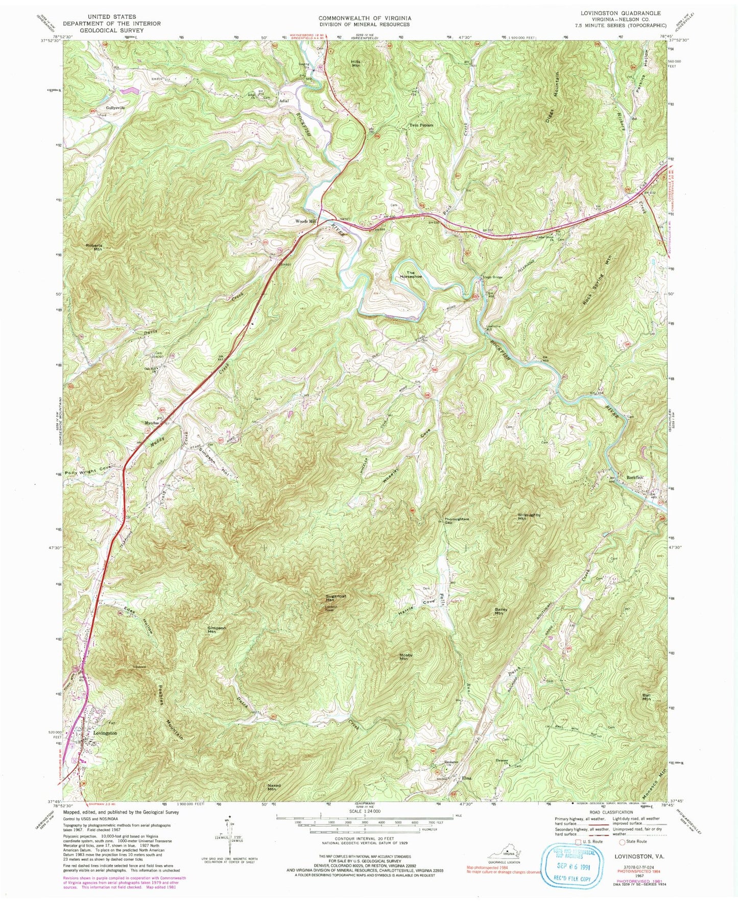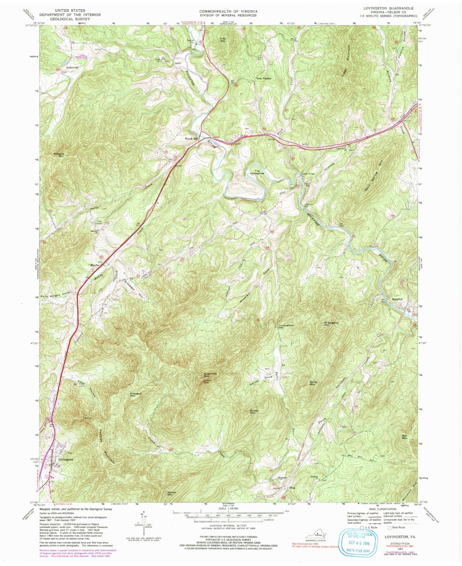
MyTopo
Classic USGS Lovingston Virginia 7.5'x7.5' Topo Map
Couldn't load pickup availability
Historical USGS topographic quad map of Lovingston in the state of Virginia. Typical map scale is 1:24,000, but may vary for certain years, if available. Print size: 24" x 27"
This quadrangle is in the following counties: Nelson.
The map contains contour lines, roads, rivers, towns, and lakes. Printed on high-quality waterproof paper with UV fade-resistant inks, and shipped rolled.
Contains the following named places: Adial Church, Bailey Mountain, Ball Mountain, Cedar Grove Church, Cove Creek, Craig Creek, Cub Creek, Diggs Mountain, Ebenezer Church, Edes Hollow, Elmington Church, Harris Cove, Mosby Mountain, Myndus, Oak Hill Church, Peebles Mountain, Roberts Mountain, Rock Spring Mountain, Simpson Hollow, Simpson Mountain, Stage Bridge, Sugarloaf Mountain, Thoroughfare Gap, Wheeler Cove, Willoughby Mountain, Elma, Buck Creek, Davis Creek, Hills Mountain, Muddy Creek, Perkins Hollow, Polly Wright Cove, Bernard Hamilton Dam, Hamilton Lake, Adial, Gullysville, Lawthorne Mill, Naked Mountain, Rockfish, The Horseshoe, Twin Poplars, Woods Mill, Lovingston, Adial Cemetery, Cedar Grove Cemetery, Cedar Grove School (historical), Davis Creek School (historical), Dutch Creek School (historical), Melton Hollow, Mount Zion Church (historical), Nelson County Courthouse, Old Myndus, Poplar School (historical), Ridgecrest Baptist Church, Ridgecrest Cemetery, Union Springs School (historical), Walnut Grove Church (historical), Schuyler District (historical), Lovingston Volunteer Fire Department, Nelson County Sheriff Office, Lovingston Census Designated Place, Central District, East District, Woodridge Field, Lovingston Post Office