MyTopo
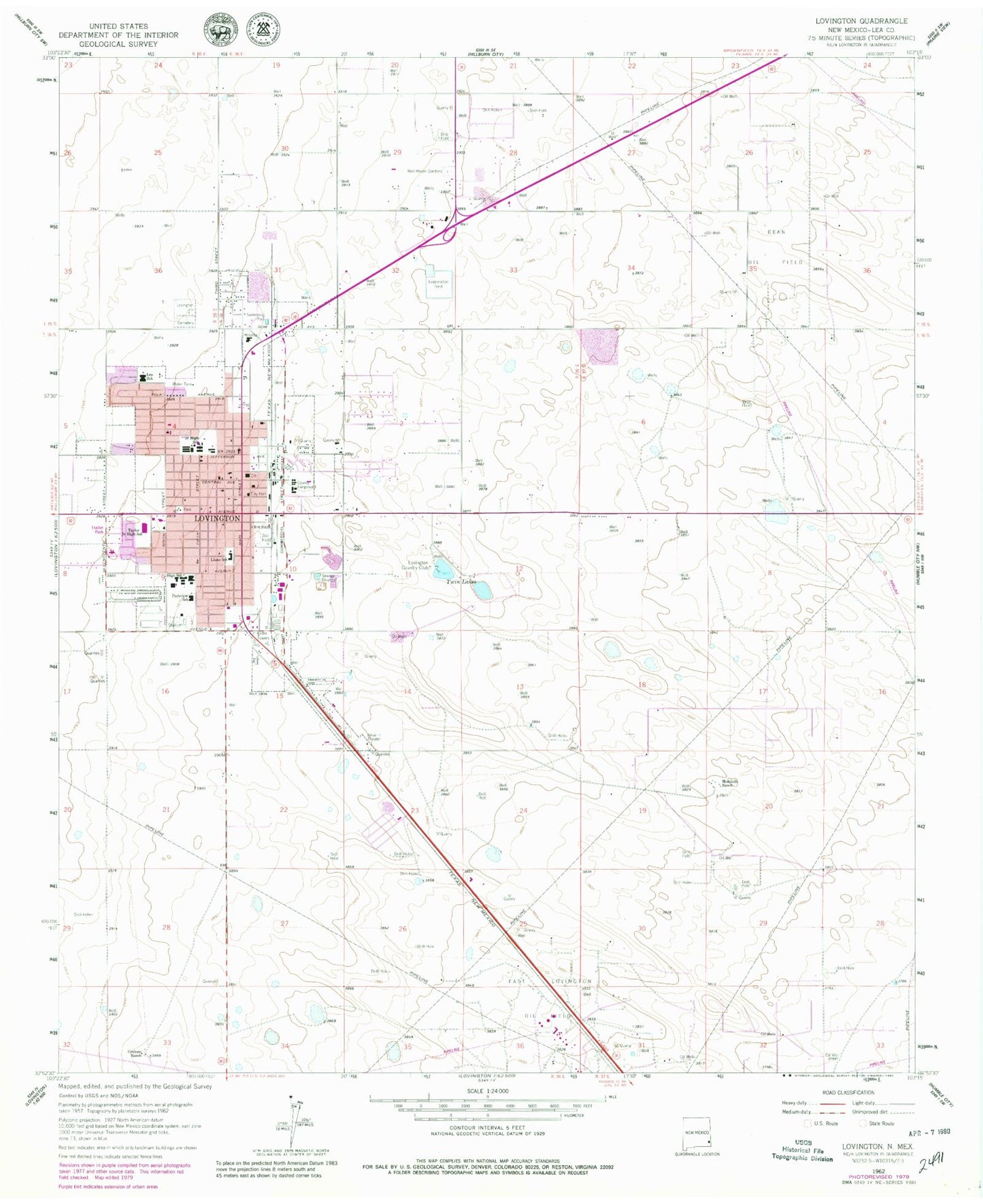
Classic USGS Lovington New Mexico 7.5'x7.5' Topo Map
Couldn't load pickup availability
Historical USGS topographic quad map of Lovington in the state of New Mexico. Map scale may vary for some years, but is generally around 1:24,000. Print size is approximately 24" x 27"
This quadrangle is in the following counties: Lea.
The map contains contour lines, roads, rivers, towns, and lakes. Printed on high-quality waterproof paper with UV fade-resistant inks, and shipped rolled.
Contains the following named places: Alexander Elementary School, Church of Christ, Church of God, Church of the Nazarene, City of Lovington, Collier Open Pit, East Lovington Oil Field, First Assembly of God Church, First Baptist Church, First Christian Church, Gospel Lighthouse Church, Graham Ranch, Hillcrest Baptist Church, Jackson Avenue Baptist Church, KLEA-AM (Lovington), KLEA-FM (Lovington), Lea County Courthouse Historic Site, Lea County Museum, Lea County Sheriff's Office Lovington, Lea Elementary School, Lea School, Llano Elementary School, Llano School, Love Street Baptist Church, Lovington, Lovington Cemetery, Lovington Country Club, Lovington Fire Department, Lovington High School, Lovington Historical Marker, Lovington Junior High School, Lovington Police Department, Lovington Post Office, Lovington Weather Station, Montieth Ranch, Nor - Lea Hospital District, Our Savior Lutheran Church, Parkview School, Primera Iglesia Bautista, Resthaven Cemetery, Taylor Junior High School, Taylor Middle School, The Church of Latter Day Saints, Town and Country Shopping Center, Trinity Baptist Church, Twin Lakes, United Pentecostal Church, Victory Baptist Church, Yarbro Elementary School