MyTopo
Classic USGS Low Wassie Missouri 7.5'x7.5' Topo Map
Couldn't load pickup availability
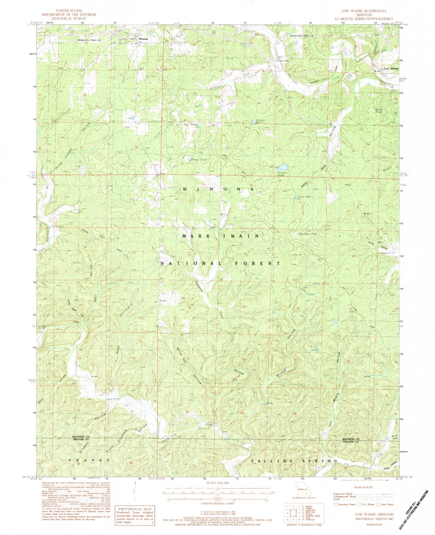
Historical USGS topographic quad map of Low Wassie in the state of Missouri. Map scale may vary for some years, but is generally around 1:24,000. Print size is approximately 24" x 27"
This quadrangle is in the following counties: Oregon, Shannon.
The map contains contour lines, roads, rivers, towns, and lakes. Printed on high-quality waterproof paper with UV fade-resistant inks, and shipped rolled.
Contains the following named places: Barnlog Hollow, Bear Hollow, Davis Hollow, Deep Pond, Deep Pond Hollow, Edmondson Pond, Folk Pond, Grassy Pond, Horse Trough Hollow, Independence School, Little Bear Hollow, Low Wassie, Marg Pond, Martin Spring, Mount Zion Cemetery, Mount Zion School, Nichols Lake, Pond Hollow, Pond Hollow School, Possum Trot Hollow, Possum Trot Lookout, Reed Hollow, Saltpetre Hollow, Seaman Creek, Shady Grove Church, South Crooked Hollow, Spring Hollow, Sunnyside School, Sycamore Creek, Tram Lookout, Tram Pond, Twinpine Picnic Area, Van Winkle Hollow, Whiteoak Hollow, Wildcat Hollow, ZIP Code: 65588