MyTopo
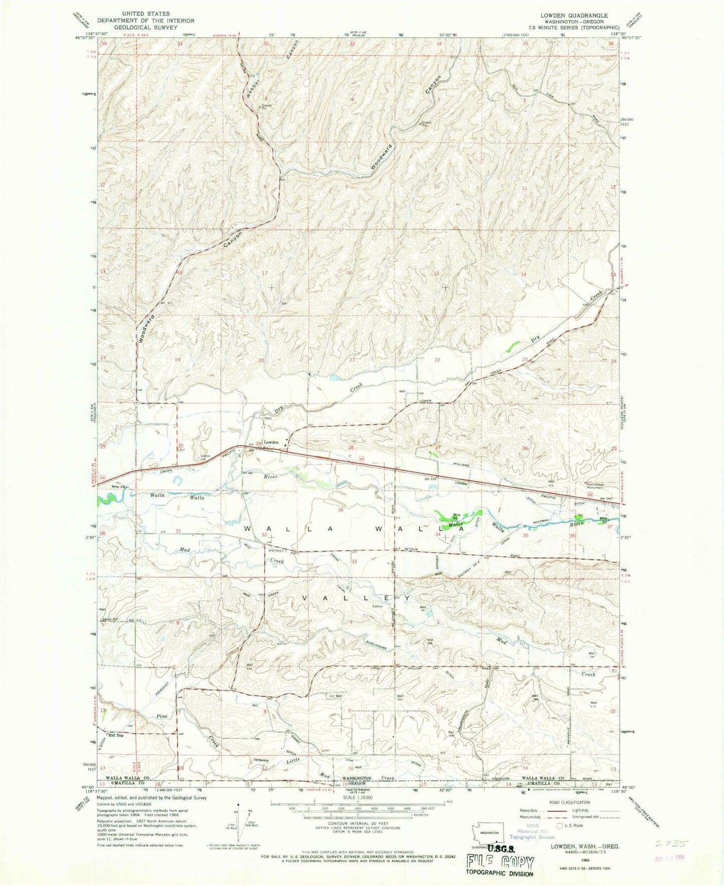
Classic USGS Lowden Washington 7.5'x7.5' Topo Map
Couldn't load pickup availability
Historical USGS topographic quad map of Lowden in the state of Washington. Map scale may vary for some years, but is generally around 1:24,000. Print size is approximately 24" x 27"
This quadrangle is in the following counties: Umatilla, Walla Walla.
The map contains contour lines, roads, rivers, towns, and lakes. Printed on high-quality waterproof paper with UV fade-resistant inks, and shipped rolled.
Contains the following named places: Burlingame Ditch, Demaris Ditch, Dry Creek, Frenchtown Monument, Galt's Gulch Airport, Garden City Ditch, Hill Top, Little Mud Creek, Lowden, Mud Creek, Mud Creek Canal, Mud District Number 2 Canal, Mud District Number 7 Canal, Short Low Ditch, Walla Walla County Fire District 6, Webber Canyon, Whitman Ditch, Williams Ditch, Woodward Canyon