MyTopo
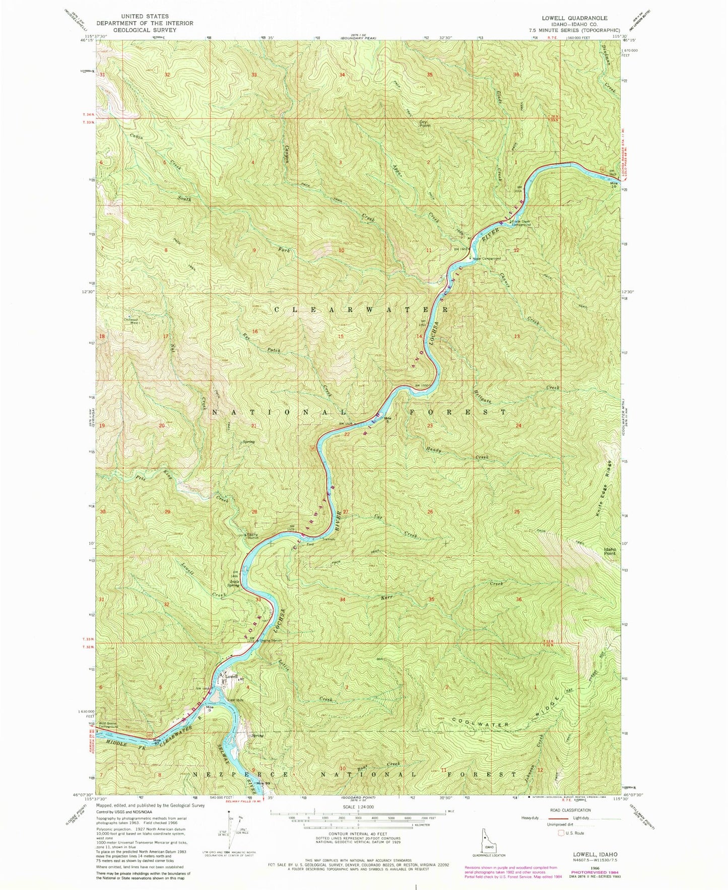
Classic USGS Lowell Idaho 7.5'x7.5' Topo Map
Couldn't load pickup availability
Historical USGS topographic quad map of Lowell in the state of Idaho. Map scale may vary for some years, but is generally around 1:24,000. Print size is approximately 24" x 27"
This quadrangle is in the following counties: Idaho.
The map contains contour lines, roads, rivers, towns, and lakes. Printed on high-quality waterproof paper with UV fade-resistant inks, and shipped rolled.
Contains the following named places: Apgar Campground, Apgar Creek, Cabin Creek, Canyon Creek, Cat Creek, Chance Creek, Chitwood Mine, Deadman Creek, Dry Point, Glade Creek, Glade Creek Campground, Handy Creek, Hellgate Creek, Icicle Spring, Idaho Point, Kerr Creek, Knife Edge Ridge, Lochsa River, Lottie Creek, Lowell, Lowell Creek, Nut Creek, Pete King Creek, Rye Patch Creek, Selway River, South Fork Canyon Creek