MyTopo
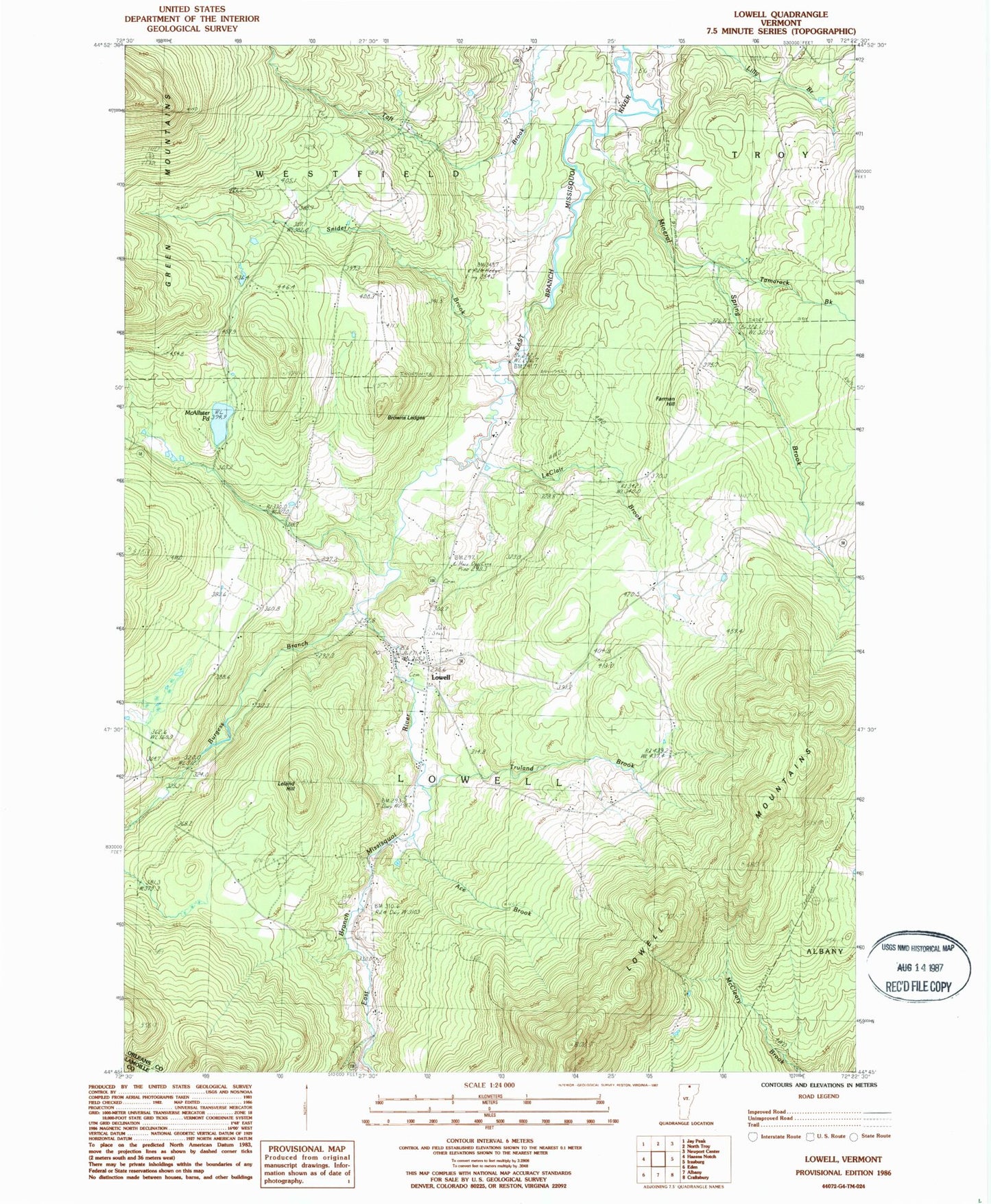
Classic USGS Lowell Vermont 7.5'x7.5' Topo Map
Couldn't load pickup availability
Historical USGS topographic quad map of Lowell in the state of Vermont. Map scale may vary for some years, but is generally around 1:24,000. Print size is approximately 24" x 27"
This quadrangle is in the following counties: Lamoille, Orleans.
The map contains contour lines, roads, rivers, towns, and lakes. Printed on high-quality waterproof paper with UV fade-resistant inks, and shipped rolled.
Contains the following named places: Ace Brook, Browns Ledges, Burgess Branch, East Branch Missisquoi River, Evergreen Cemetery, Farman Hill, Federated Church, Hitchcock School, Le Clair Brook, Leland Hill, Lowell, Lowell Census Designated Place, Lowell Graded School, Lowell Mountains, Lowell Municipal Forest, Lowell Plain, Lowell Post Office, Lowell Volunteer Fire Department, McAllister Pond, Mineral Spring Brook, Mountainview Cemetery, Old Catholic Cemetery, Saint Ignatius Cemetery, Shortsleve Mink Farm, Snider Brook, Tamarack Brook, Town of Lowell, Truland Brook, ZIP Codes: 05820, 05847