MyTopo
Classic USGS Lower Red Rock Lake Montana 7.5'x7.5' Topo Map
Couldn't load pickup availability
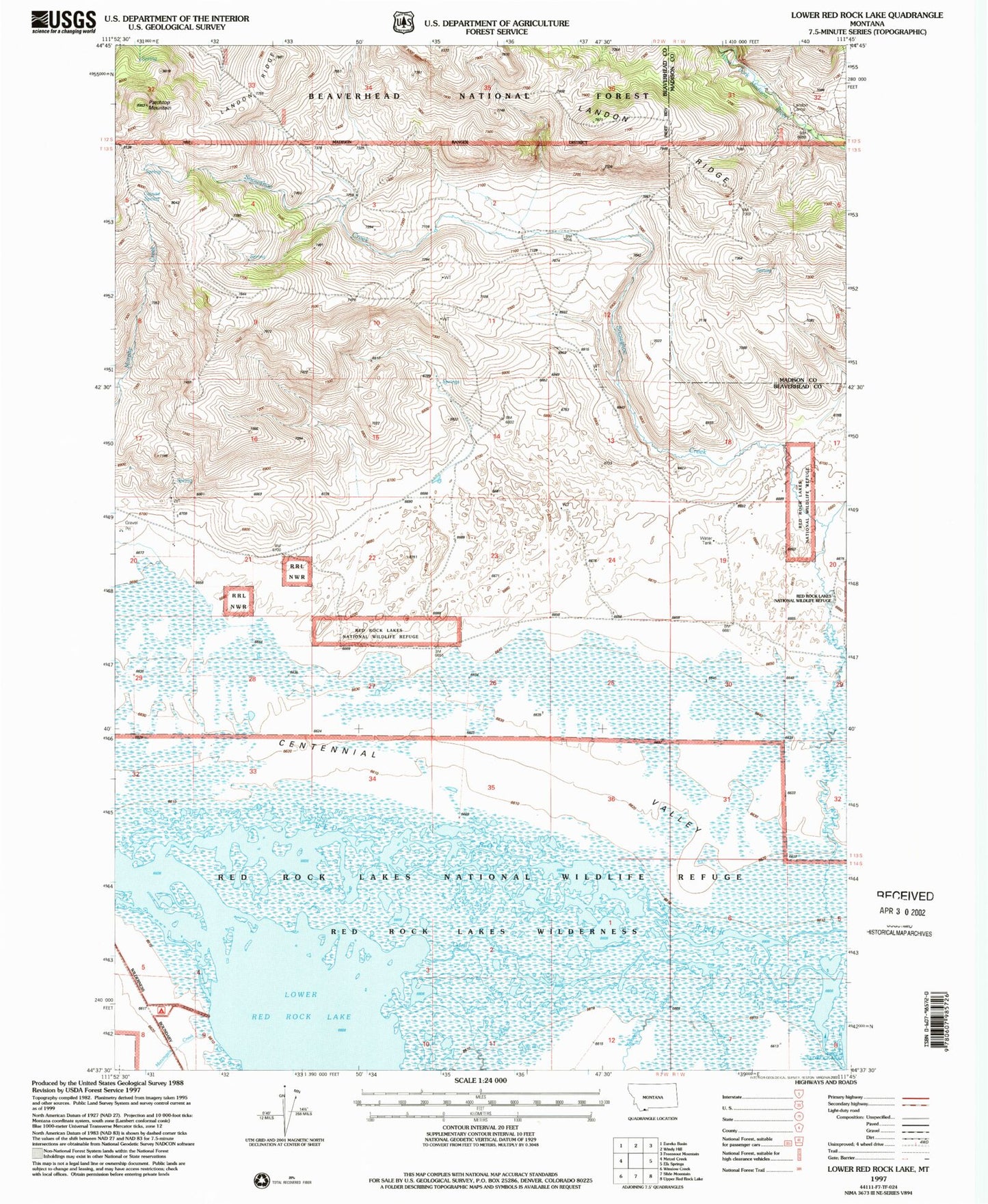
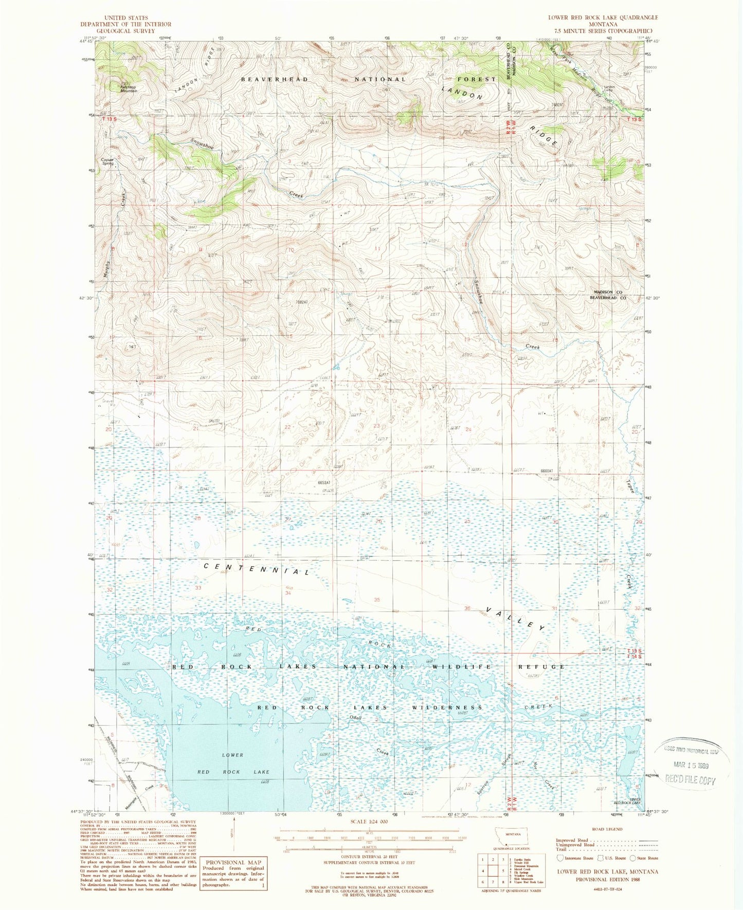
Historical USGS topographic quad map of Lower Red Rock Lake in the state of Montana. Map scale may vary for some years, but is generally around 1:24,000. Print size is approximately 24" x 27"
This quadrangle is in the following counties: Beaverhead, Madison.
The map contains contour lines, roads, rivers, towns, and lakes. Printed on high-quality waterproof paper with UV fade-resistant inks, and shipped rolled.
Contains the following named places: 13S01W19BADD01 Well, 13S01W30CBA_01 Well, 13S02W01BAA_01 Spring, 13S02W05CAAA01 Spring, 13S02W12BCCC01 Well, 13S02W12CBBA01 Well, 13S02W14BDCA01 Well, 13S02W20AACA01 Well, 13S02W20ADCA01 Well, 13S02W24DCCC01 Well, 13S02W26DDDB01 Well, Cayuse Spring, Goble Ranch, Landon Camp, Landon Ridge, Lower Red Rock Lake, Matsingale Creek, Nye Creek, Odell Creek, Patchtop Mountain, Red Rock Lakes National Wildlife Refuge, Red Rock Lakes Wilderness, Snowshoe Creek, Sparrow Slough, Tepee Creek