MyTopo
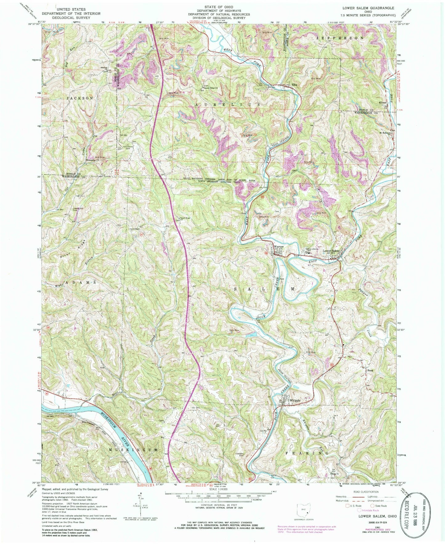
Classic USGS Lower Salem Ohio 7.5'x7.5' Topo Map
Couldn't load pickup availability
Historical USGS topographic quad map of Lower Salem in the state of Ohio. Typical map scale is 1:24,000, but may vary for certain years, if available. Print size: 24" x 27"
This quadrangle is in the following counties: Noble, Washington.
The map contains contour lines, roads, rivers, towns, and lakes. Printed on high-quality waterproof paper with UV fade-resistant inks, and shipped rolled.
Contains the following named places: Bear Creek, Berg Church, Dixon Ridge, Flanders Cemetery, Good Hope Church, Hill Grove Cemetery, Liberty Hill Cemetery, Mount Ephraim Church, Shafer Cemetery, Smith Ridge Church, Warner, West Fork Duck Creek, Whipple, Lower Salem, Whipple Community Church, Buells (historical), Bonn, Elba, Honesty, Kilmer, Salem-Liberty High School (historical), East Fork Duck Creek, Pawpaw Creek, Whipple Run, Salem-Liberty Elementary School, New Years Creek, Township of Aurelius, Township of Salem, Shafers Church, Berg Church Cemetery, Evangelical Cemetery, Good Hope Church Cemetery, Highland Ridge Community Church, Hill Grove Church (historical), Lower Salem Cemetery, Lutheran Cemetery, Mount Ephriam Church Cemetery, Smith Ridge Cemetery, Honesty Post Office (historical), Kilmer Post Office (historical), Village of Lower Salem, Salem Township Volunteer Fire Department, Lower Salem Post Office