
MyTopo
Classic USGS Lower Valley Idaho 7.5'x7.5' Topo Map
Regular price
$16.95
Regular price
Sale price
$16.95
Unit price
per
Couldn't load pickup availability
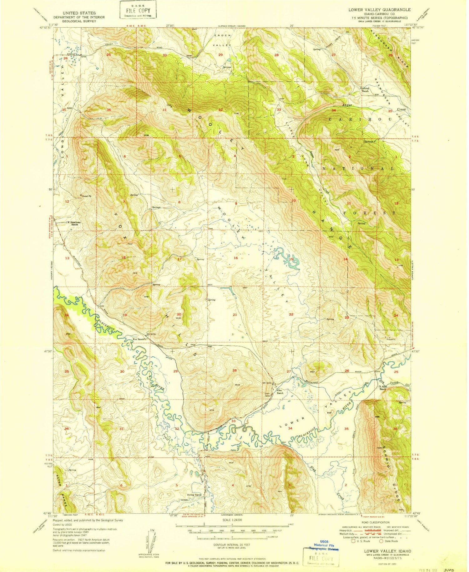
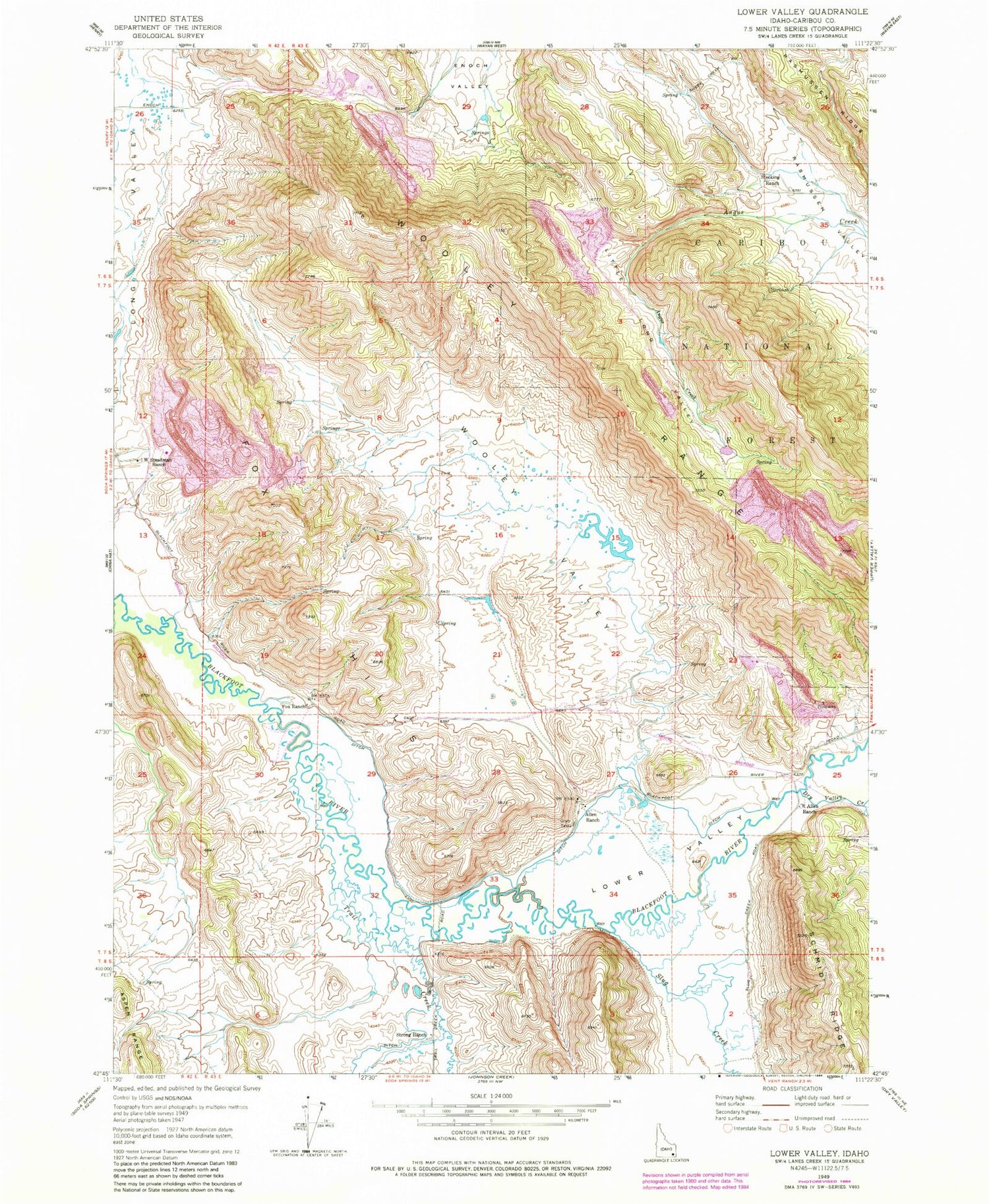
Historical USGS topographic quad map of Lower Valley in the state of Idaho. Map scale may vary for some years, but is generally around 1:24,000. Print size is approximately 24" x 27"
This quadrangle is in the following counties: Caribou.
The map contains contour lines, roads, rivers, towns, and lakes. Printed on high-quality waterproof paper with UV fade-resistant inks, and shipped rolled.
Contains the following named places: Allen Ranch, Dry Valley Creek, Fox Hills, Fox Ranch, Little Long Valley, Lower Valley, R Allen Ranch, Slug Creek, Stocking Ranch, Strong Ranch, Trail Creek, Unit Three Haulroad Dam, West Steadman Ranch, Wooley Range, Wooley Valley


