
MyTopo
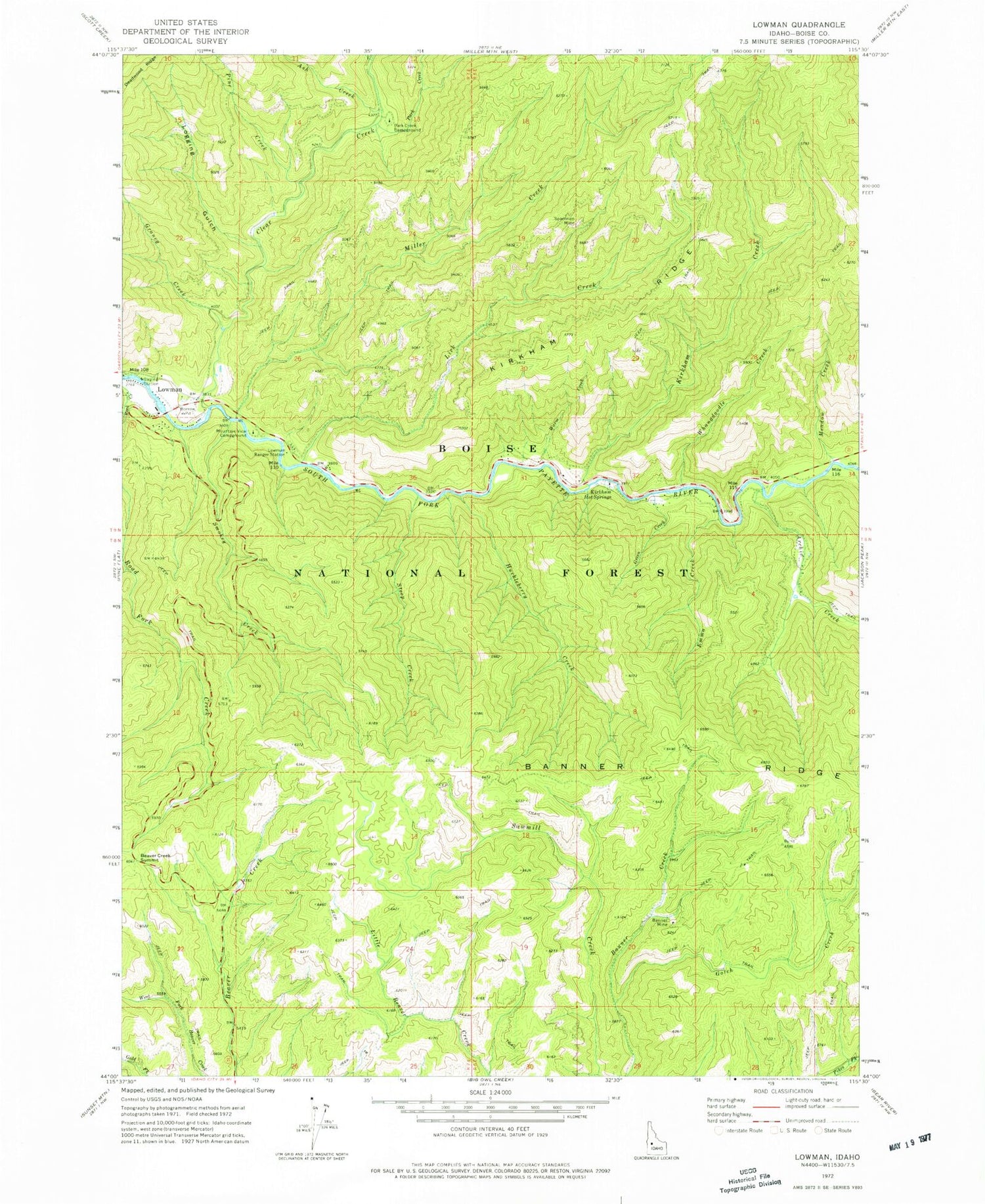
Classic USGS Lowman Idaho 7.5'x7.5' Topo Map
Couldn't load pickup availability
Historical USGS topographic quad map of Lowman in the state of Idaho. Map scale may vary for some years, but is generally around 1:24,000. Print size is approximately 24" x 27"
This quadrangle is in the following counties: Boise.
The map contains contour lines, roads, rivers, towns, and lakes. Printed on high-quality waterproof paper with UV fade-resistant inks, and shipped rolled.
Contains the following named places: Archie Creek, Ash Creek, Banner, Banner Mine, Banner Ridge, Banner Ridge Recreation Site, Beaver Creek Summit, Boise National Forest, Clear Creek, Emma Creek, Garden Valley Division, Gotch Creek, Graney Creek, Green Creek, Huckleberry Creek, Kirkham Creek, Kirkham Hot Springs, Kirkham Hot Springs Campground, Kirkham Ridge, Lice Creek, Lick Creek, Logging Gulch, Lower Ranger Station, Lowman, Lowman Census Designated Place, Lowman Elementary School, Lowman Ranger District, Lowman Volunteer Fire Department Station 3, Lowman Work Center, Meadow Creek, Miller Creek, Mountain View Campground, Park Creek, Park Creek Campground, Pine Creek, Smokey Creek, Specimen Mine, Steep Creek, Warm Creek, Whangdoodle Creek


