MyTopo
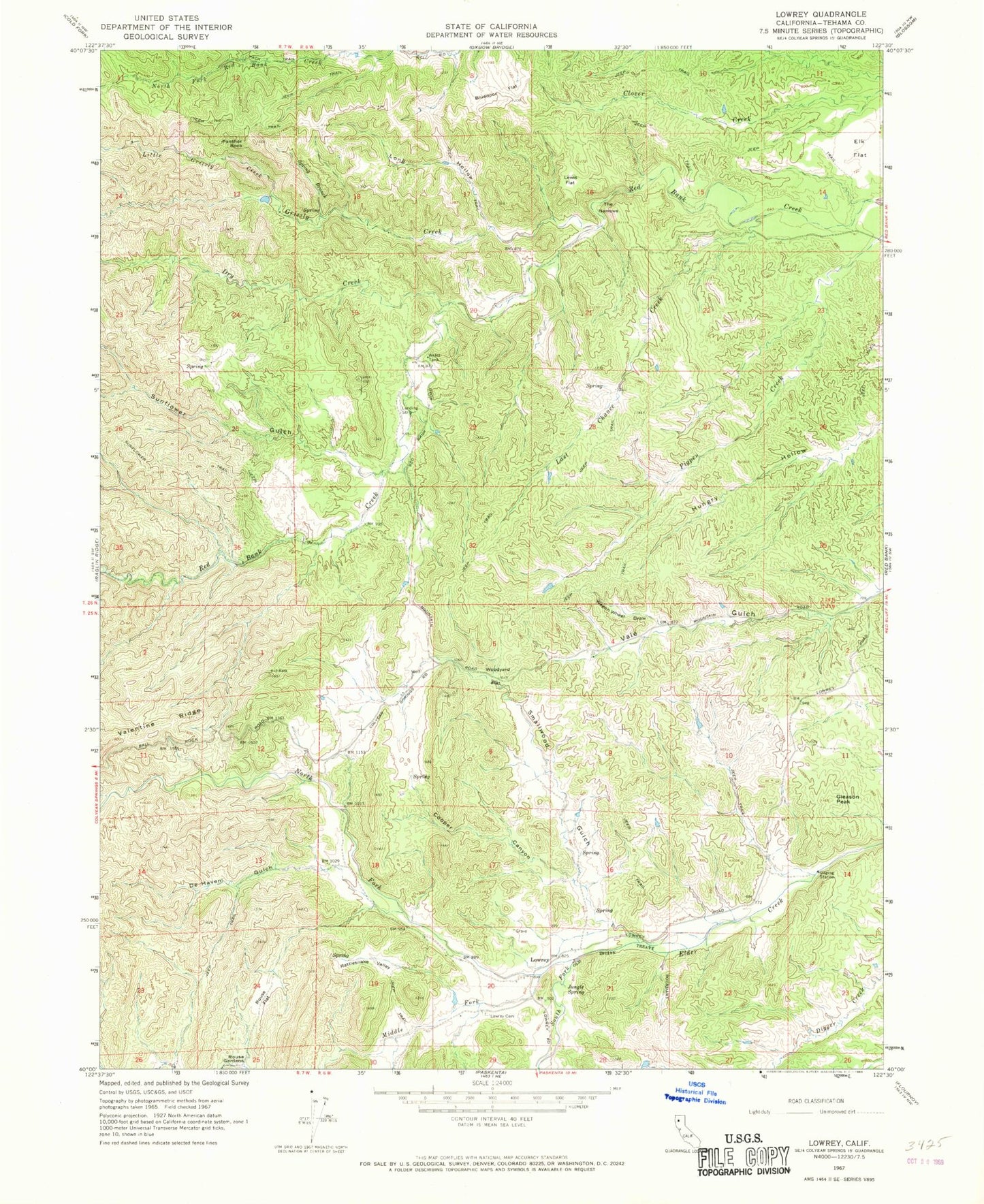
Classic USGS Lowrey California 7.5'x7.5' Topo Map
Couldn't load pickup availability
Historical USGS topographic quad map of Lowrey in the state of California. Typical map scale is 1:24,000, but may vary for certain years, if available. Print size: 24" x 27"
This quadrangle is in the following counties: Tehama.
The map contains contour lines, roads, rivers, towns, and lakes. Printed on high-quality waterproof paper with UV fade-resistant inks, and shipped rolled.
Contains the following named places: Bluedoor Flat, Cooper Canyon, De Haven Gulch, Gleason Peak, Jungle Spring, Last Chance Creek, Lewis Flat, Long Hollow, Lowrey Cemetery, Panther Rock, Rattlesnake Valley, Rouse Flat, Smallwood Gulch, Elk Flat, Spring Branch, The Narrows, Wagon Wheel Draw, Woodyard Flat, Lowrey, Dry Creek, Grizzly Creek, Little Grizzly Creek, Middle Fork Elder Creek, North Fork Elder Creek, South Fork Elder Creek, Sunflower Gulch, Big Bluff Ranch Airport (historical), Sunflower 1261 Dam, Banfield Place, Brown Place, Leonard Place (historical), Miller Ranch, Montgomery Place, Saunders Place, Westend Galatin Place (historical)