MyTopo
Classic USGS Lowry City Missouri 7.5'x7.5' Topo Map
Couldn't load pickup availability
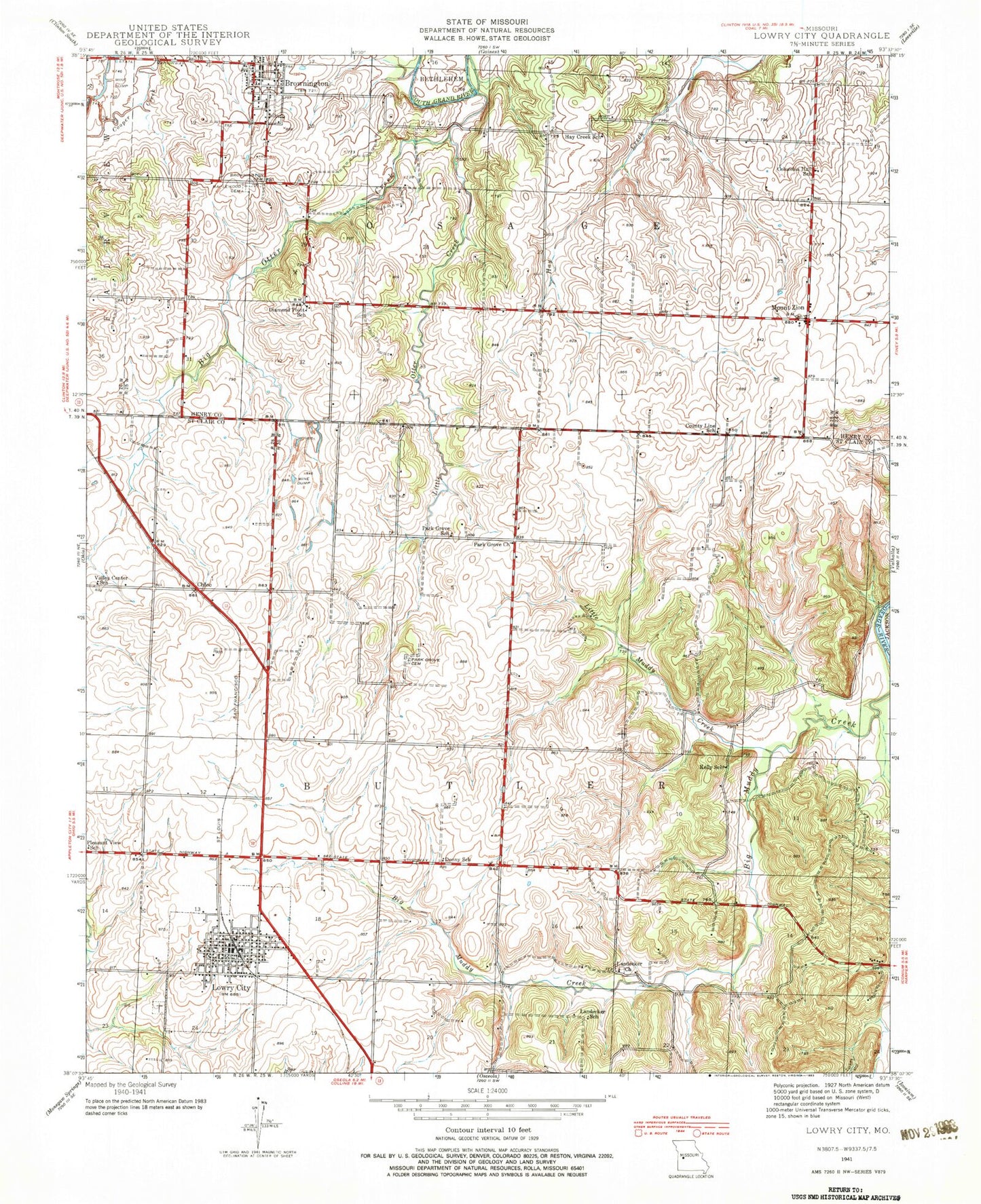
Historical USGS topographic quad map of Lowry City in the state of Missouri. Map scale may vary for some years, but is generally around 1:24,000. Print size is approximately 24" x 27"
This quadrangle is in the following counties: Henry, St. Clair.
The map contains contour lines, roads, rivers, towns, and lakes. Printed on high-quality waterproof paper with UV fade-resistant inks, and shipped rolled.
Contains the following named places: Ackley Lake, Ackley Lake Dam, Big Otter Creek, Brownington, Brownington Cemetery, Brownington Community Center, Brownington Presbyterian Church, Brownington School, Brownington State Wildlife Area, Chloe, City of Lowry City, Clary Lake Dam, Columbia Community Center, Columbia Hall School, Consville, County Line School, Denny School, Diamond Point School, Dunlap, Haverland Lake Dam, Hay Creek School, Kelly School, Lakeland Elementary School, Lakeland High School, Landecker Church, Landecker School, Little Muddy Creek, Little Otter Creek, Lowry City, Lowry City Cemetery, Lowry City Municipal Building, Lowry City Police Department, Lowry City Post Office, Lowry City School, Lowry City Volunteer Fire Department, Maplewood Cemetery, Mount Zion, Mount Zion Baptist Church, Mount Zion Cemetery, Mount Zion United Methodist Church, Park Grove Cemetery, Park Grove Church, Park Grove School, Pleasant View School, Town of Brownington, Township of Butler, Township of Osage, Turkey Hollow, Valley Center School, ZIP Codes: 64740, 64763