MyTopo
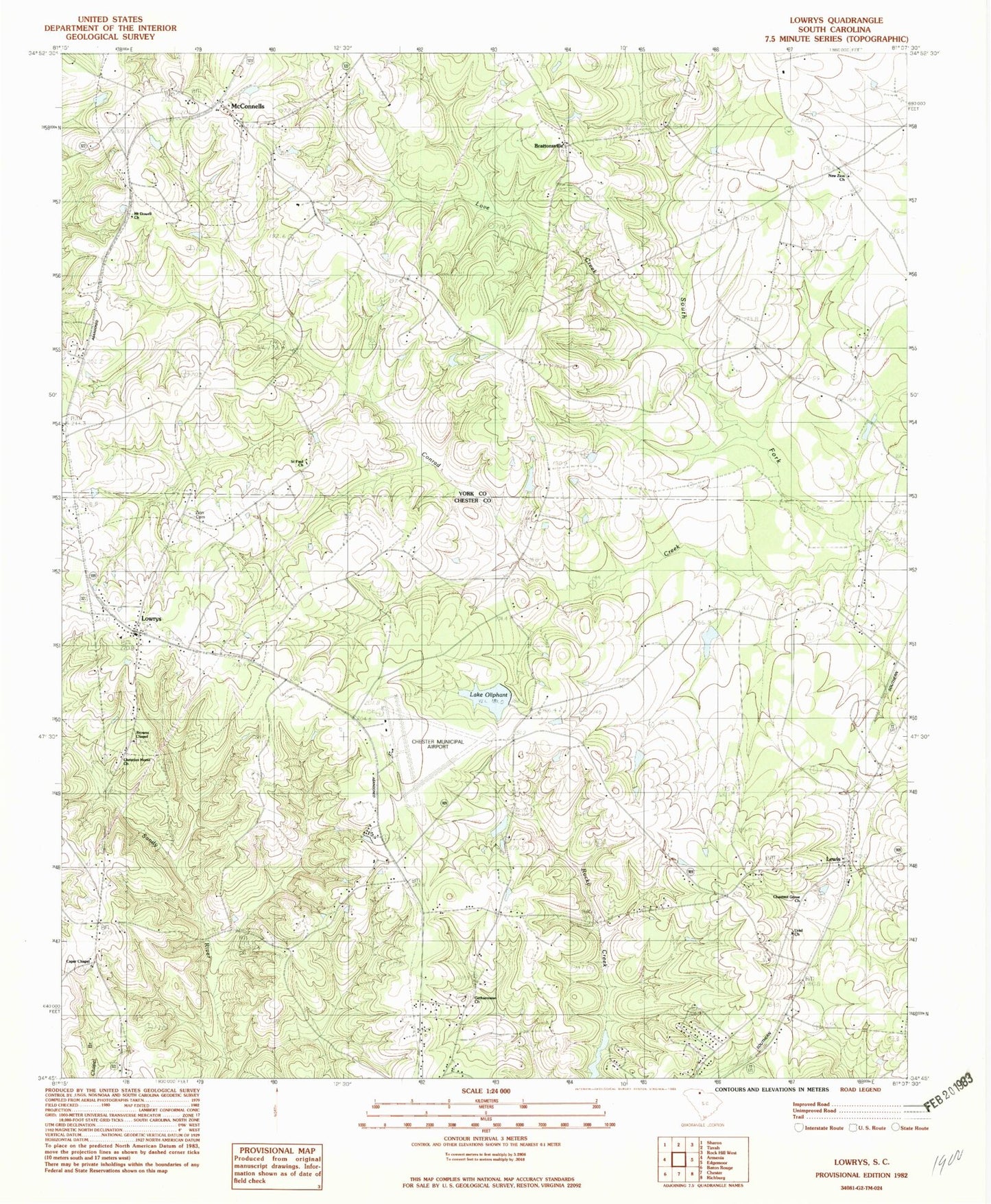
Classic USGS Lowrys South Carolina 7.5'x7.5' Topo Map
Couldn't load pickup availability
Historical USGS topographic quad map of Lowrys in the state of South Carolina. Map scale may vary for some years, but is generally around 1:24,000. Print size is approximately 24" x 27"
This quadrangle is in the following counties: Chester, York.
The map contains contour lines, roads, rivers, towns, and lakes. Printed on high-quality waterproof paper with UV fade-resistant inks, and shipped rolled.
Contains the following named places: Aycock Pond Dam D-3667, Brattonsville, Brattonsville Historic District, Browns Chapel, Caper Chapel, Capers Chapel School, Chester Catawba Regional Airport, Chestnut Grove Church, Chestnut Grove School, Christian Home Church, Christian Home School, Conrad Creek, Dinber, Gethsemane Baptist Church, Hermit Hill Farm, Lewis, Lewis Fire Department Lewis, Logans Pond D-1439 Dam, Love Creek, Lowrys, Lowrys Baptist Church, Lowryville School, McConnells, McConnells Fire Department, Mount Dowell Baptist Church, New Home Rosenwald School, New Zion Church, New Zion Community Center, North Chester Fire Department, Oakdale Fire Department Station 3, Rosenwald School, Saint Paul Church, Saint Paul School, Sloan Farms, South Carolina Noname 12003 D-0217 Dam, South Carolina Noname 12024 D-0219 Dam, South Carolina Noname 46024 D-3672 Dam, Town of Lowrys, Town of McConnells, Uriel Church, Williams School, Zion Cemetery, Zion Presbyterian Church, ZIP Code: 29726