MyTopo
Classic USGS Loy Butte Arizona 7.5'x7.5' Topo Map
Couldn't load pickup availability
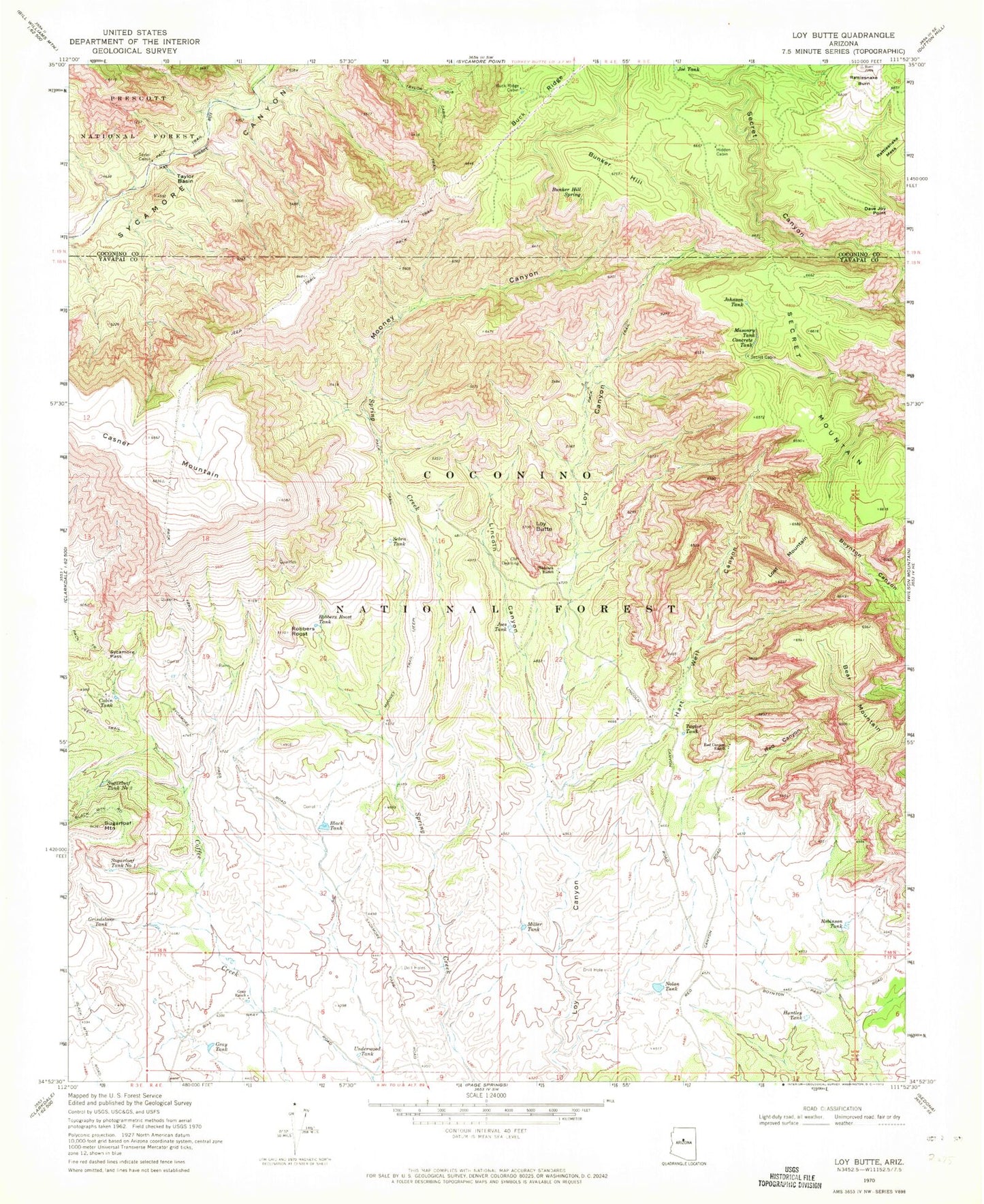
Historical USGS topographic quad map of Loy Butte in the state of Arizona. Typical map scale is 1:24,000, but may vary for certain years, if available. Print size: 24" x 27"
This quadrangle is in the following counties: Coconino, Yavapai.
The map contains contour lines, roads, rivers, towns, and lakes. Printed on high-quality waterproof paper with UV fade-resistant inks, and shipped rolled.
Contains the following named places: Bear Mountain, Black Tank, Buck Ridge Cabin, Bunker Hill, Bunker Hill Spring, Cabin Tank, Casner Mountain, Concrete Tank, Dave Joy Point, Gray Ranch, Gray Tank, Grindstone Tank, Hancock Ranch, Hart Well Canyon, Hidden Cabin, Huntley Tank, Jacks Canyon, Joe Tank, Joes Tank, Johnson Tank, Lincoln Canyon, Lost Mountain, Loy Butte, Masonry Tank, Miller Tank, Mooney Canyon, Mooney Trail, Nolan Tank, Rattlesnake Burn, Red Canyon, Red Canyon Ranch, Robbers Roost, Robbers Roost Tank, Robinson Tank, Sebra Tank, Secret Cabin, Secret Mountain, Sugarloaf Mountain, Sugarloaf Tank Number One, Sugarloaf Tank Number Two, Sycamore Pass, Taylor Cabin, Taylor Tank, Underwood Tank, Dutch Kid Tank, Taylor Basin, Taylor Basin Tank, Casner Mountain Tank, Casner Mountain Tank, Casner Mountain Trail Eight, Loy Butte Five, Nichols Well, Thomas Tank, Sycamore Spring, Corral Tank, Lincoln Canyon Tank, Red Tank