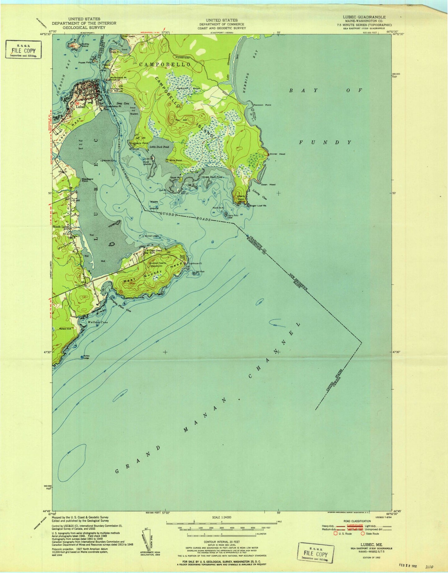
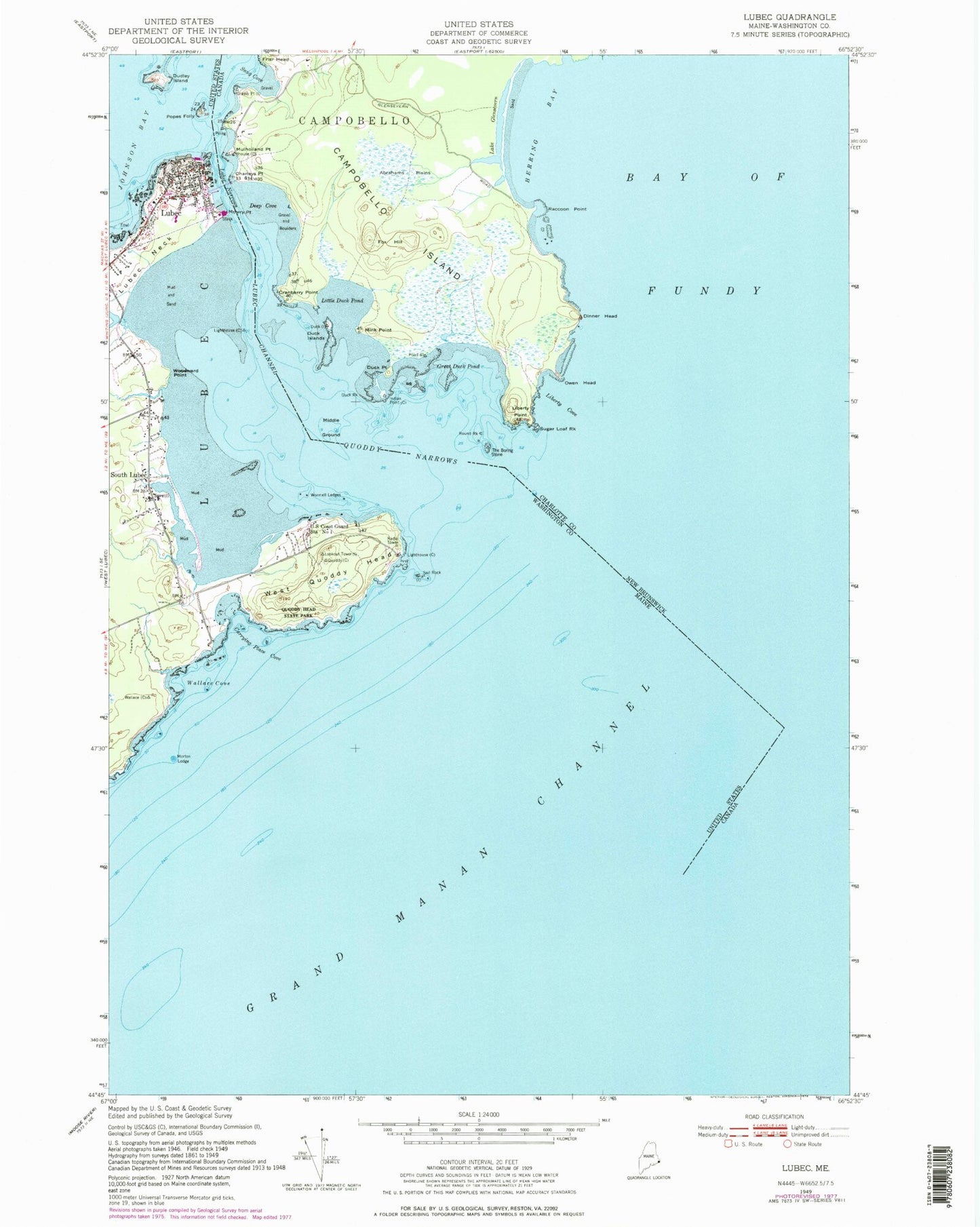
MyTopo
Classic USGS Lubec Maine 7.5'x7.5' Topo Map
Couldn't load pickup availability
Historical USGS topographic quad map of Lubec in the state of Maine. Map scale may vary for some years, but is generally around 1:24,000. Print size is approximately 24" x 27"
This quadrangle is in the following counties: Washington.
The map contains contour lines, roads, rivers, towns, and lakes. Printed on high-quality waterproof paper with UV fade-resistant inks, and shipped rolled.
Contains the following named places: Carrying Place Cove, Christian Temple Church, Downeast Emergency Medical Services Lubec, Dudley Island, Franklin Delano Roosevelt Memorial Bridge, Gravel Bar, Gullivers Hole, Lubec, Lubec Cemetery, Lubec Census Designated Place, Lubec Channel, Lubec Channel Light, Lubec Channel Light Station, Lubec Consolidated School, Lubec Memorial Library, Lubec Narrows, Lubec Neck, Lubec Post Office, Lubec Volunteer Fire Department, Middle Ground, Morton Ledge, Mowry Point, Popes Folly, Quoddy Head State Park, Quoddy Narrows, Sail Rock, South Lubec, Wallace Cove, West Quaddy Head Light, West Quoddy Head, West Quoddy Head Light Station, West Quoddy Life Saving Station, Woodward Point, Wormell Ledges