MyTopo
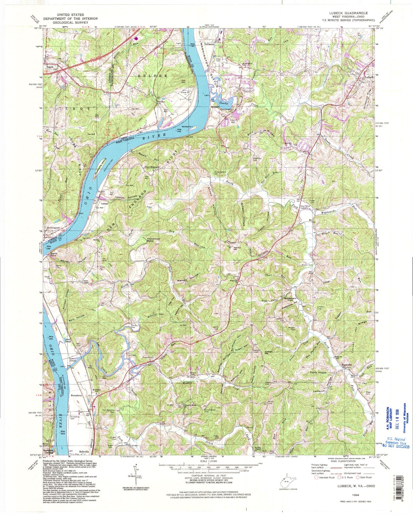
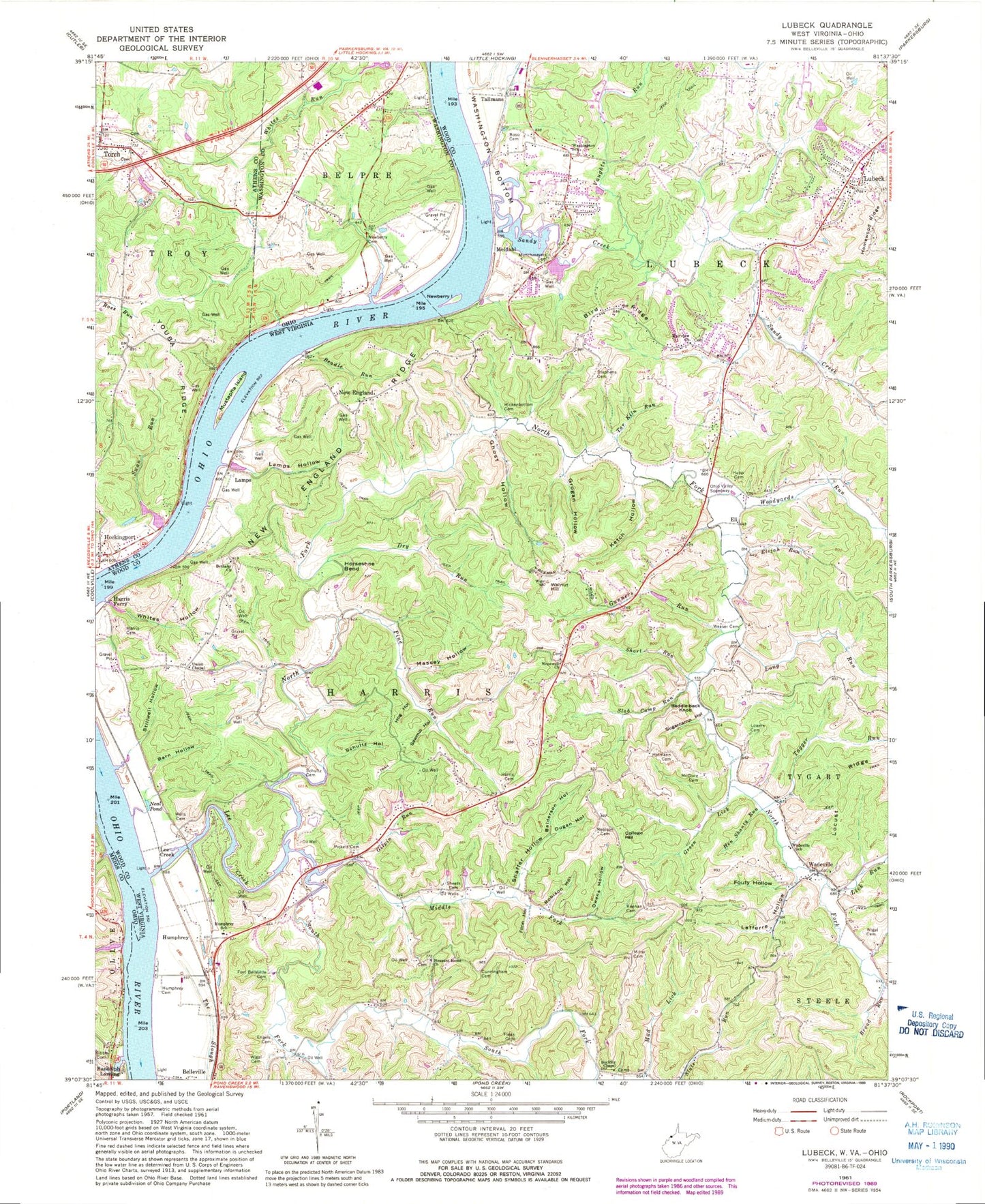
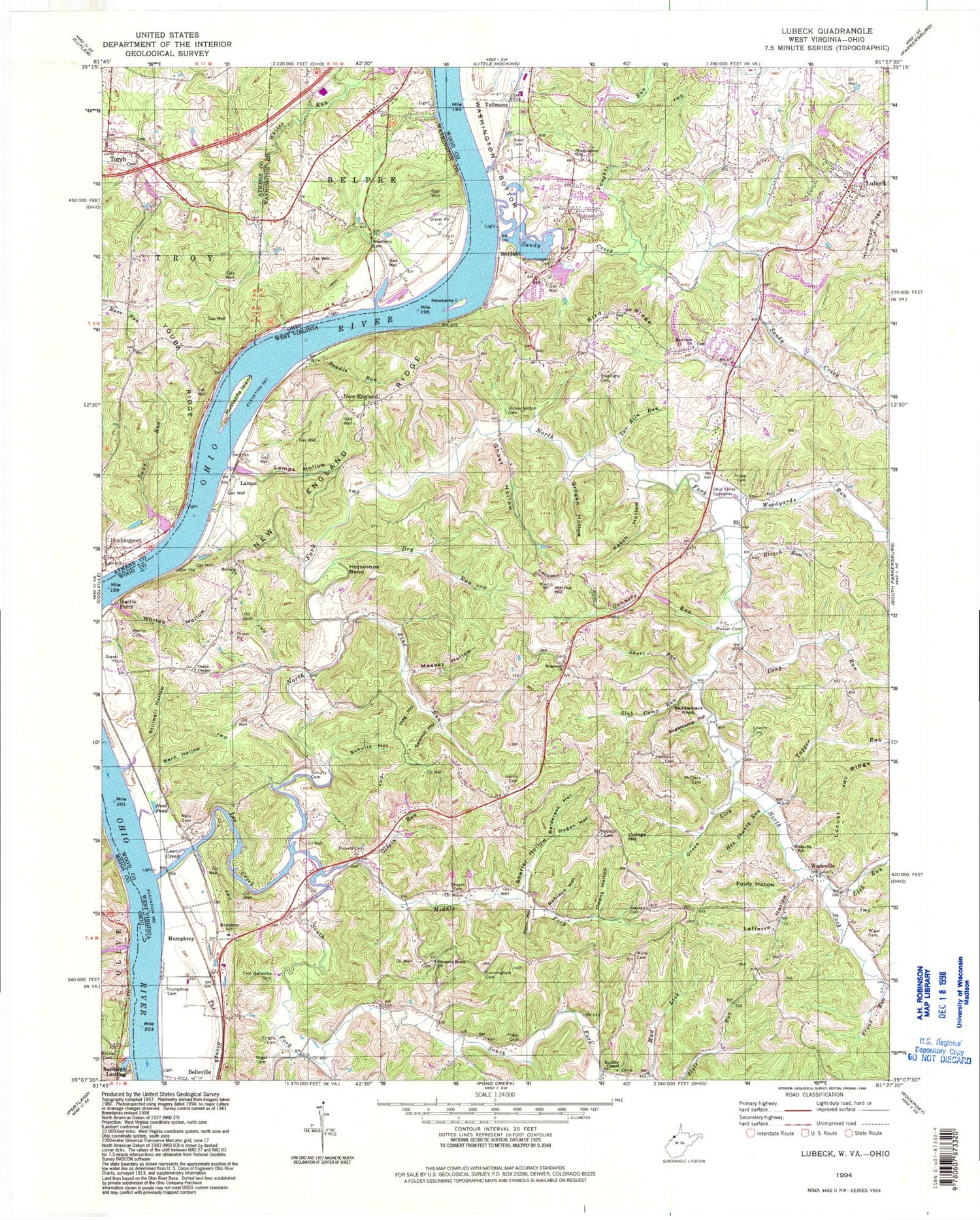
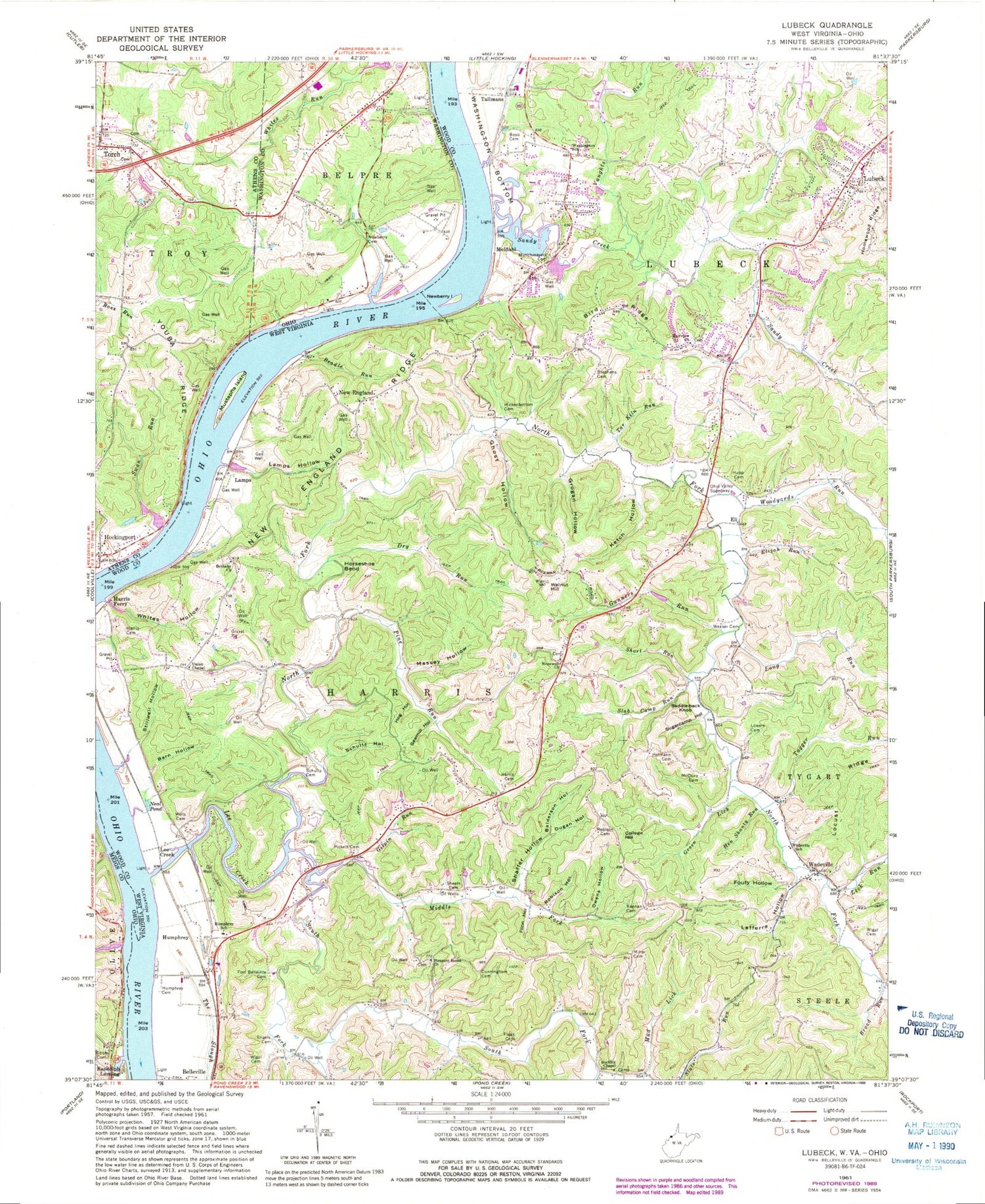
Classic USGS Lubeck West Virginia 7.5'x7.5' Topo Map
Couldn't load pickup availability
Historical USGS topographic quad map of Lubeck in the states of West Virginia, Ohio. Map scale may vary for some years, but is generally around 1:24,000. Print size is approximately 24" x 27"
This quadrangle is in the following counties: Athens, Meigs, Washington, Wood.
The map contains contour lines, roads, rivers, towns, and lakes. Printed on high-quality waterproof paper with UV fade-resistant inks, and shipped rolled.
Contains the following named places: Armenia, Balderson, Balderson Hollow, Barn Hollow, Beadle Run, Beckwith Cemetery Number 1, Belleville Post Office, Bethany Christian Church, Bethany Christian Church Cemetery, Big Champion School, Binola, Bird Ridge, Bird Ridge School, Blake Run, Boso Cemetery, Broad Run, Buckley Cemetery, Buckley Chapel, Burd Cemetery, College Hill, College Hill School, Crystal Spring Lake, Cunningham Cemetery, Curtis Landing, Dewey School, Dry Run, Dugan Hollow, Duttons Landing, Eli, Elijah Run, Engels Cemetery, Fairview Acres, Fairview Church, Fairview Methodist Episcopal Church Cemetery, Fleak Cemetery, Flinn Hollow, Fort Belleville Cemetery, Fouty Hollow, Frankhauser School, Ghost Hollow, Gilpin Run, Green Lick, Grogan Cemetery, Grogan Hollow, Gunners Run, Harris Cemetery, Harris District, Harris Ferry, Hen Shanty Run, Henry School, Hetzer - Kibble Cemetery, Hickenbottom Cemetery, Hockingport Census Designated Place, Hockingport Post Office, Hofmann Cemetery, Hog Hollow, Hopewell Cemetery, Hopewell Church, Horseshoe Bend, Humphrey, Humphrey Cemetery, Humphrey School, Hupp Cemetery, Keenan Cemetery, Kennedys Landing, Ketch Hollow, Lafferre Hollow, Lamps, Lamps Hollow, Lee Creek, Lick Run, Little Champion School, Lock and Dam Number 20, Locust Ridge, Long Run, Lowers Cemetery, Lubeck, Lubeck Cemetery, Lubeck Census Designated Place, Lubeck District, Lubeck Elementary School, Lubeck Hills, Lubeck Volunteer Fire Department Station 1, Lubeck Volunteer Fire Department Station 2, Massey Hollow, McClure Cemetery, McCollins Run, McGill Run, McPherson Addition, Meldahl, Meldahl Cemetery, Middle Fork Lee Creek, Miller Cemetery, Monitor School, Moores Landing, Munchmeyers Cemetery, Mustapha Island, Mustapha Island Bridge, Neal Pond, New England, New England Cemetery, New England Heights Addition, New England Ridge, New Torch Cemetery, Newberry Cemetery, Newberry One, Newberry School, North Fork Lee Creek, North Fork Valley Golf Course, Oak, Oak Acres, Oak Valley School, Oakes Landing, Ohio Valley Speedway, Old Torch Cemetery, Owens Hollow, Parkers Landing, Pickett Cemetery, Pine Grove School, Pine Run, Pleasant Home Cemetery, Pleasant Home Church, Randolph Landing, Remus, Robin Hood Road Bridge, Robinson Cemetery, Robison Cemetery, Robison Hollow, Rock Bluff, Rock Run, Saddle Back Knob, Sandy Creek, Sawmill Hollow, Schultz Cemetery, Schultz Hollow, Scott, Shaffer Hollow, Sheep Gap School, Sheets Cemetery, Short Run, Slab Camp Run, South Fork Lee Creek, Spenser Spring, Stephens Cemetery, Stillwell Hollow, Sugar Camp Creek Bar, Sugar Camp Creek Landing, Sugarcamp Hollow, Sugarcamp Run, Swan Run, Tagger Run, Tallmans, Tar Kiln Run, Torch, Torch Speedway, Tyner, Union Chapel, Vaughts Run, Wadesville Cemetery, Wadeville, Wadeville School, Wakefield, Walkers Crossing, Walnut Hill, Washington Bottom Volunteer Fire Department, Washington Census Designated Place, Washington Gardens, Washington School, Weaser Cemetery, Wells Cemetery, Wesley, West Point School, Whites Hollow, Wigal Cemetery, Woodyards Run, Youba, Youba Post Office, Youba Ridge, ZIP Code: 26181