MyTopo
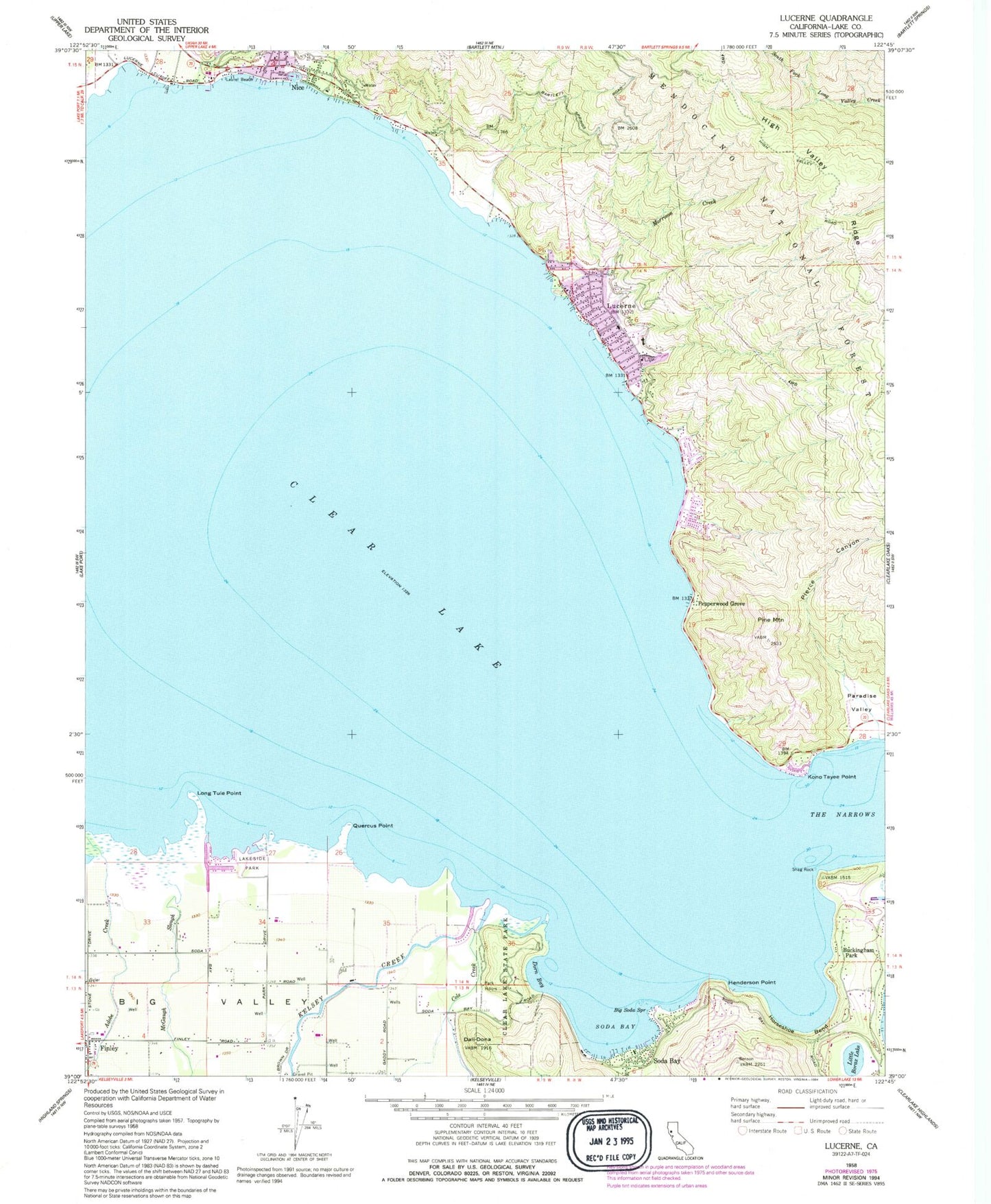
Classic USGS Lucerne California 7.5'x7.5' Topo Map
Couldn't load pickup availability
Historical USGS topographic quad map of Lucerne in the state of California. Typical map scale is 1:24,000, but may vary for certain years, if available. Print size: 24" x 27"
This quadrangle is in the following counties: Lake.
The map contains contour lines, roads, rivers, towns, and lakes. Printed on high-quality waterproof paper with UV fade-resistant inks, and shipped rolled.
Contains the following named places: Big Soda Spring, Clear Lake, Clear Lake State Park, Cole Creek, Dali-Dona, Dorn Bay, Henderson Point, Horseshoe Bend, Kelsey Creek, Kono Tayee Point, Lakeside Park, Laurel Beach, Little Borax Lake, Long Tule Point, McGaugh Slough, Morrison Creek, Paradise Valley, Pierce Canyon, Pine Mountain, Quercus Point, Shag Rock, Soda Bay, The Narrows, Lake View Campground, Shirley Slough, Lake County, Lucerne, Ferndale Resort Seaplane Base, Buckingham Park, Nice, Pepperwood Grove, Soda Bay, KXBX-FM (Lakeport), Clear Lake, Kelsey Creek School (historical), Quercus Ranch, Buckingham Golf Course, Clear Lake State Park Visitor Center, Cole Creek Campground, Dorn Nature Trail, Indian Nature Trail, Keeling Park, Kelsey Creek Campground, Lower Bayview Campground, Lucerne Christian Conference Center, Lucerne Elementary School, Lucerne Post Office, Nice Post Office, Old Kelsey Creek, Queen of the Rosary Catholic Church, Sonrise Assembly Charismatic Church, Upper Bayview Campground, Lucerne Census Designated Place, Soda Bay Census Designated Place, Northshore Fire Protection District Station 85 Nice, Northshore Fire Protection District Station 80 Lucerne Headquarters, Kelseyville Fire Station, Lake County Sheriff's Office Lucerne Substation