MyTopo
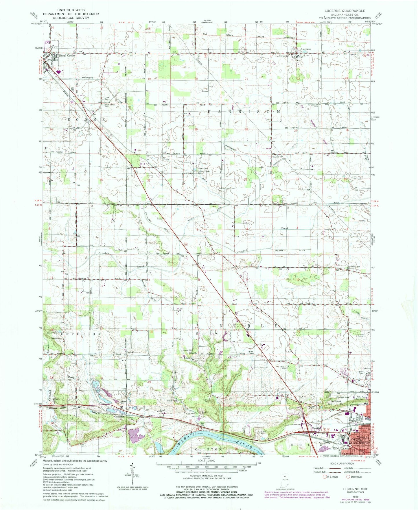
Classic USGS Lucerne Indiana 7.5'x7.5' Topo Map
Couldn't load pickup availability
Historical USGS topographic quad map of Lucerne in the state of Indiana. Map scale may vary for some years, but is generally around 1:24,000. Print size is approximately 24" x 27"
This quadrangle is in the following counties: Cass.
The map contains contour lines, roads, rivers, towns, and lakes. Printed on high-quality waterproof paper with UV fade-resistant inks, and shipped rolled.
Contains the following named places: Bethel Church, Brown Ditch, Busard Ditch, Cline Cemetery, Concord Church, Crooked Creek Cemetery, Dunkirk, Dykeman Park, East Sandridge Cemetery, Fredricks Ditch, Grant Cemetery, Harper Cemetery, Harrison Township Fire Department Lucerne, Kenneth, Lucerne, Lucerne Post Office, McNitt Ditch, Miller Ditch, Pisgah Church, Riley Ditch, Rolhausen Ditch, Royal Center, Royal Center City Fire Department, Royal Center Police Department, Royal Center Post Office, Royal Centre Cemetery, Saint Bridgets School, Saint Elizabeth Cemetery, Shiloh Church, Skyline Drive-In, Township of Harrison, Township of Noble, Umbenhour Ditch, Webb Chapel, Wheatland Avenue Church, Zion Church, ZIP Code: 46947