MyTopo
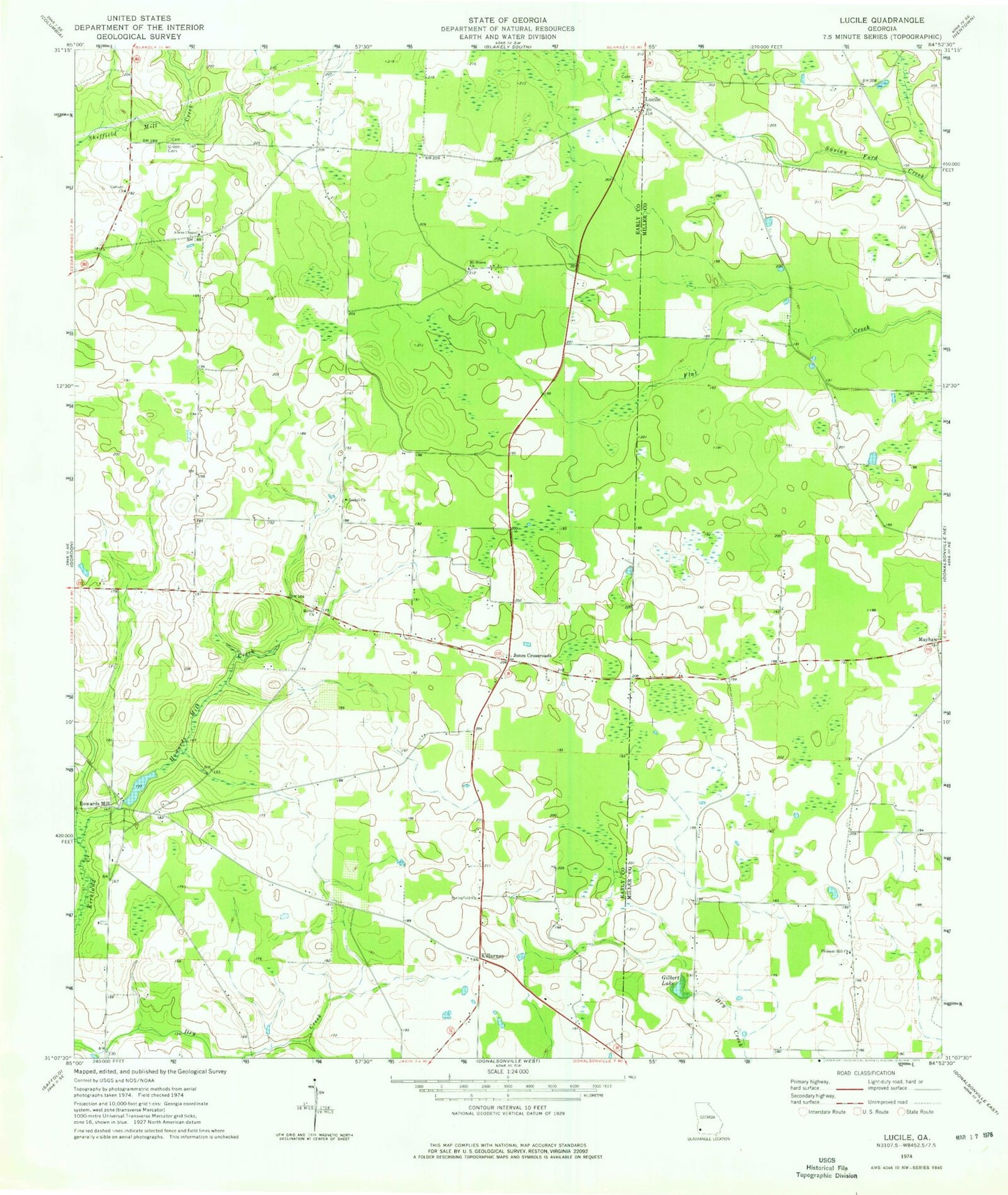
Classic USGS Lucile Georgia 7.5'x7.5' Topo Map
Couldn't load pickup availability
Historical USGS topographic quad map of Lucile in the state of Georgia. Map scale may vary for some years, but is generally around 1:24,000. Print size is approximately 24" x 27"
This quadrangle is in the following counties: Early, Miller.
The map contains contour lines, roads, rivers, towns, and lakes. Printed on high-quality waterproof paper with UV fade-resistant inks, and shipped rolled.
Contains the following named places: Acocks Creek, Allens Chapel, Bethel Cemetery, Bethel Church, Bethel Primitive Baptist Church, Calvary Church, Early County Fire Department Lucille Station, Gilbert Lake, Gilbert Lake Dam, Green Cemetery, Griggs School, Howards Mill, Howards Mill Creek, Jones Crossroads, Killarney, Lucile, Mayhaw, Mims Millpond Dam, Mount Hosea Church, Pine View Baptist Church, Pleasant Hill Church, Sheffield Still, Spooners School, Springfield, Springfield Baptist Church Cemetery, Springfield Missionary Baptist Church, Springfield School, White Plains Free Will Baptist Church, White Plains Freewill Baptist Church Cemetery, ZIP Code: 39861