
MyTopo
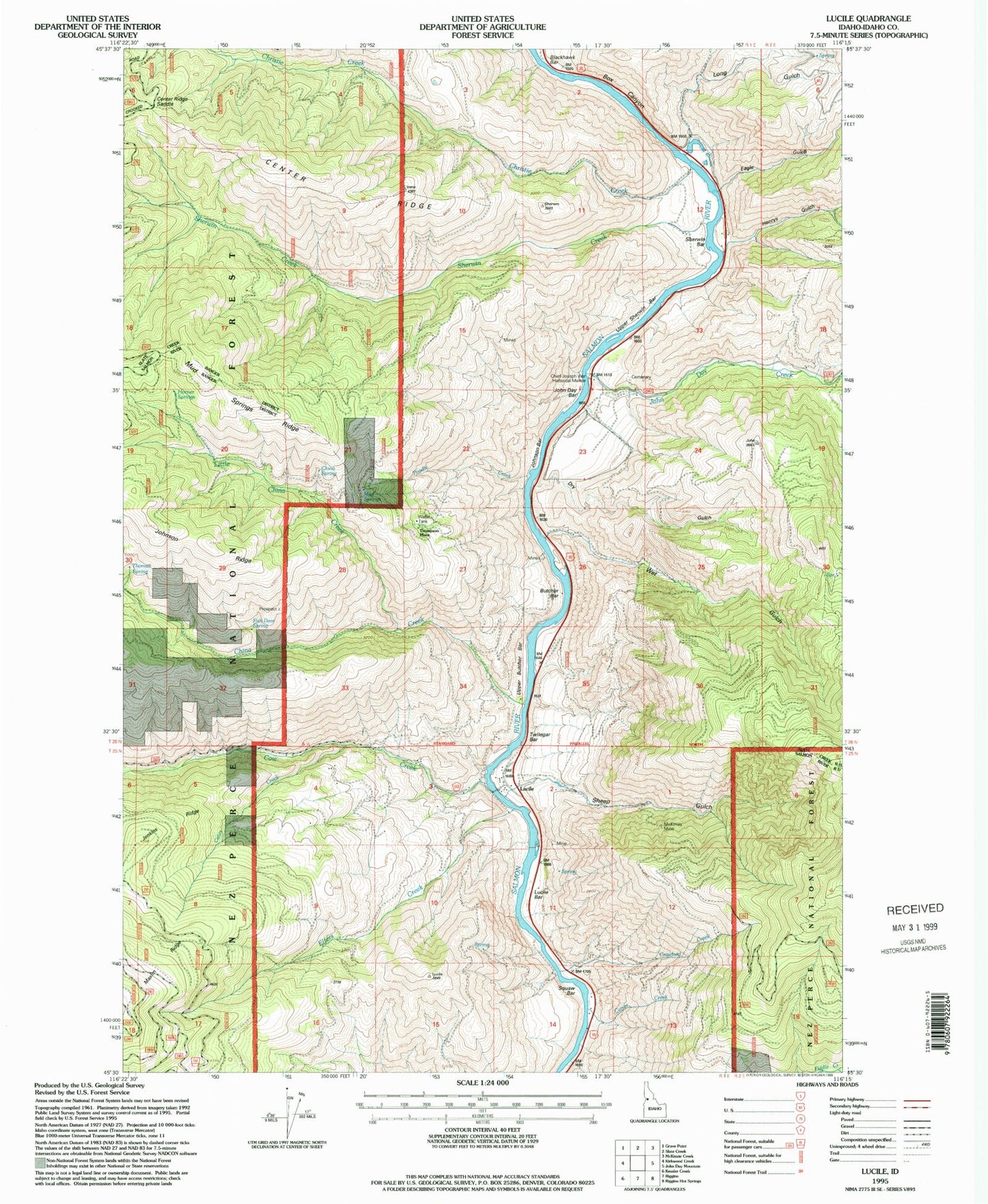
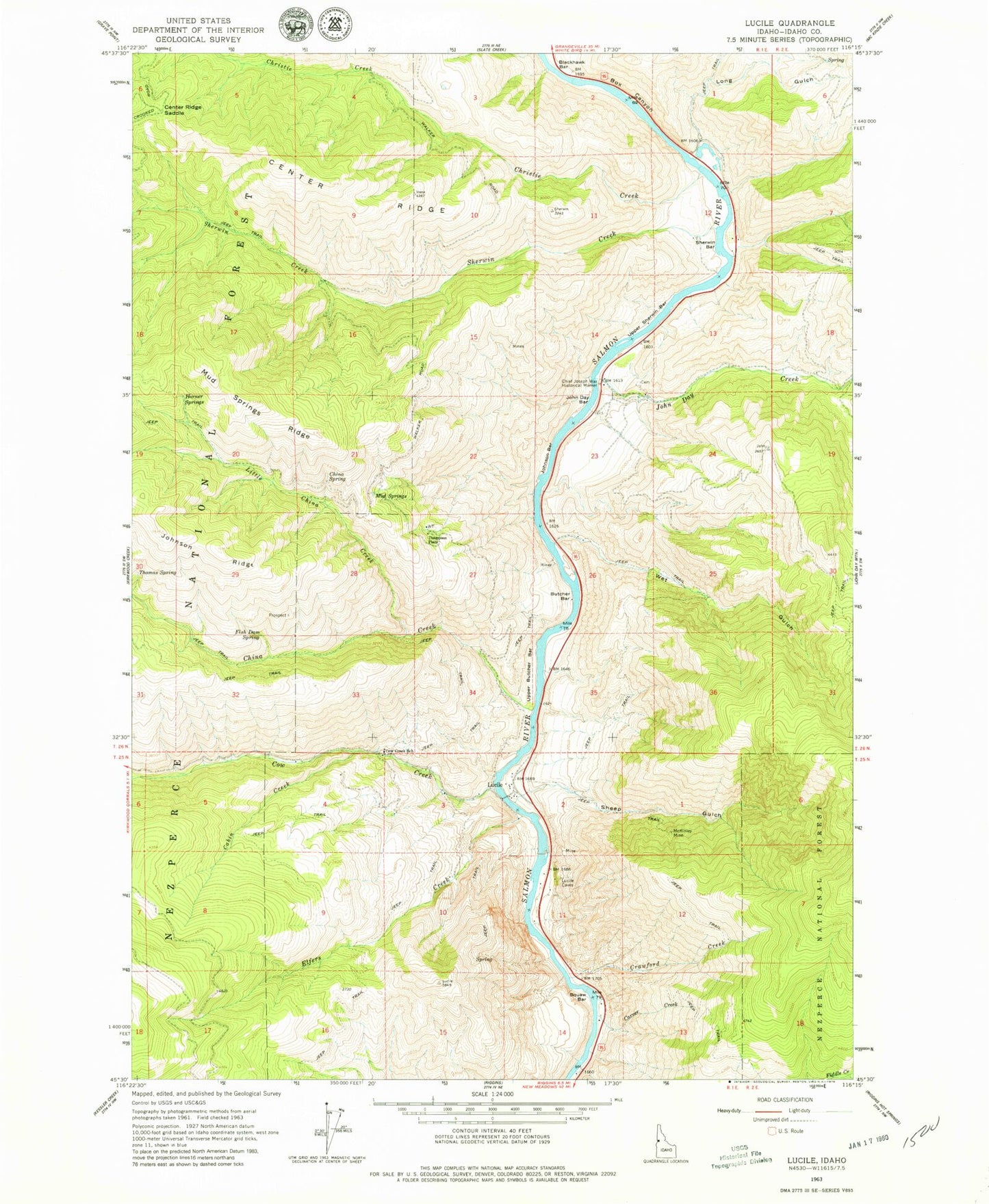
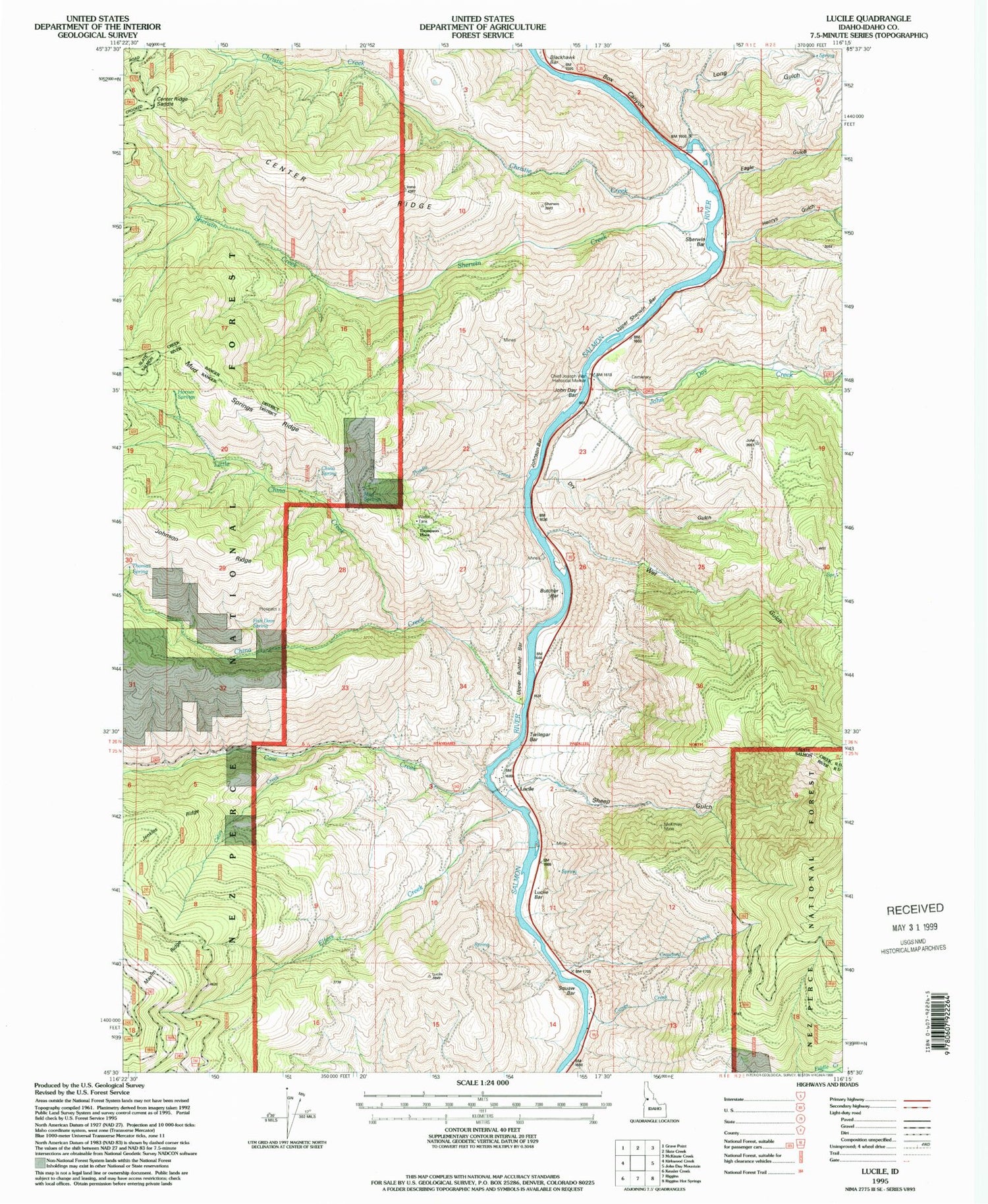
Classic USGS Lucile Idaho 7.5'x7.5' Topo Map
Couldn't load pickup availability
Historical USGS topographic quad map of Lucile in the state of Idaho. Map scale may vary for some years, but is generally around 1:24,000. Print size is approximately 24" x 27"
This quadrangle is in the following counties: Idaho.
The map contains contour lines, roads, rivers, towns, and lakes. Printed on high-quality waterproof paper with UV fade-resistant inks, and shipped rolled.
Contains the following named places: Blackhawk Rapid, Bob Sewell, Box Canyon, Butcher Bar, Cabin Creek, Carver Creek, Center Ridge, Center Ridge Saddle, Chief Joseph War Historical Marker, China Creek, China Spring, Christie Creek, Circle C Ranch, Cow Creek, Cow Creek School, Crawford Creek, Dry Gulch, Eagle Gulch, Elfers Creek, Fish Dam Spring, George Gill, Hayes, Henry Rhett, Henrys Gulch, Herb Brown, Horner Springs, John Day Bar, John Day Creek, Johnson Bar, Johnson Ridge, Little China Creek, Long Gulch, Lucile, Lucile Bar, Lucile Post Office, McKinley Mine, Mud Springs, Mud Springs Ridge, Poodle Creek, Salmon River Rural Fire District Station 4, Sewell, Sheep Gulch, Sherwin Bar, Sherwin Creek, Squaw Bar, Thomas Spring, Thompson Place, Twilegar Bar, Upper Butcher Bar, Upper Sherwin Bar, Wet Gulch, ZIP Code: 83542