MyTopo
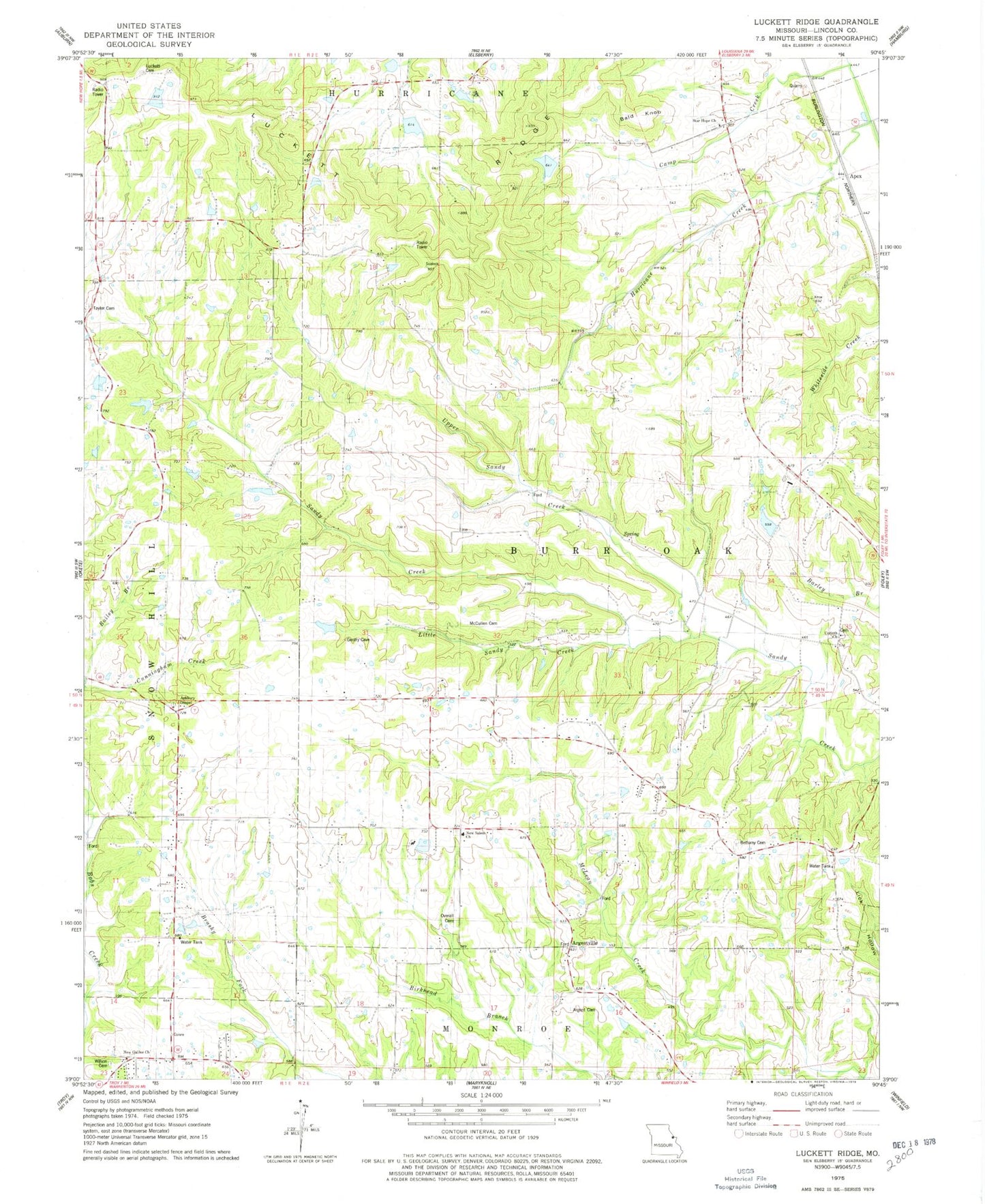
Classic USGS Luckett Ridge Missouri 7.5'x7.5' Topo Map
Couldn't load pickup availability
Historical USGS topographic quad map of Luckett Ridge in the state of Missouri. Map scale may vary for some years, but is generally around 1:24,000. Print size is approximately 24" x 27"
This quadrangle is in the following counties: Lincoln.
The map contains contour lines, roads, rivers, towns, and lakes. Printed on high-quality waterproof paper with UV fade-resistant inks, and shipped rolled.
Contains the following named places: Apex, Argent Cemetery, Argentville, Ashbury Chapel, Ashbury Chapel Cemetery, Bald Knob, Bethany Cemetery, Bethany Methodist Church, Birkhead Lake, Birkhead Lake Dam, Boehm Lake, Boehm Lake Dam, Britt School, Brussells School, Burr Oak, Burr Oak School, Camp Creek, Campbell Lake, Campbell Lake Dam, Corinth Cemetery, Corinth Church, Cornick School, Cunningham Creek, Ellis School, Gentry Lake, Gentry Lake Dam, Glosier Lake, Glosier Lake Dam, Hickory Ridge School, Hillside Gardens Lake, Hillside Gardens Lake Dam, Hurricane Creek, Little Sandy Creek, Lost Creek Watershed E-2 Dam, Lost Creek Watershed E-2 Reservoir, Lost Creek Watershed Structure E-7 Lake, Lost Lake, Lost Lake Dam, Luckett Cemetery, Luckett Ridge, McCane Lake, McCane Lake Dam, McCullen Cemetery, Merenaught Farms Lake, Merenaught Farms Lake Dam, Myers School, Nelsens Lake, Nelsens Lake Dam, New Galilee Cemetery, New Galilee Church, New Salem, New Salem Cemetery, New Salem Church, New Salem School, Overall Cemetery, Peek Lake Section 13, Peek Lake Section 13 Dam, Peek Lake Section 18, Peek Lake Section 18 Dam, Pleasant Hill Cemetery, Ross-Mulvehill Lake, Ross-Mulvehill Lake Dam, Skyway Lake, Skyway Lake Dam, Smith Lake, Smith Lake Dam, Star Hope Cemetery, Star Hope Church, Star Hope School, Taylor Cemetery, Taylor Lake, Taylor Lake Dam, Taylor School, Terrell Lake, Terrell Lake Dam, Township of Burr Oak, Upper Sandy Creek, Wilson Cemetery, Winfield - Foley Fire Protection District Station 4, Winfield Manor Heliport, Wollgast Lake, Wollgast Lake Dam, ZIP Codes: 63347, 63389