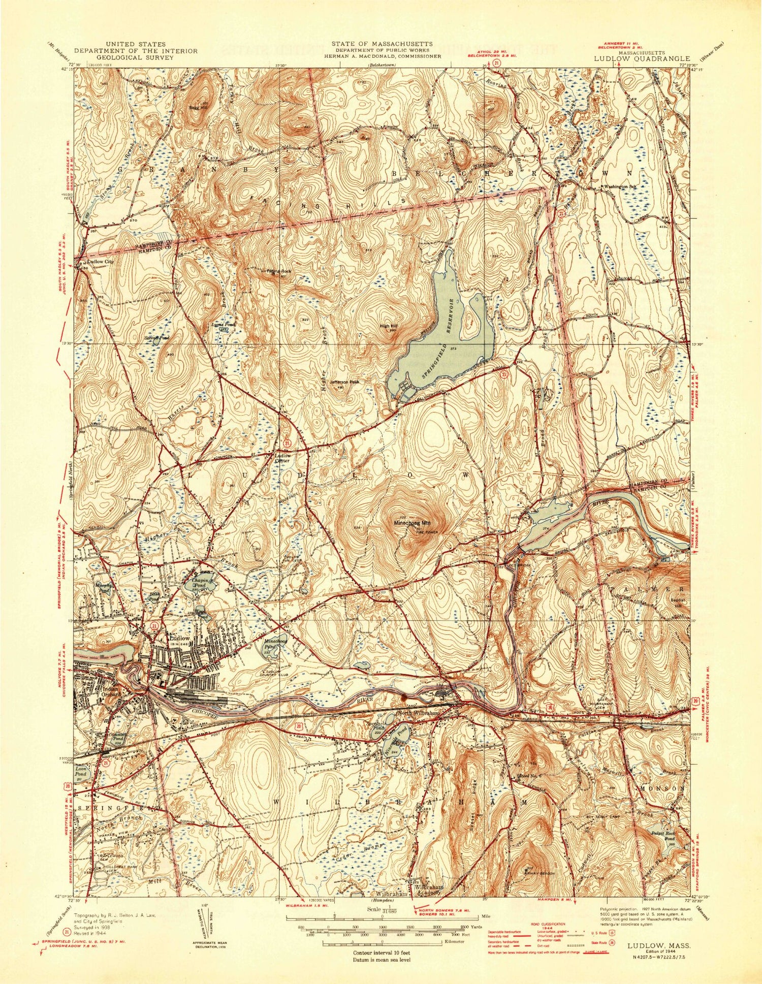
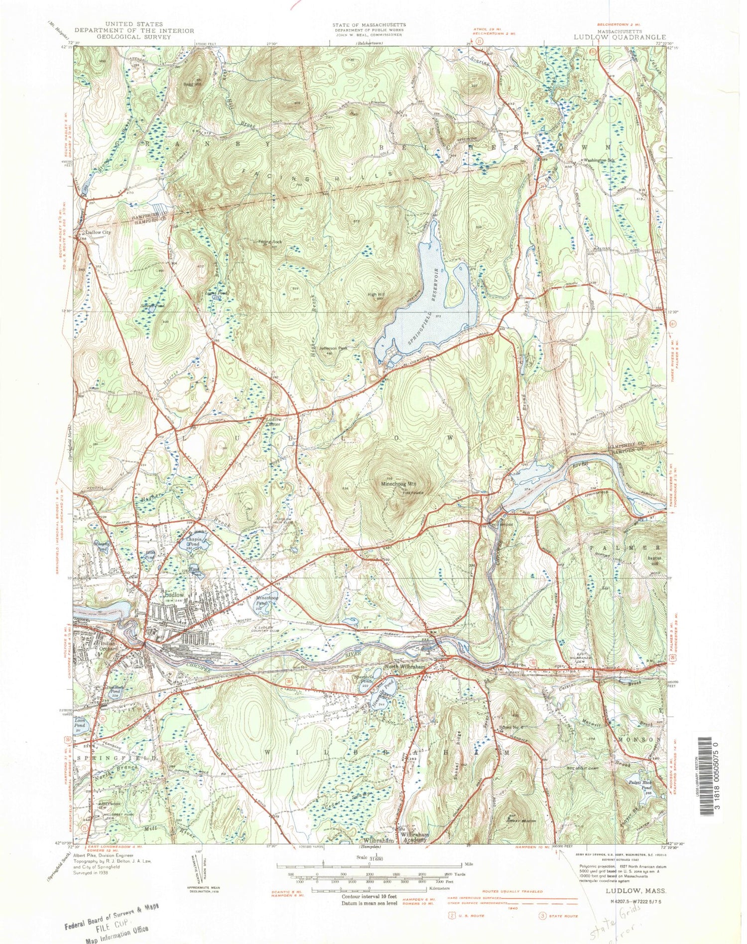
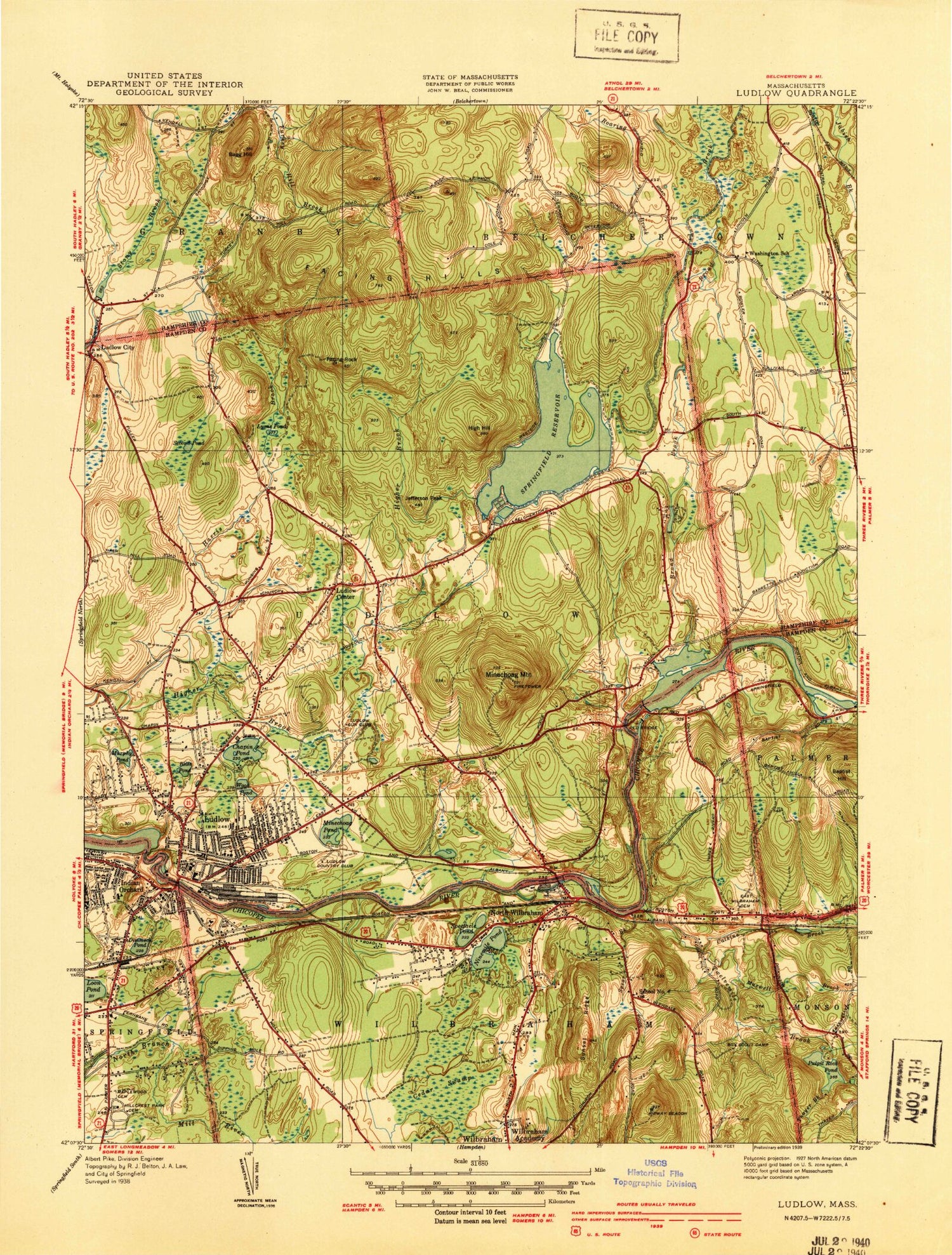
MyTopo
Classic USGS Ludlow Massachusetts 7.5'x7.5' Topo Map
Couldn't load pickup availability
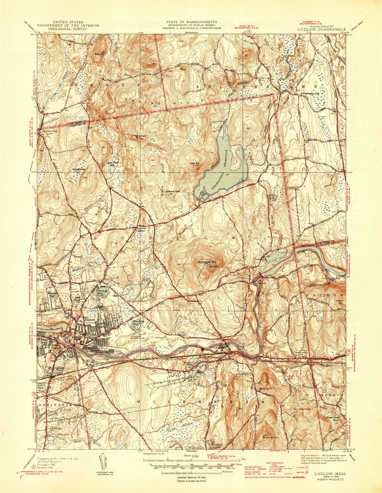
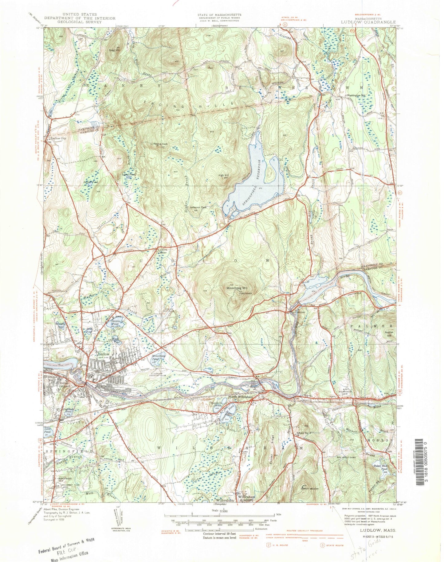
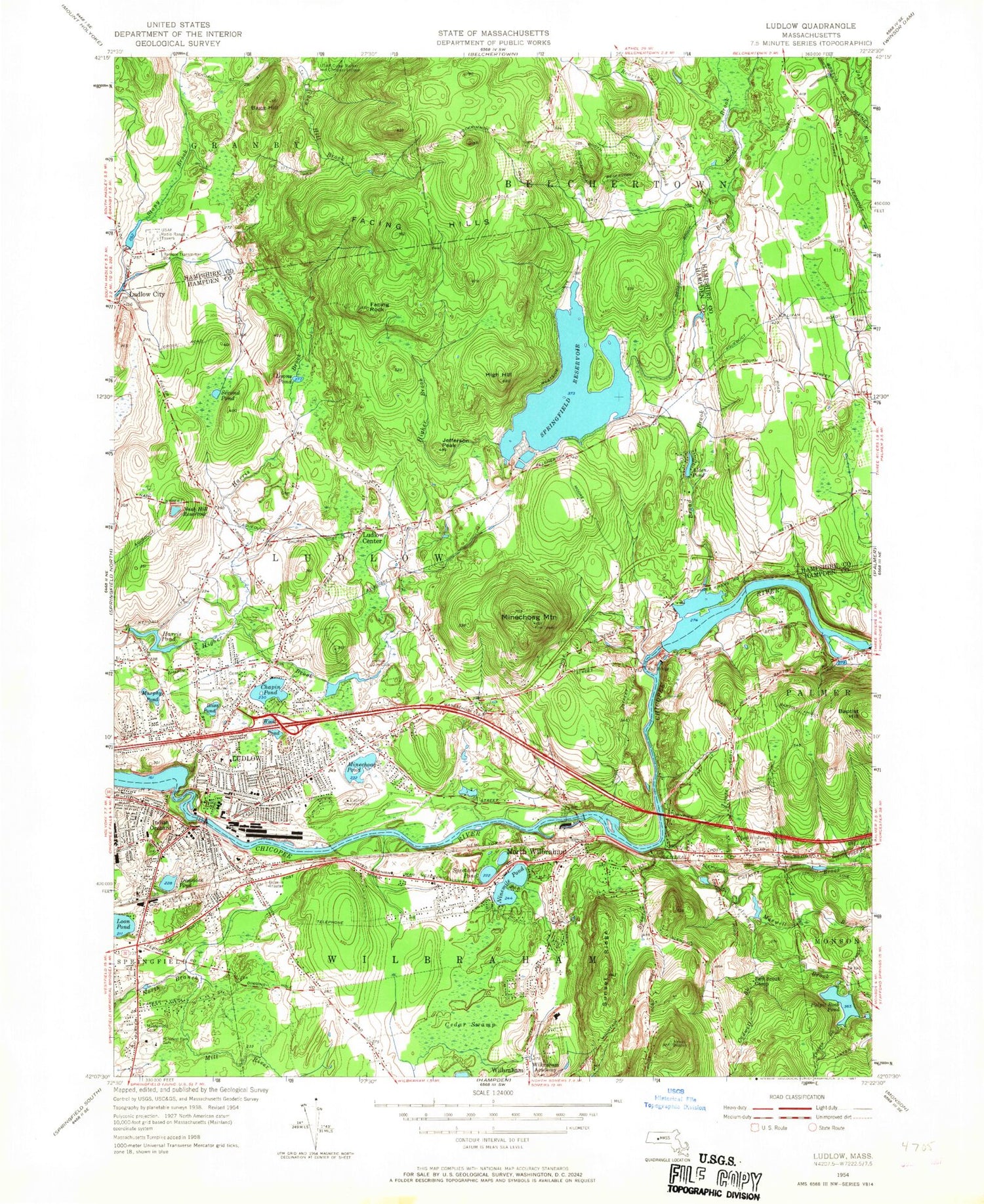
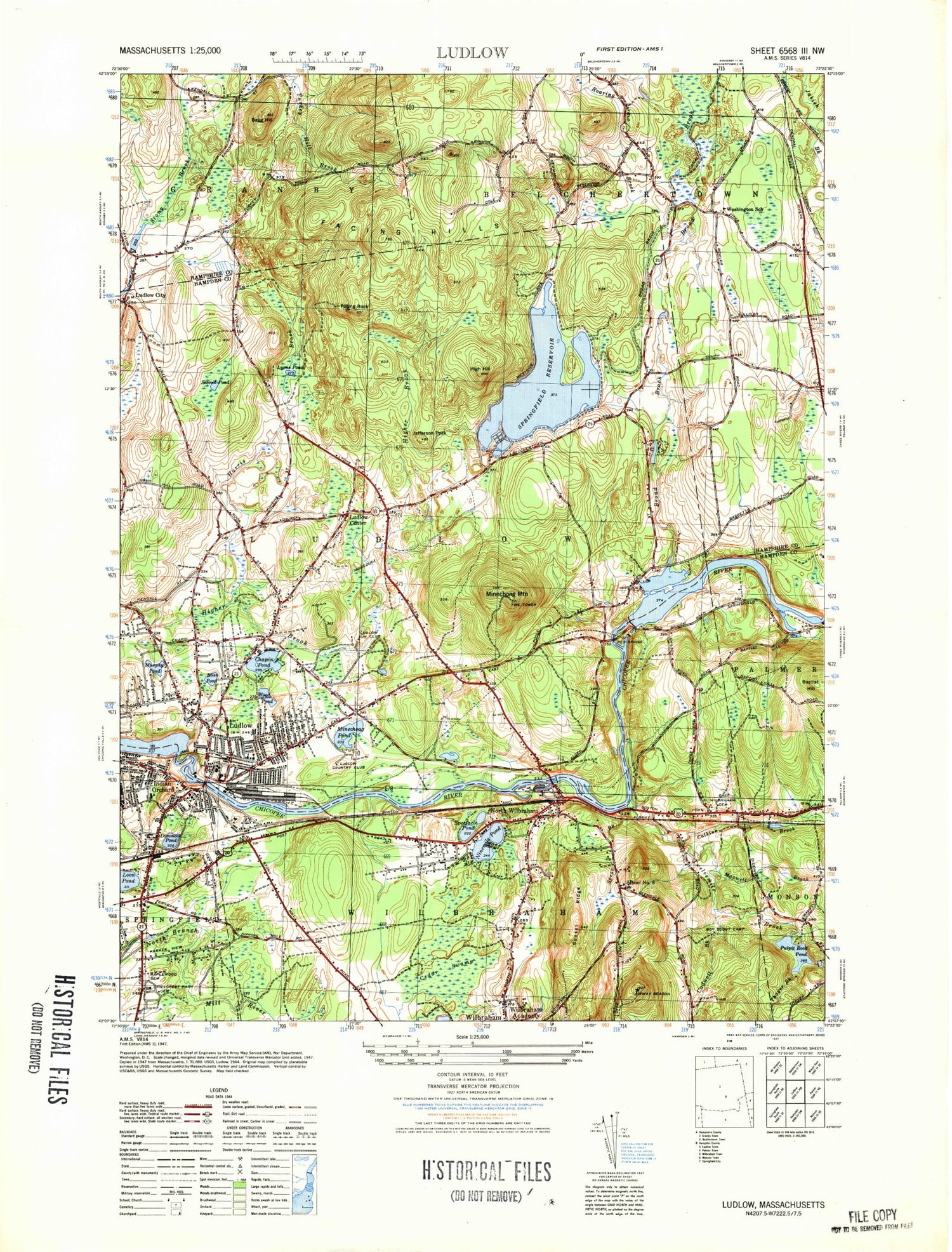
Historical USGS topographic quad map of Ludlow in the state of Massachusetts. Map scale may vary for some years, but is generally around 1:24,000. Print size is approximately 24" x 27"
This quadrangle is in the following counties: Hampden, Hampshire.
The map contains contour lines, roads, rivers, towns, and lakes. Printed on high-quality waterproof paper with UV fade-resistant inks, and shipped rolled.
Contains the following named places: Ahearn Heliport, Alden Pond, Alden Pond Dam, Axe Factory Brook, Bagg Hill, Benjamin Sikes Cemetery, Boston Road Shopping Center, Broad Brook, Broad Brook Canal, Butlerville, Cadwell Brook, Calkins Brook, Cedar Swamp, Chapin Elementary School, Chapin Street Elementary School Library Media Center, Cherry Valley Dam, Chicopee River Reservoir, Chopin Pond, Cole School, Dimmock Pond, East Street Elementary School Library, East Street School, East Wilbraham, East Wilbraham Cemetery, Eastfield Mall, Eastfield Mall Shopping Center, Ellis Mills, Facing Hills, Facing Rock, Finast Shopping Center, First Church in Ludlow, Fox Hill, Gamache Pond, Grace Union Church, Harris Brook, Harris Pond, Harris Pond Dam, Haviland Pond, HealthSouth Rehabilitation Hospital of Western Massachusetts, High Hill, Higher Brook, Hillcrest Park Cemetery, Hubbard Memorial Library, Hubbard Park, Iinast Shopping Center, Immaculate Conception School, Indian Leap, Indian Orchard, Indian Orchard Elementary School, Island Pond Cemetery, Jefferson Peak, Kingdom Hall of Jehovahs Witnesses, Loon Pond, Ludlow, Ludlow Ambulance Service, Ludlow Center, Ludlow Center Cemetery, Ludlow Center Historic District, Ludlow City, Ludlow Country Club, Ludlow Dam, Ludlow Fire Department, Ludlow High School Library Media Center, Ludlow Medical Center, Ludlow Plaza Shopping Center, Ludlow Police Department, Ludlow Post Office, Ludlow Senior High School, Ludlow Shopping Center, Ludlow Shopping Plaza, Lyons Pond, Maplewood Cemetery, Marshalls Boston-Parker Plaza Shopping Center, Mary A Dryden Veterans Memorial School, Maxwell Brook, Meadowbrook Shopping Center, Minechoag Brook, Minechoag Mountain, Minechoag Pond, Mount Marcy, Mullins School, Murphy Pond, Nash Hill Reservoir, Nash Hill Reservoir Dam, Ninemile Pond, North Branch Park, North Wilbraham, Orchard Children's Corner School, Our Lady of Fatima Church, Paul R Baird Middle School, Pickerel Pond, Pulpit Rock Pond, Pulpit Rock Pond New Dam, Pulpit Rock Pond West Dam, Red Bridge, Red Bridge Dam, Red Bridge State Park, Reynolds Pond, Roaring Brook, Rock Rimmon, Saint Cecilias Parish Church, Saint Gregory Armenian Church, Saint John the Baptist School, Saint Marys Church, Saint Pauls United Methodist Church, Saint Peter and Paul Ukranian Catholic Church, Second Pond, Spear Brook, Spectacle Pond, Springdale Mall, Springdale Mall Shopping Center, Springfield Reservoir, Stony Hill Plaza Shopping Center, Sunset Ridge, Thayer Brook, Town of Ludlow, Town of Wilbraham, Turkey Hill, Twelvemile Brook, Union Church of Christ, United Church of Christ, Veterans Park Elementary School, Wallamanumps Falls, Warner School, Warner School Library, Western Mass Electric Dam, Wilbraham Bible Church, Wilbraham Census Designated Place, Wilbraham Fire Department, Wilbraham Middle School, Wilbraham Mountains, Wilbraham Police Department, Wilbraham Post Office, Wood Pond, ZIP Codes: 01056, 01095