
MyTopo
Classic USGS Ludville Georgia 7.5'x7.5' Topo Map
Couldn't load pickup availability
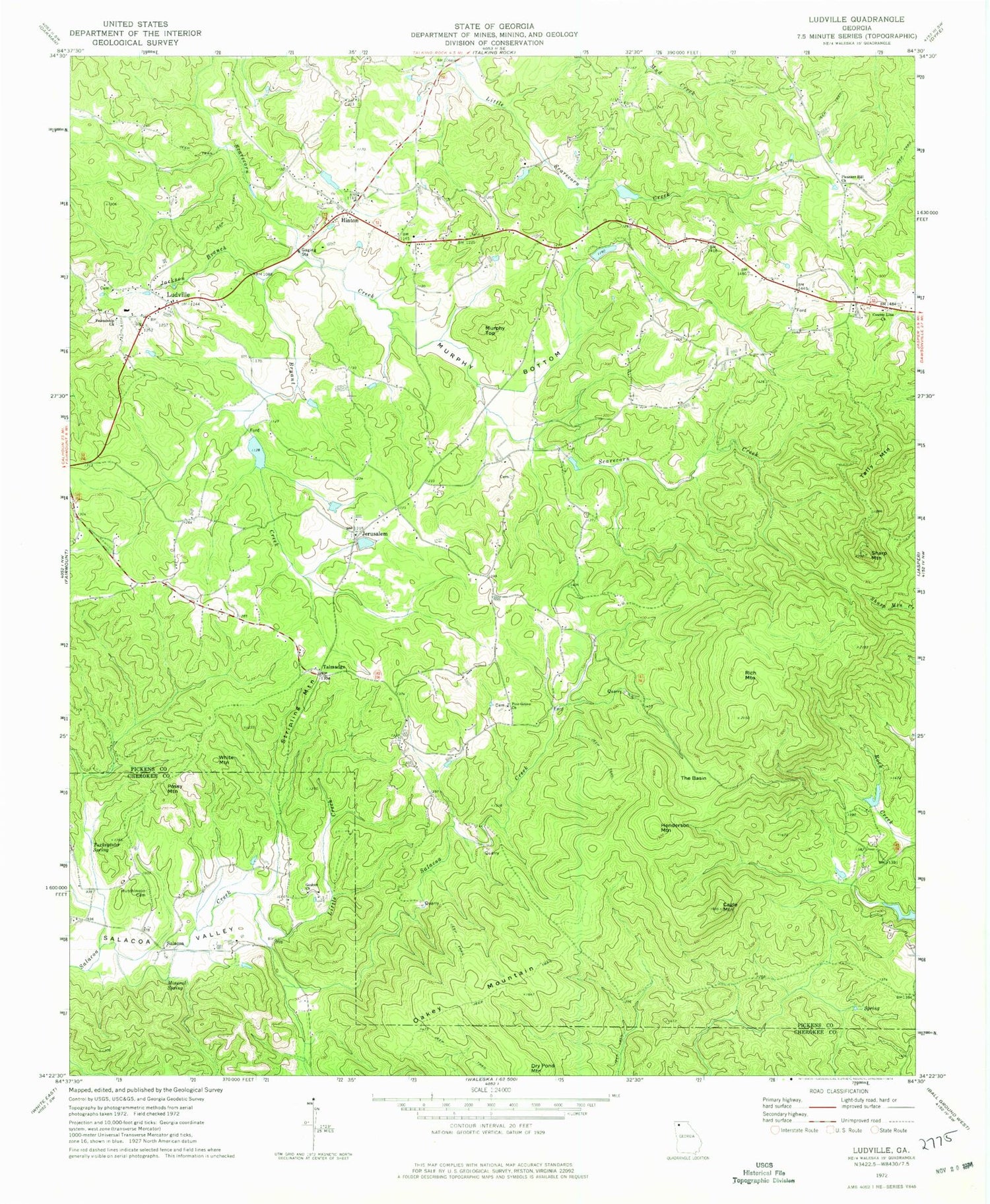
Historical USGS topographic quad map of Ludville in the state of Georgia. Typical map scale is 1:24,000, but may vary for certain years, if available. Print size: 24" x 27"
This quadrangle is in the following counties: Cherokee, Pickens.
The map contains contour lines, roads, rivers, towns, and lakes. Printed on high-quality waterproof paper with UV fade-resistant inks, and shipped rolled.
Contains the following named places: Bryant Creek, Cagle Mountain, County Line Church, Friendship Church, Goshen Church, Hutcherson Cemetery, Jackson Branch, Little Creek, Mineral Spring, Murphy Bottom, Oakey Mountain, Pine Grove Church, Pleasant Hill Church, Sharp Mountain, The Basin, Turkeytoter Spring, Jerusalem, Talmadge, Henderson Mountain, Hinton, Ludville, Murphy Top, Posey Mountain, Rich Mountain, Salacoa, Stripling Mountain, Tally Mountain, White Mountain, Mullinax Lake, Talking Rock Watershed Dam Number One, Watson Lake, Talking Rock Watershed Dam Number Two, Medlin Lake, Talking Rock Watershed Dam Number Three, Van Valkenburgh Lake, Talking Rock Watershed Dam Number Four, Martin Lake, Sallacoa Creek Watershed Dam Number 95, Kraft Lake, Dobbs Lake Dam, Dobbs Lake, County Line Cemetery, Crossroads Church, Jerusalem Church, Ludville Church, Ludville High School (historical), Unity Church, Ludville Division, Hill City Elementary School, Pickens County Fire and Rescue Department Station 6


