MyTopo
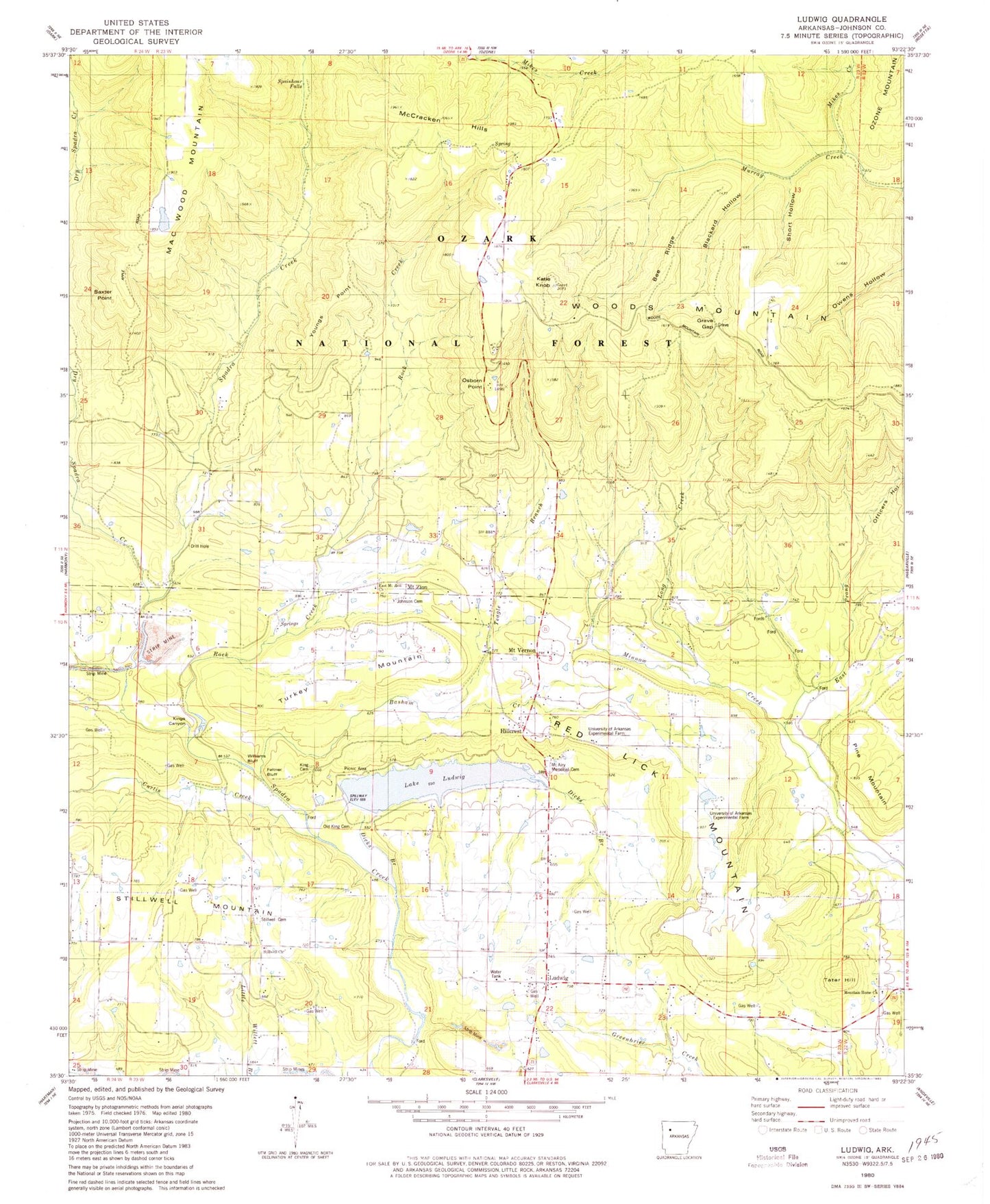
Classic USGS Ludwig Arkansas 7.5'x7.5' Topo Map
Couldn't load pickup availability
Historical USGS topographic quad map of Ludwig in the state of Arkansas. Typical map scale is 1:24,000, but may vary for certain years, if available. Print size: 24" x 27"
This quadrangle is in the following counties: Johnson.
The map contains contour lines, roads, rivers, towns, and lakes. Printed on high-quality waterproof paper with UV fade-resistant inks, and shipped rolled.
Contains the following named places: Feltner Bluff, Grave Gap, Hillcrest, Johnson Cemetery, King Cemetery, Kings Canyon, Long Creek, Mount Airy Memorial Cemetery, Mount Vernon, Mount Zion, Old King Cemetery, Short Hollow, Spainhour Falls, Stillwell Cemetery, Turkey Mountain, Williams Bluff, Ludwig Gas Field, Township of King, Township of Red Lick, Johnson County, Owens Hollow, Pine Mountain, Officers Hollow, Baxter Point, Bee Ridge, Blackard Hollow, Curtis Creek, Dry Spadra Creek, Gillian School, Katie Knob, East Prong Minnow Creek, Ludwig, Mac Wood Mountain, Martin Spring, McCracken Hills, Mikes Creek, Minnow Creek School, Mount Vernon School, Mount Zion School, Osborn Point, Pleasant Ridge School, Red Lick Mountain, Rock Creek, Stillwell Mountain, Stillwell School, Trinity Church, Youngs Point, Lake Ludwig, Basham Creek, Dicks Branch, East Mount Zion Baptist Church, Mountain Home Freewill Baptist Church, Stillwell Bible Baptist Church, University of Arkansas Experimental Farm, Ludwig Lake Dam, Holloway Pond Dam, KXIO-FM (Clarksville), Johnson County Rural Fire Department Station 1 Mount Vernon, Johnson County Rural Fire Department Station 1 Substation