MyTopo
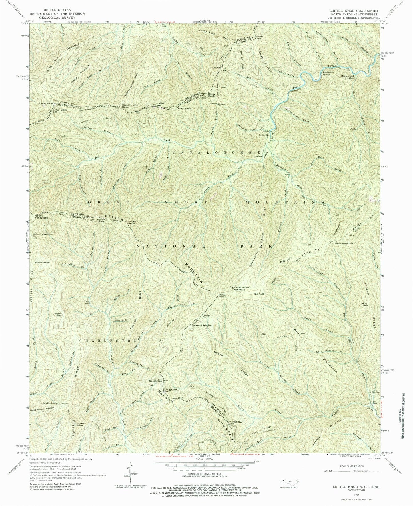
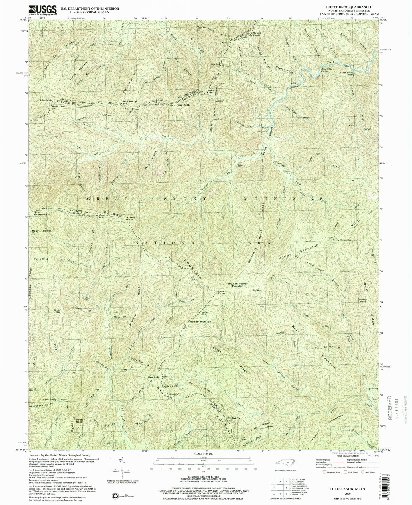
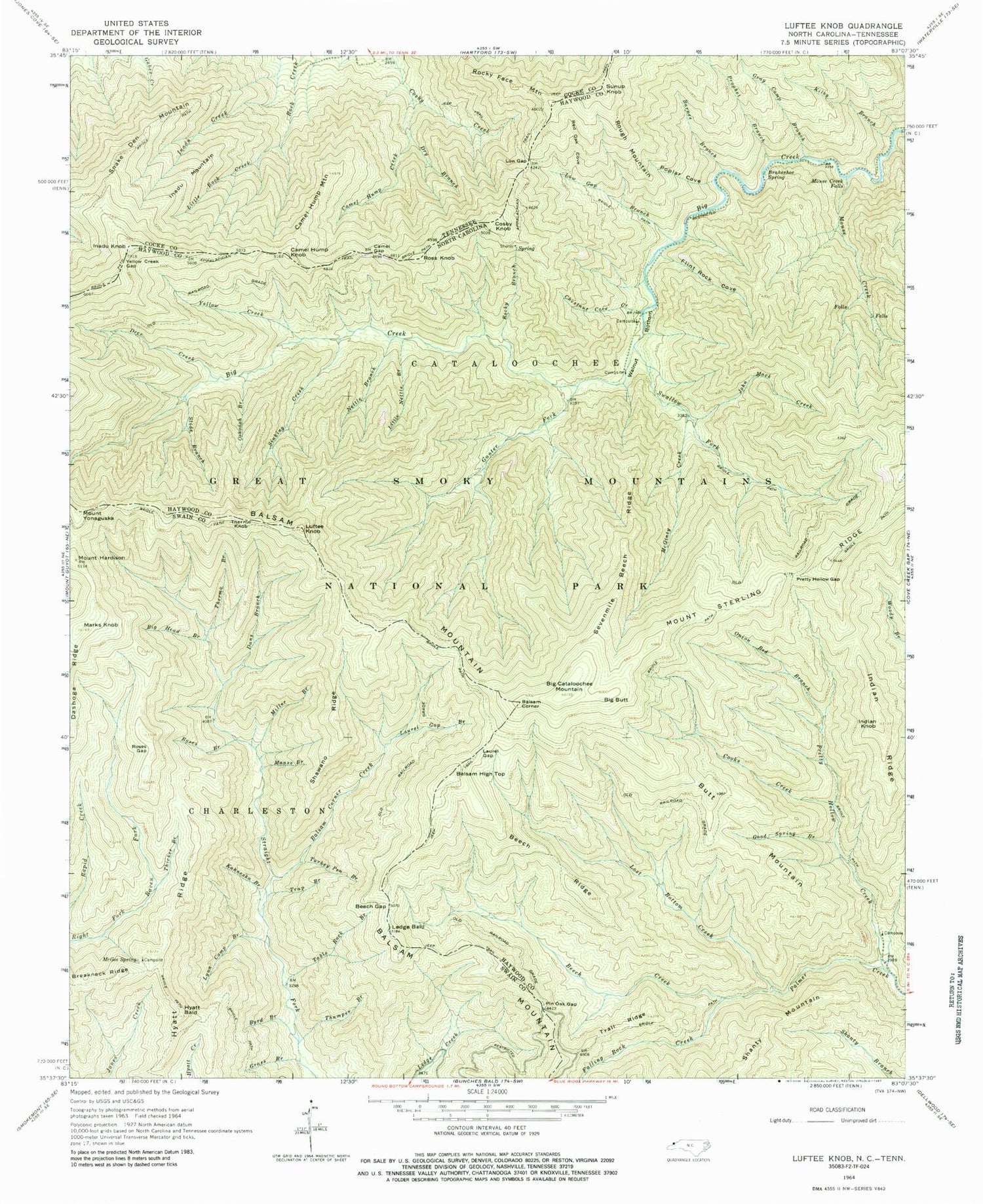
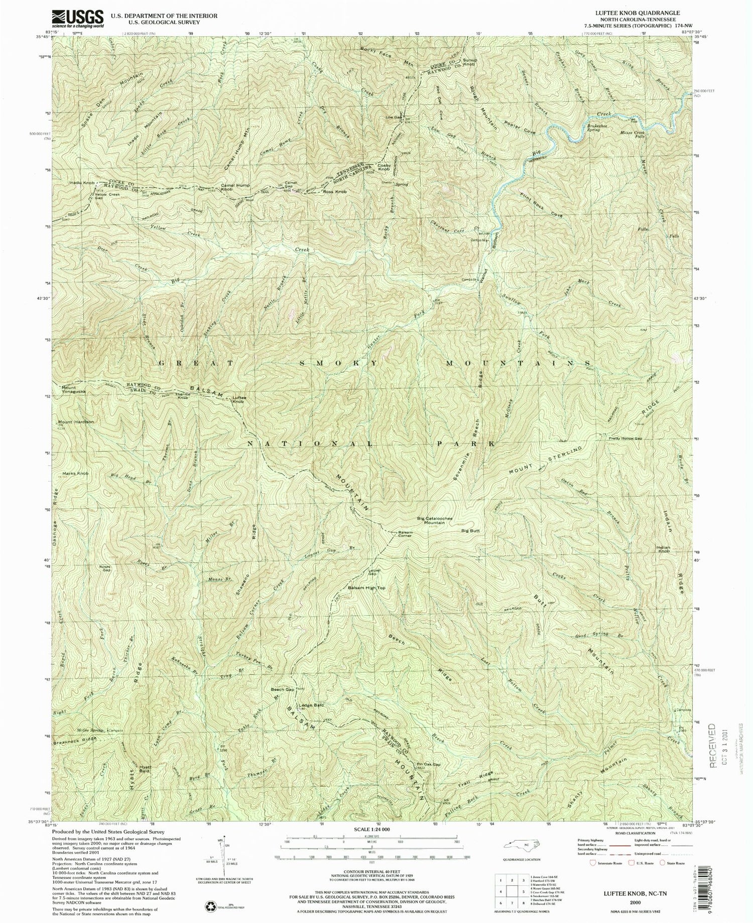
USGS Classic Luftee Knob North Carolina 7.5'x7.5' Topo Map
Couldn't load pickup availability
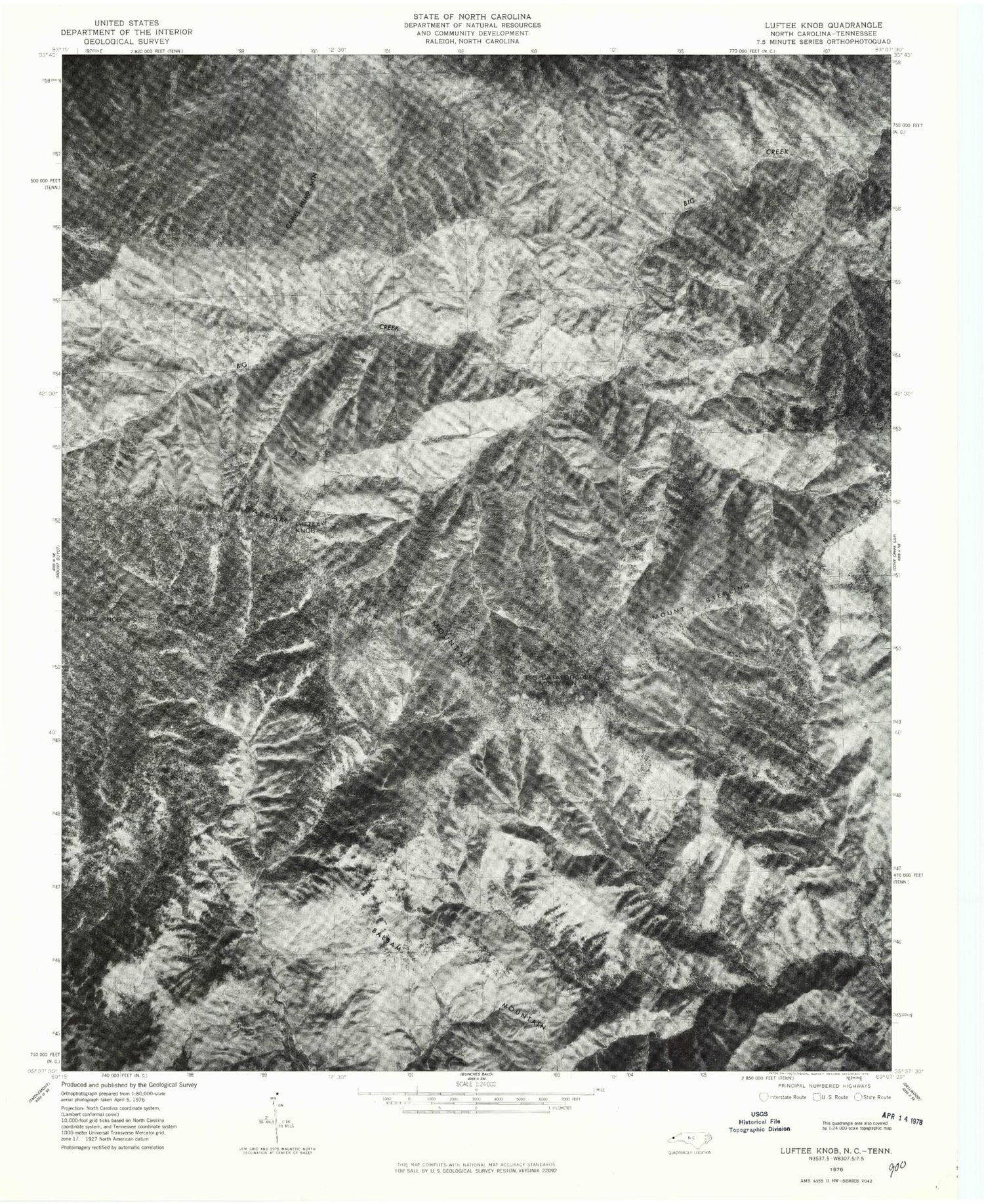
Historical USGS topographic quad map of Luftee Knobin the states of North Carolina, Tennessee. Scale: 1:24000. Print size: 24" x 27"
This quadrangle is in the following counties: Cocke, Haywood, Swain.
The map contains contour lines, roads, rivers, towns, lakes, and grids including latitude / longitude and UTM / MGRS. Printed on high-quality waterproof paper with UV fade-resistant inks.
Contains the following named places: Balsam Corner Creek, Barnes Branch, Beech Creek, Beech Gap, Beech Ridge, Big Head Branch, Brakeshoe Spring, Byrd Branch, Camel Gap, Chestnut Cove Creek, Cooks Creek, Dans Branch, Deer Creek, Falling Rock Creek, Flint Rock Cove, Good Spring Branch, Grass Branch, Gunter Fork, Hyatt Bald, Hyatt Ridge, Indian Knob, Indian Ridge, John Mack Creek, Kahneska Branch, Kilby Branch, Laurel Gap, Laurel Gap Branch, Ledge Bald, Little Nettle Branch, Lost Bottom Creek, Low Gap, Low Gap Branch, Luftee Knob, Lynn Camp Branch, Manse Branch, Marks Knob, Mc Gee Spring, Mc Ginty Creek, Miller Branch, Mouse Creek, Mouse Creek Falls, Nettle Branch, Onion Bed Branch, Oskodah Branch, Pin Oak Gap, Poplar Cove, Pretty Hollow Creek, Pretty Hollow Gap, Red Oak Cove, Rocky Branch, Roses Branch, Roses Gap, Sevenmile Beech Ridge, Shawano Ridge, Sinking Creek, Slide Branch, Swallow Fork, Table Rock Branch, Thermo Branch, Thicket Branch, Thumper Branch, Trail Ridge, Trap Branch, Turkey Pen Branch, Walnut Bottom, Yellow Creek, Yellow Creek Gap, Bettis Branch, Gray Camp Branch, Mount Sterling Ridge, Prophet Branch, Balsam Corner, Balsam High Top, Balsam Mountain, Big Cataloochee Mountain, Thermo Knob, Mount Hardison, Mount Yonaguska, Township of Cataloochee, Big Butt, Butt Mountain, Dasohga Ridge, Rough Mountain, Sunup Knob, Camel Hump Knob, Cosby Knob, Inadu Knob, Rocky Face Mountain, Ross Knob, Walnut Bottoms Cemetery, Cosby Knob Shelter, Laurel Gap Shelter, Camel Gap, Low Gap, Balsam Mountain, Snake Den Mountain, Sunup Knob, Camel Hump Creek, Camel Hump Knob, Camel Hump Mountain, Cosby Knob, Dry Branch, Inadu Creek, Inadu Knob, Inadu Mountain, Little Rock Creek, Rocky Face Mountain, Ross Knob, Snakeden Mountain Campsite, Sugar Cove Campsite, Williamson Cemetery