MyTopo
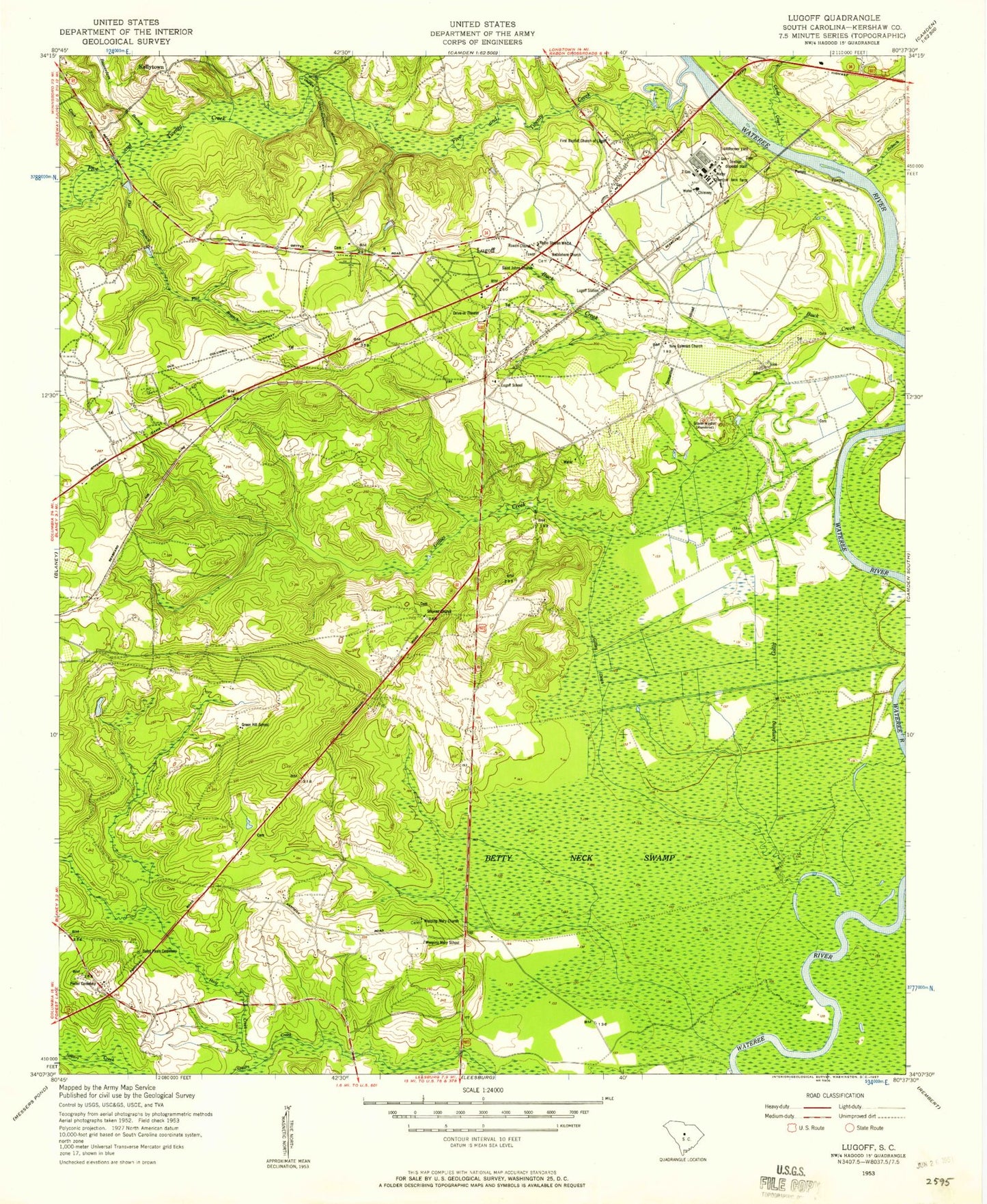
Classic USGS Lugoff South Carolina 7.5'x7.5' Topo Map
Couldn't load pickup availability
Historical USGS topographic quad map of Lugoff in the state of South Carolina. Map scale may vary for some years, but is generally around 1:24,000. Print size is approximately 24" x 27"
This quadrangle is in the following counties: Kershaw.
The map contains contour lines, roads, rivers, towns, and lakes. Printed on high-quality waterproof paper with UV fade-resistant inks, and shipped rolled.
Contains the following named places: Beaverdam Creek, Belmont Plantation, Bethlehem Church, Betty Neck Swamp, Bolton Branch, Bramblewood Plantation, Buck Creek, Camp Creek, Carnes Pond, Carys Fort Plantation, Cook Run, Crescent School, Duck Pond, Elgin Division, First Baptist Church of Lugoff, Flat Branch, Four Seasons, Fredricksburg Pond, Gettysburg, Gilles Ditch, Gillies Creek, Green Hill School, Green Valley, Gum Swamp, Haig Creek, Jordan Mill, Jumping Gully, Kellytown, Kershaw County Fire Station Doby's Mill, Lugoff, Lugoff Census Designated Place, Lugoff Elementary School, Lugoff Fire Department Station 10, Lugoff Fire Department Station 8, Lugoff Fire Department Sub - Station 9, Lugoff School, Lugoff Station, Lugoff-Elgin High School, Lugoff-Elgin Middle School, Mayfield Acres, New Ephesus Church, Oglesby Plantation, Over the Hill Airport, Pecan Grove, Pecan Orchard, Pepper Ridge, Pindar Hill Plantation, Pine Land, Pine Mark, Porter Cemetery, Ralph Pond, Ralph Smith Pond Dam D-2544, Rowan Church, Saint John Church, Saint Johns Church, Saint Pauls Cemetery, Saint Pauls Church, Sandwood Hills, Smyrna Church, South Carolina Noname 28015 D-2540 Dam, South Carolina Noname 28024 D-2538 Dam, South Carolina Noname 28031 D-2541 Dam, South Carolina Noname 28033 D-2542 Dam, South Carolina Noname 28043 D-2530 Dam, South Carolina Noname 28050 Dam, Spring Village, Stokes Pond, Stokes Pond Dam D-2543, The Groves, Thunderwoods, Twentyfive Mile Creek, Wateree Farm Pond Number One, Wateree Farm Pond Number Three, Waterham Plantation, WCAM-AM (Camden), Weeping Mary Church, Weeping Mary School, Whitehead Brothers Pond, Woodland Forest, WPUB-FM (Camden), ZIP Code: 29078