MyTopo
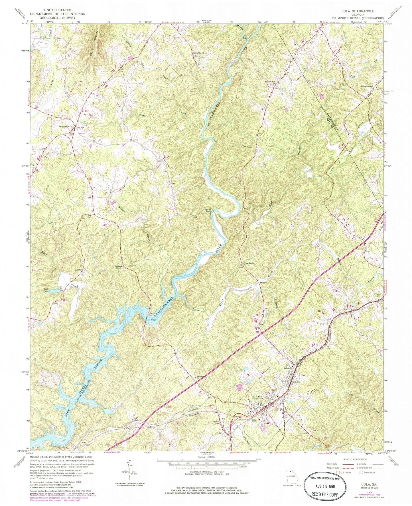
Classic USGS Lula Georgia 7.5'x7.5' Topo Map
Couldn't load pickup availability
Historical USGS topographic quad map of Lula in the state of Georgia. Map scale may vary for some years, but is generally around 1:24,000. Print size is approximately 24" x 27"
This quadrangle is in the following counties: Banks, Habersham, Hall.
The map contains contour lines, roads, rivers, towns, and lakes. Printed on high-quality waterproof paper with UV fade-resistant inks, and shipped rolled.
Contains the following named places: Bellton, Bellton Baptist Cemetery, Bellton Bridge, Bellton Church, Bellton Creek, Belton, Bethlehem Church, Calvary Cross Church, City of Lula, Clemons Chapel, Clemons Chapel Cemetery, Crowder Ford, Dog Creek, Don Carter State Park, Enon Church, Enon School, First Baptist Church, Flat Creek, Garner Creek, Glade Lake, Glade Lake Dam, Glades, Hagen Creek, Hall County Fire Station 6, Haynie Lake, Haynie Lake Dam, Hog Mountain, Holly Springs Cemetery, Holly Springs Church, Hulsey Cemetery, Kings Church, Little John Creek, Little Mud Creek, Living Mission Cemetery, Living Mission Church, Living Word Tabernacle, Lula, Lula Bridge, Lula Elementary School, Lula Park, Lula Post Office, Lula Residential Historic District, Mossy Creek, Mud Creek, Pitts Creek, Pleasant Grove Cemetery, Pleasant Grove Church, Pleasant Hill Cemetery, Pleasant Hill Church, Seven Island Ford, Skitt Mountain School, Skitts Mountain Cemetery, Skitts Mountain Church, Whitmire Lake Dam, ZIP Code: 30554