MyTopo
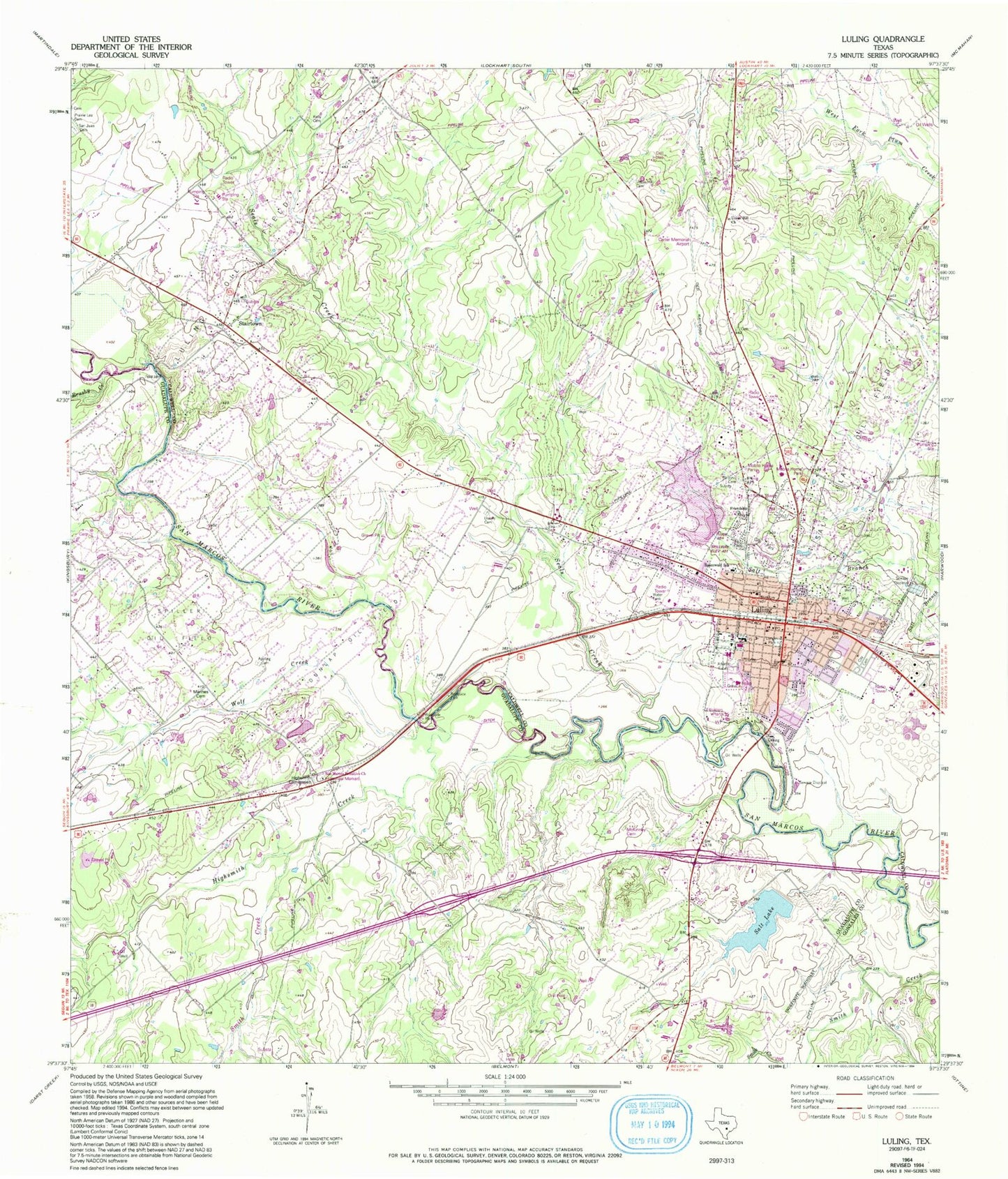
Classic USGS Luling Texas 7.5'x7.5' Topo Map
Couldn't load pickup availability
Historical USGS topographic quad map of Luling in the state of Texas. Map scale may vary for some years, but is generally around 1:24,000. Print size is approximately 24" x 27"
This quadrangle is in the following counties: Caldwell, Gonzales, Guadalupe.
The map contains contour lines, roads, rivers, towns, and lakes. Printed on high-quality waterproof paper with UV fade-resistant inks, and shipped rolled.
Contains the following named places: Antioch Baptist Church, Appling Cemetery, Ascension Seton Edgar Davis Hospital, Bethel Tabernacle Pentecostal Church of God, Brushy Creek, Caldwell County Constable's Office Precinct 2, Carter Lake, Carter Lake Dam, Central Baptist Church, City of Luling, Dunlap Oil Field, Episcopal Church of the Annunciation, First Baptist Church, First Presbyterian Church, Friendship Church, Gatesville Public Library, Highsmith Cemeteries, Highsmith Creek, Kelly Cemetery, Leonard Shanklin Elementary School, Longer Park, Luling, Luling City Hall, Luling Emergency Medical Service, Luling Fire Department Station 1, Luling Fire Department Station 2, Luling High School, Luling Junior High School, Luling Oil Field, Luling Police Department, Luling Post Office, Luling Primary School, Marines Cemetery, Martin Memorial Church of God in Christ, Mount Pleasant Church, Northside Park, PAM Specialty Hospital of Luling, Rocky Creek, Rose Lake, Rose Lake Dam, Rosenwald Primary School, Rosenwald School, Saint Johns Cemetery, Salt Lake, Seals Creek, Smith Creek, Soil Conservation Service Site 38 Dam, Soil Conservation Service Site 38 Reservoir, Southside Park, Spiller Oil Field, Stairtown, Taylor Methodist Church, The Carter Memorial Airport, Union Hill Cemetery, Union Hill Church, Ussery Cemetery, Wolf Creek, ZIP Code: 78648


