MyTopo
Classic USGS Lumberton Mississippi 7.5'x7.5' Topo Map
Couldn't load pickup availability
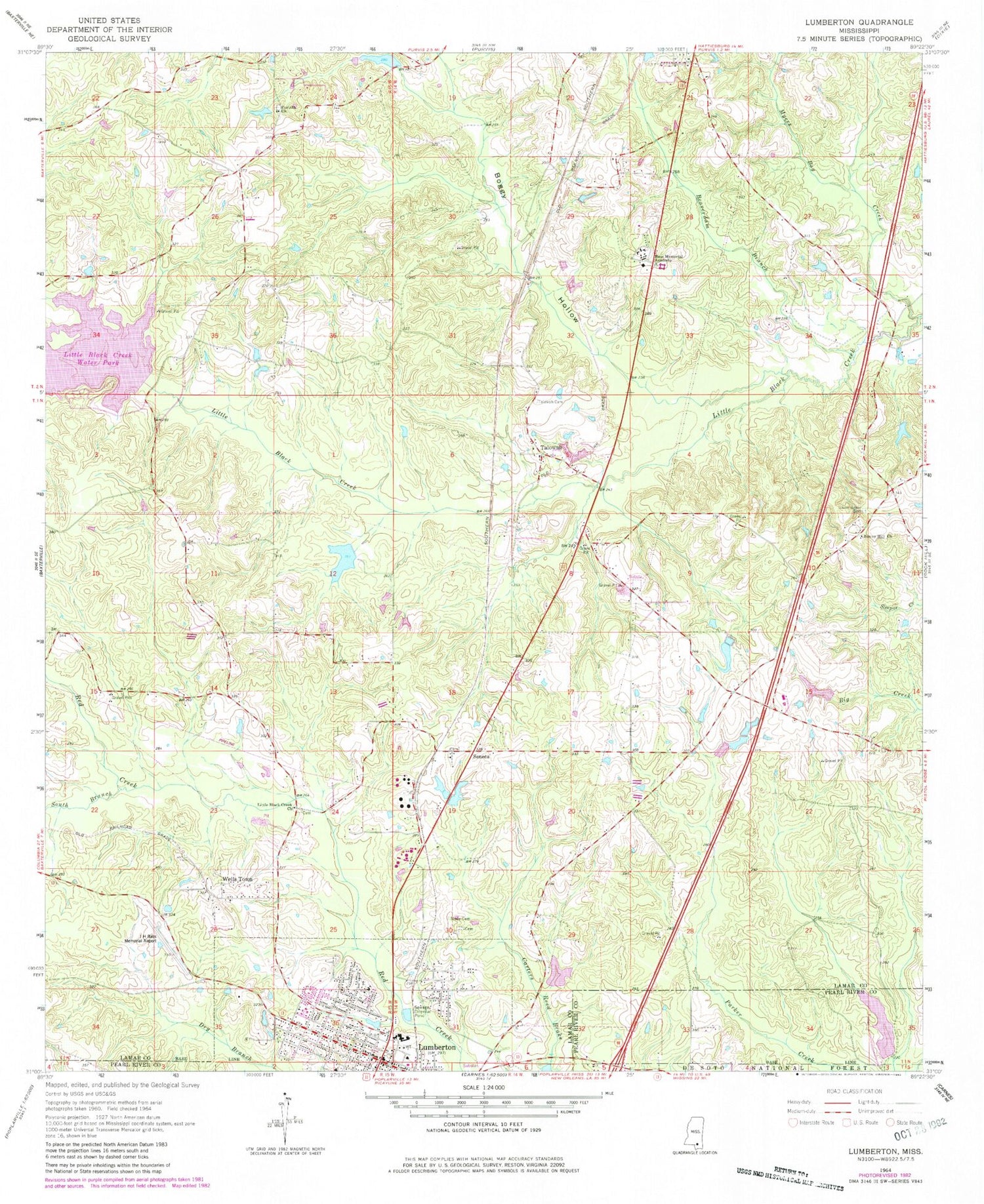
Historical USGS topographic quad map of Lumberton in the state of Mississippi. Map scale may vary for some years, but is generally around 1:24,000. Print size is approximately 24" x 27"
This quadrangle is in the following counties: Lamar, Pearl River.
The map contains contour lines, roads, rivers, towns, and lakes. Printed on high-quality waterproof paper with UV fade-resistant inks, and shipped rolled.
Contains the following named places: Bass Memorial Academy, Bass Pecan Plant Pond Dam, Beaverdam Branch, Boggy Hollow, Buster Crider Pond Dam, Christ Gospel Church, City of Lumberton, Corinth Baptist Church, Corinth Cemetery, Corinth School, Freedom Strip, Gateway Baptist Church, Hanford, Harmon, Hoyle D Byrd, I H Bass Jr Memorial Airport, Little Black Creek Cemetery, Little Black Creek Church, Little Black Creek Water Park, Little Creek, Lumberton, Lumberton Citizens Hospital, Lumberton Family Life Center, Lumberton Fire Department, Lumberton Police Department Chief of Police, Lumberton Post Office, Morning Star Baptist Church, Mrs Florine Ulmer Pond Dam, Myers Bay Creek, Our Lady of Perpetual Help Church, Pat Harrison Waterway Lake Dam, Paul H Barrett Lake Dam, Rehoboth Word of Life Fellowship Church, Samuel Slade Cemetery, Sawed Horn Spring, Seneca, Seneca Cemetery, Slade Cemetery, South Branch Red Creek, Southeast Lamar Volunteer Fire Department - Station 1, Sunny Hill Church, Supervisor District 2, Sweet Beulah Missionary Baptist Church, Tabernacle Baptist Church, Talowah, Talowah Cemetery, Trinity Christian Fellowship Church, Union Grove Cemetery, Wells Town, West Boggy Hollow Creek, Yawn School, Zion Hill Baptist Church, ZIP Code: 39455


