MyTopo
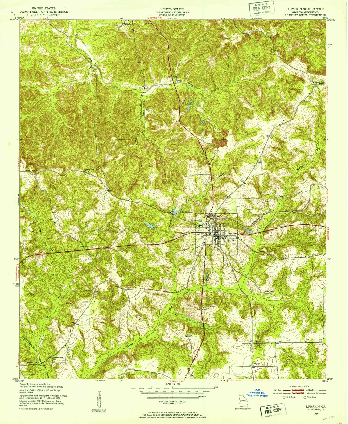
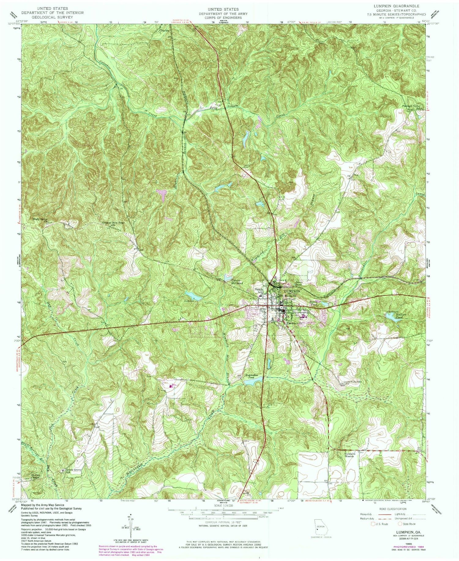
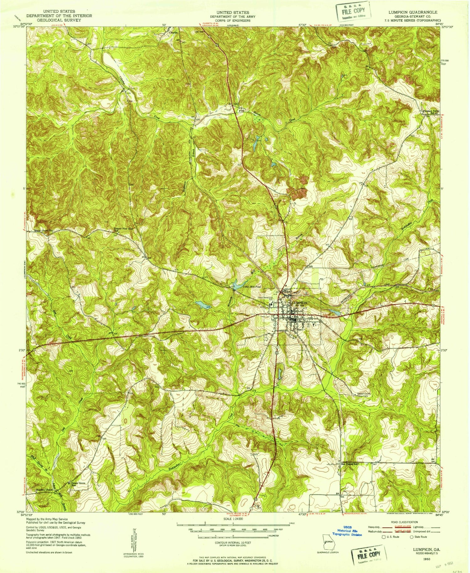
Classic USGS Lumpkin Georgia 7.5'x7.5' Topo Map
Couldn't load pickup availability
Historical USGS topographic quad map of Lumpkin in the state of Georgia. Map scale may vary for some years, but is generally around 1:24,000. Print size is approximately 24" x 27"
This quadrangle is in the following counties: Stewart.
The map contains contour lines, roads, rivers, towns, and lakes. Printed on high-quality waterproof paper with UV fade-resistant inks, and shipped rolled.
Contains the following named places: Adams Mill, Ball Branch, Ben Daniel School, Bluff Springs Branch, City of Lumpkin, Davis Pond, Dowd School, East Main Street Residential Historic District, East Side Cemetery, Ebenezer Cemetery, Ebenezer Church, Elders Pond, First Baptist Church, Forts Pond, Forts Pond Dam, Frog Bottom Creek, Greater New Hope Church, Greater New Hope Church Cemetery, Greater New Hope School, Greater Saint Mark AME Church Cemetery, Green Grove Church, Green Grove School, Hightower Branch, Hodchodkee Pond, Hodchodkee Pond Dam, Holders Pond, Holders Pond Dam, Humber School, Humbers Mission, Johnson Hill Church, Lumpkin, Lumpkin Commercial Historic District, Lumpkin Police Department, Lumpkin Post Office, Lumpkin Volunteer Fire Department, North Side Cemetery, Peek Hollow, Pigtail Alley Historic District, Pleasant Valley School, Saint Marks Church, Saint Phillip Church, Second Methodist Church, Shady Grove Church, Shady Grove Church Cemetery, Shorter Chapel, Stewart County, Stewart County Correctional Institution, Stewart County Courthouse, Stewart County Prison Farm, Stewart County Sheriff's Office, Stewart-Quitman High School, Uptown Residential Historic District, Ushers Millpond, Ushers Millpond Dam, Vorus Bridge, West Branch, Westville, Wimberly Mill Branch, ZIP Code: 31815