
MyTopo
Classic USGS Luna Arkansas 7.5'x7.5' Topo Map
Couldn't load pickup availability
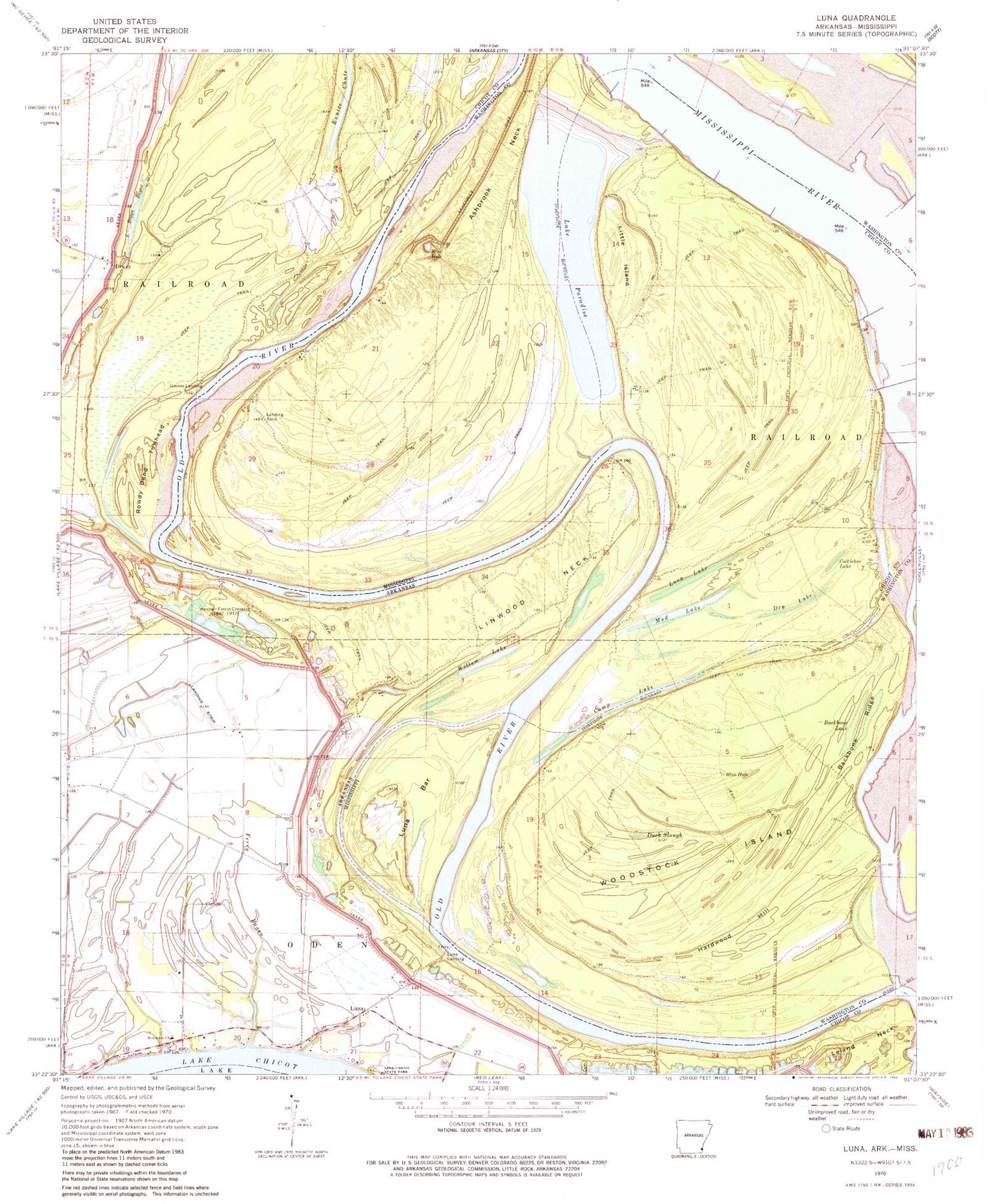
Historical USGS topographic quad map of Luna in the states of Arkansas, Mississippi. Map scale may vary for some years, but is generally around 1:24,000. Print size is approximately 24" x 27"
This quadrangle is in the following counties: Chicot, Washington.
The map contains contour lines, roads, rivers, towns, and lakes. Printed on high-quality waterproof paper with UV fade-resistant inks, and shipped rolled.
Contains the following named places: Ashbrook Cutoff, Ashbrook Neck, Ashbrook Point, Backbone Lake, Backbone Ridge, Blue Hole, Camp Lake, Carter Point, Carter Point Landing, Cocklebur Lake, Dewey, Dewey Landing, Dry Lake, Duck Slough, Eunice Chute, Ferry Bayou, Gaines Landing, Hardwood Hill, Island Number 81, Island Number 82, Lake Boggy Bayou, Lake Paradise, Leland Neck, Leland Neck Revetment, Linwood Landing, Linwood Neck, Little Island, Long Lake, Luna, Luna Bar, Luna Landing, Mud Lake, Old River, Panther Forest Crevasse, Panther Forest Landing, Panther Forest Revetment, Paradise Lake Dam, Point Comfort, Point Comfort Landing, Rossmere Church, Rowdy Bend, Rowdy Bend Towhead, Sevenmile Dike, Spanish Moss Bend, Spanish Moss Revetment, Vinson, Willow Lake, Woodstock Island


