MyTopo
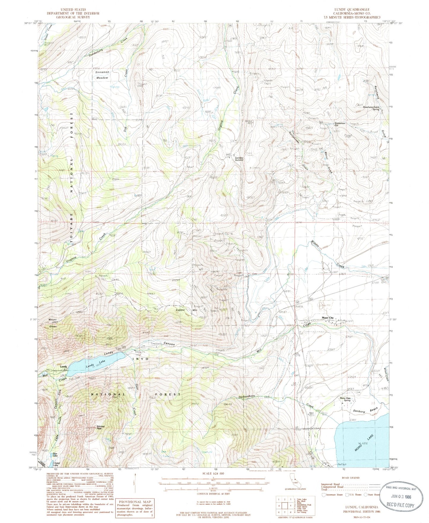
Classic USGS Lundy California 7.5'x7.5' Topo Map
Couldn't load pickup availability
Historical USGS topographic quad map of Lundy in the state of California. Typical map scale is 1:24,000, but may vary for certain years, if available. Print size: 24" x 27"
This quadrangle is in the following counties: Mono.
The map contains contour lines, roads, rivers, towns, and lakes. Printed on high-quality waterproof paper with UV fade-resistant inks, and shipped rolled.
Contains the following named places: Bacon Gulch, Blue Lake, Conway Ranch, Conway Summit, Copper Mountain, Crystal Lake, Danburg Beach, Dechambeau Creek, Deer Creek, Dunderberg Creek, Lake Canyon, Lundy Canyon, Lundy Lake, Mill Creek, Mono Diggings, Mono Vista Spring, Mount Olsen, Rancheria Gulch Spring, Rattlesnake Gulch, Sinnamon Cut, Sinnamon Meadow, South Fork Mill Creek, Virginia Lakes Pack Outfit, Conway Guard Station, Jordan Spring, Lundy Canyon Recreation Site, Gilcrest Peak, Lundy, Mono Lake Tufa State Natural Reserve, Lundy Lake 104-035 Dam, Mono City, Lakes Canyon Trailhead, Mono City Census Designated Place, Bureau of Land Management - Mono Lake Fire Station, Mono City Fire Protection District, Mono Lake, Copper Mountain Cemetery, Lundy Cemetery, Mono Cemetery