
MyTopo
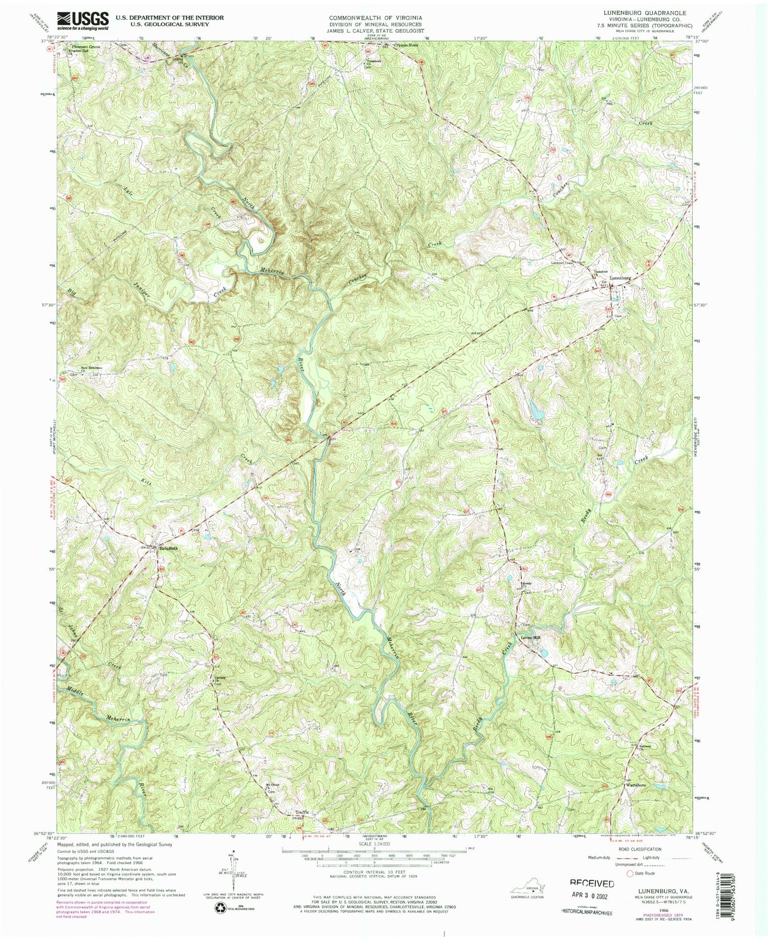
Classic USGS Lunenburg Virginia 7.5'x7.5' Topo Map
Couldn't load pickup availability
Historical USGS topographic quad map of Lunenburg in the state of Virginia. Map scale may vary for some years, but is generally around 1:24,000. Print size is approximately 24" x 27"
This quadrangle is in the following counties: Lunenburg.
The map contains contour lines, roads, rivers, towns, and lakes. Printed on high-quality waterproof paper with UV fade-resistant inks, and shipped rolled.
Contains the following named places: Bethany Church, Bethlehem Reformed Zion Union Apostolic Church, Big Juniper Creek, Calvary Church, Couches Creek, Crymes Store, Hurricane Creek, Kits Creek, Loves Mill, Loves Mill District, Lunenburg, Lunenburg Census Designated Place, Lunenburg County Courthouse, Lunenburg County Sheriff's Office, Lunenburg Courthouse Historic District, Lunenburg Post Office, Lyle Creek, McCormicks Mill, Mount Olivet Church, New Hope Church, New Rehoboth Church, Reedy Church, Reedy Creek, Reedy Creek Christian Church, Rehoboth, Rosewood, Saint Johns Creek, Thowhorn Dam, Traffic, Tussekiah Church, Victoria Fire Department, Wattsboro, ZIP Codes: 23952, 23974


