MyTopo
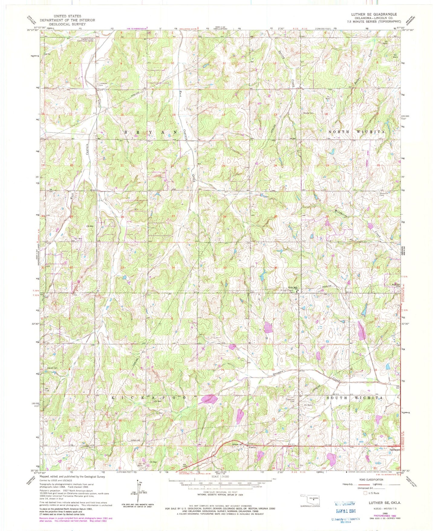
Classic USGS Luther SE Oklahoma 7.5'x7.5' Topo Map
Couldn't load pickup availability
Historical USGS topographic quad map of Luther SE in the state of Oklahoma. Map scale may vary for some years, but is generally around 1:24,000. Print size is approximately 24" x 27"
This quadrangle is in the following counties: Lincoln.
The map contains contour lines, roads, rivers, towns, and lakes. Printed on high-quality waterproof paper with UV fade-resistant inks, and shipped rolled.
Contains the following named places: Anderson Cemetery, Captain Creek Community Center, Fowler, Frost Ranch Airport, Hillside Church, Jacktown, Jacktown Airport, Jacktown Fire Department, Jamison Cemetery, Kickapoo Oklahoma Tribal Statistical Area, Levescy Airport, Mammoth Church, Newby Cemetery, Oknoname 08101 Dam, Oknoname 08101 Reservoir, Quapaw Creek Site 22 Dam, Quapaw Creek Site 22 Reservoir, Quapaw Creek Site 24 Dam, Quapaw Creek Site 24 Reservoir, Quapaw Creek Site 25 Dam, Quapaw Creek Site 25 Reservoir, Quapaw Creek Site 26 Dam, Quapaw Creek Site 26 Reservoir, Quapaw Creek Site 27 Dam, Quapaw Creek Site 27 Reservoir, Quapaw Creek Site 28 Dam, Quapaw Creek Site 28 Reservoir, Quapaw Creek Site 29 Dam, Quapaw Creek Site 29 Reservoir, Quapaw Creek Site 30 Dam, Quapaw Creek Site 30 Reservoir, Quapaw Creek Site 32 Dam, Quapaw Creek Site 32 Reservoir, Rossville Cemetery, Saint Pauls Lutheran Cemetery, Southwest Lincoln County Fire Protection District 1 Station 1, Southwest Lincoln County Fire Protection District 1 Station 2, Tom Ferrell Community Cemetery, Township of Bryan, Township of Kickapoo, White Rock Elementary School, Wilson Chapel Cemetery