MyTopo
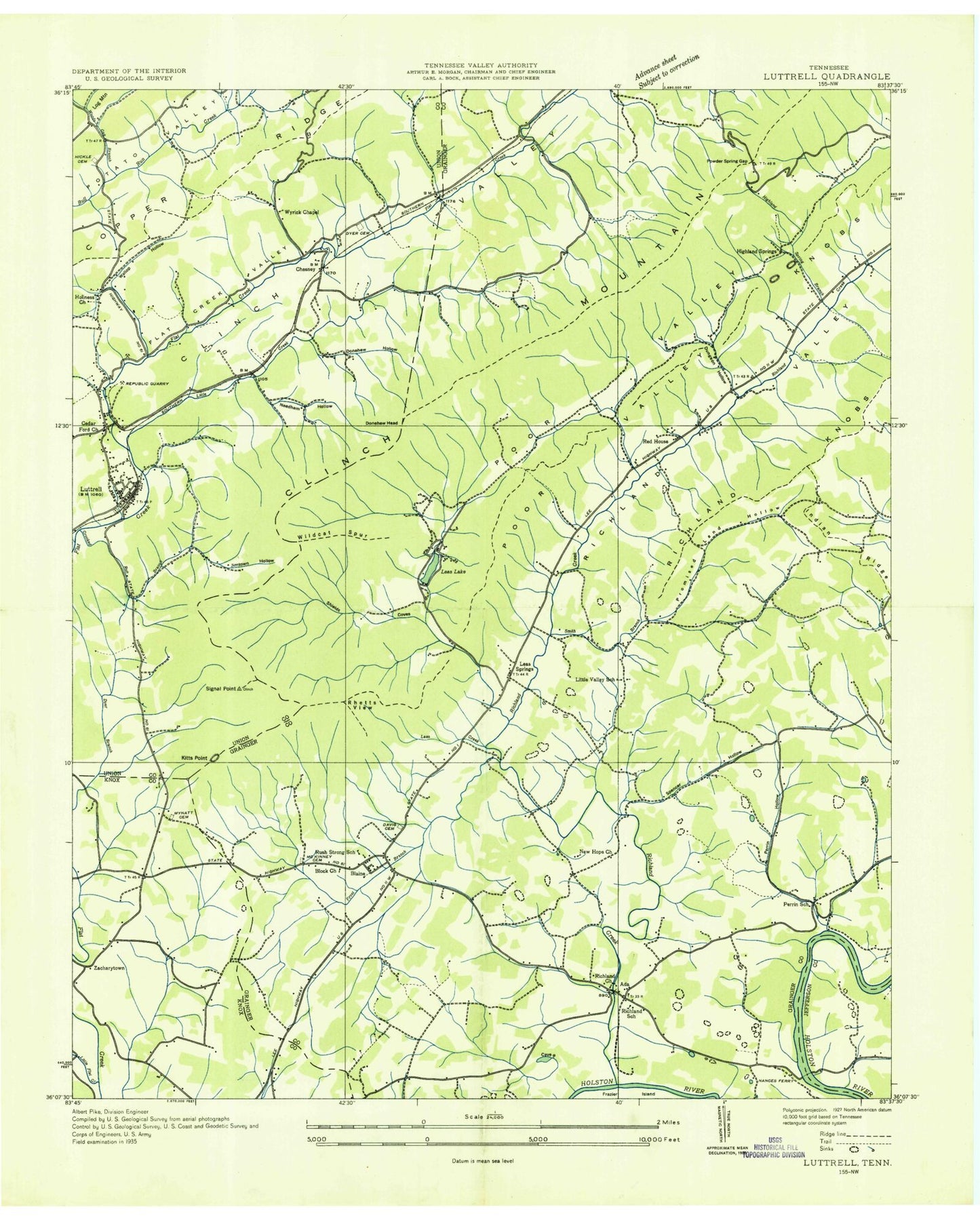
Classic USGS Luttrell Tennessee 7.5'x7.5' Topo Map
Couldn't load pickup availability
Historical USGS topographic quad map of Luttrell in the state of Tennessee. Map scale may vary for some years, but is generally around 1:24,000. Print size is approximately 24" x 27"
This quadrangle is in the following counties: Grainger, Jefferson, Knox, Union.
The map contains contour lines, roads, rivers, towns, and lakes. Printed on high-quality waterproof paper with UV fade-resistant inks, and shipped rolled.
Contains the following named places: Ailor, Blaine, Blaine Police Department, Blaine Post Office, Blaine Volunteer Fire Department, Block House Church, Booker Hollow, Brock Cemetery, Brown School, Cedar Ford Church, Chamberlain Cemetery, Chesney, Chesney School, Chestnut Flat, City of Blaine, Clinch Valley, Commissioner District 2, Commissioner District 3, Crooked Run, Davis Cemetery, Donehew Head, Donehew Hollow, Dungeon Hollow, Dyer Branch, Dyer Cemetery, Flat Creek Valley, Frost Branch, Hamilton Gap Branch, Heatherly Spring, Hickie Cemetery, Highland Springs, Highland Springs Branch, Highland Springs Cove Dam, Highland Springs Cove Lake, Highlands, Holiness Church, Jarnagin Cemetery, Jimtown Hollow, Kitts Point, Laurel Hollow, Lea Creek, Lea Lake, Lea Lake Dam, Lea Springs, Lea Springs Baptist Church, Lea Springs Cemetery, Leas Creek, Lick Branch, Little Creek, Little Flat Creek, Little Valley Cemetery, Little Valley Church, Little Valley School, Luttrell, Luttrell Division, Luttrell Post Office, Luttrell Volunteer Fire Department, Maples, McKinney Cemetery, Melton Field, Mitchell Cemetery, Mitchell Ford, Mouth of Richalnd Cemetery, Mouth of Richland Baptist Church, Mynatt Cemetery, Nance Cemetery, Nance Ferry, Nances Island, Nances Shoals, Needham Hollow, New Hope Church, Perrin Hollow, Perrin Hollow Cemetery, Perrin Hollow School, Poor Valley, Powder Spring Gap, Promised Land Hollow, Race Track Bluff, Red House, Red House Baptist Church, Red House Cemetery, Red House School, Republic Quarry, Rhetts View, Richland, Richland Creek, Richland School, Richland Valley, Rush Strong School, Rutledge Division, Shields Cove, Shipe Cemetery, Signal Point, Silo Hollow, Smith Branch, Smith Hollow, Smith Hollow Branch, Spencer Hollow, Spout Spring Branch, Stillhouse Hollow, Stone Cemetery, Stones Mill, Sulphur Spring, Texas Hollow, Town of Luttrell, Vineyard Cemetery, Wallop Hollow, Wildcat Spur, Willow Spring Church, WIMZ-FM (Knoxville), Woods Gap Branch, Wyrick Chapel, Zachary Cemetery, Zacharytown, ZIP Codes: 37709, 37848


