MyTopo
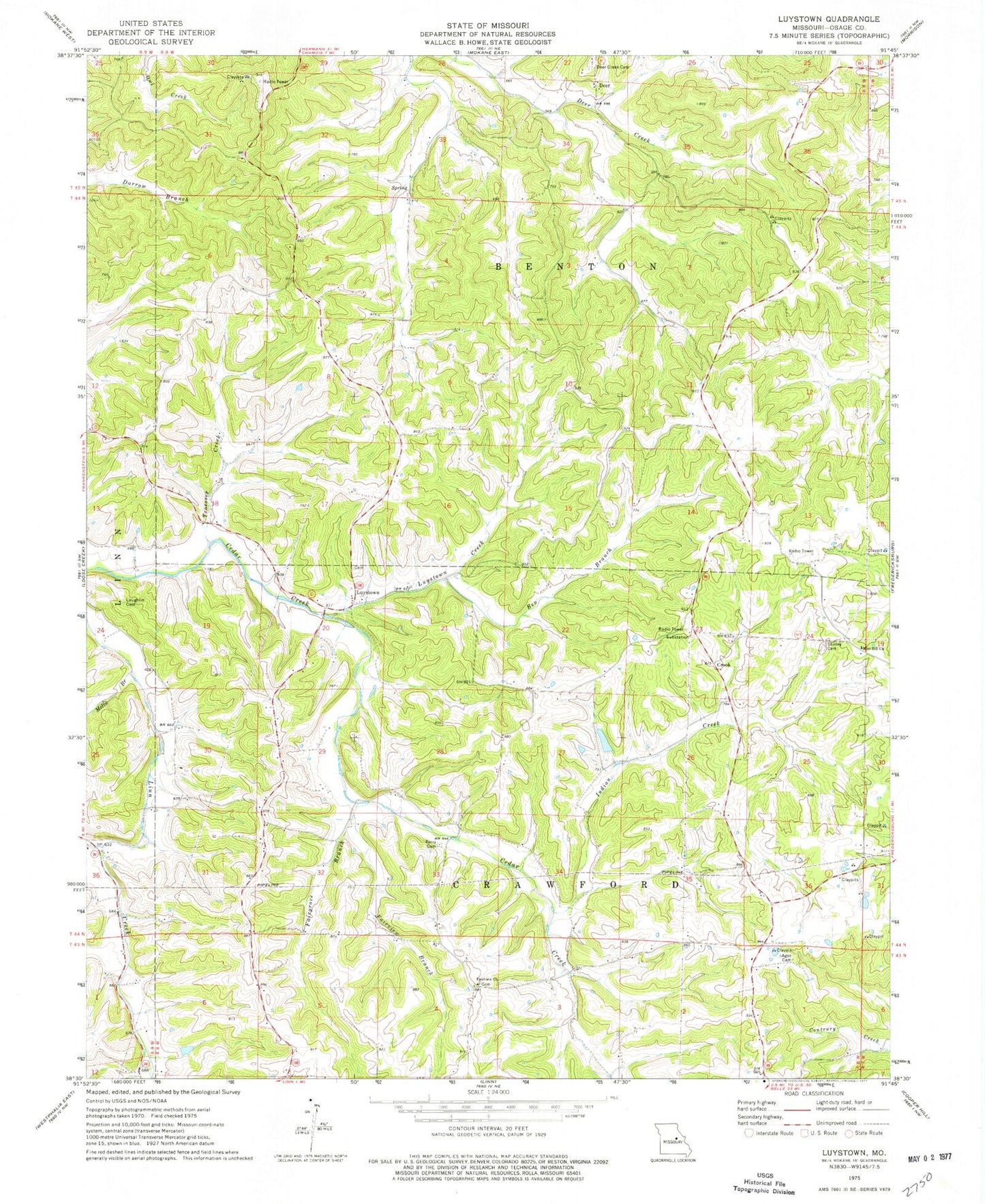
Classic USGS Luystown Missouri 7.5'x7.5' Topo Map
Couldn't load pickup availability
Historical USGS topographic quad map of Luystown in the state of Missouri. Map scale may vary for some years, but is generally around 1:24,000. Print size is approximately 24" x 27"
This quadrangle is in the following counties: Osage.
The map contains contour lines, roads, rivers, towns, and lakes. Printed on high-quality waterproof paper with UV fade-resistant inks, and shipped rolled.
Contains the following named places: Agee Cemetery, Baileys Creek, Ben Branch, Boes School, Crook, Deer, Deer Creek Cemetery, Deer Creek School, Fairgrove Branch, Fairview Branch, Fairview Church, Flat Rock School, Flora School, Franken Lake, Franken Lake Dam, Georgetown School, Indian Creek, Lake Acres, Lake Acres Dam, Laughlin Cemetery, Luystown, Luystown Creek, Melin Branch, Mint Hill Church, Mount Pleasant School, Peachland, Perry Cemetery, Shirley Cemetery, Troesser Creek, Union Church, ZIP Code: 65024