MyTopo
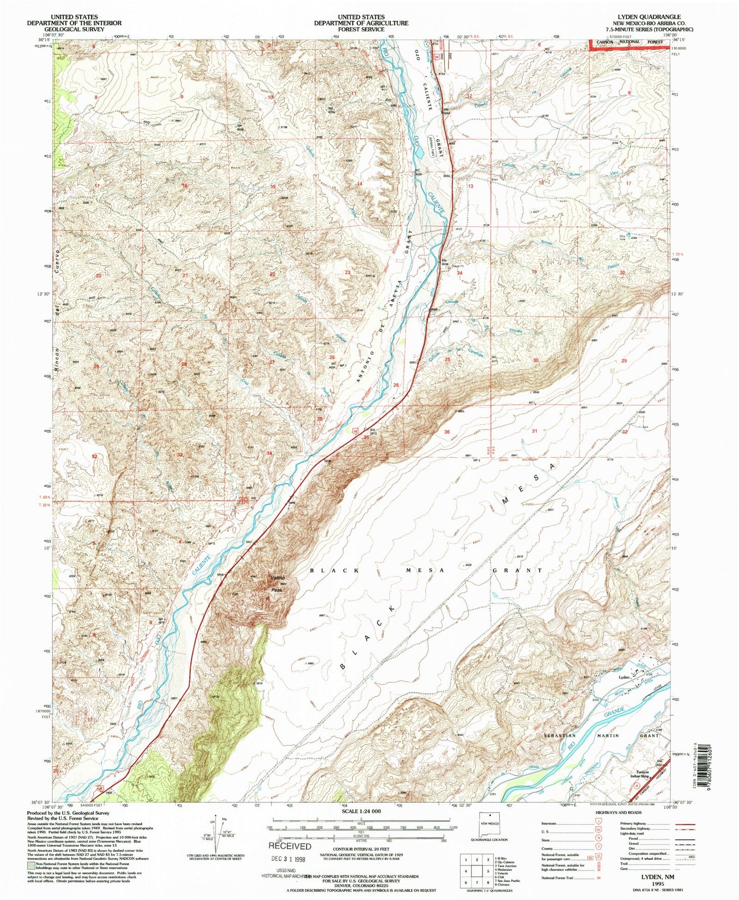
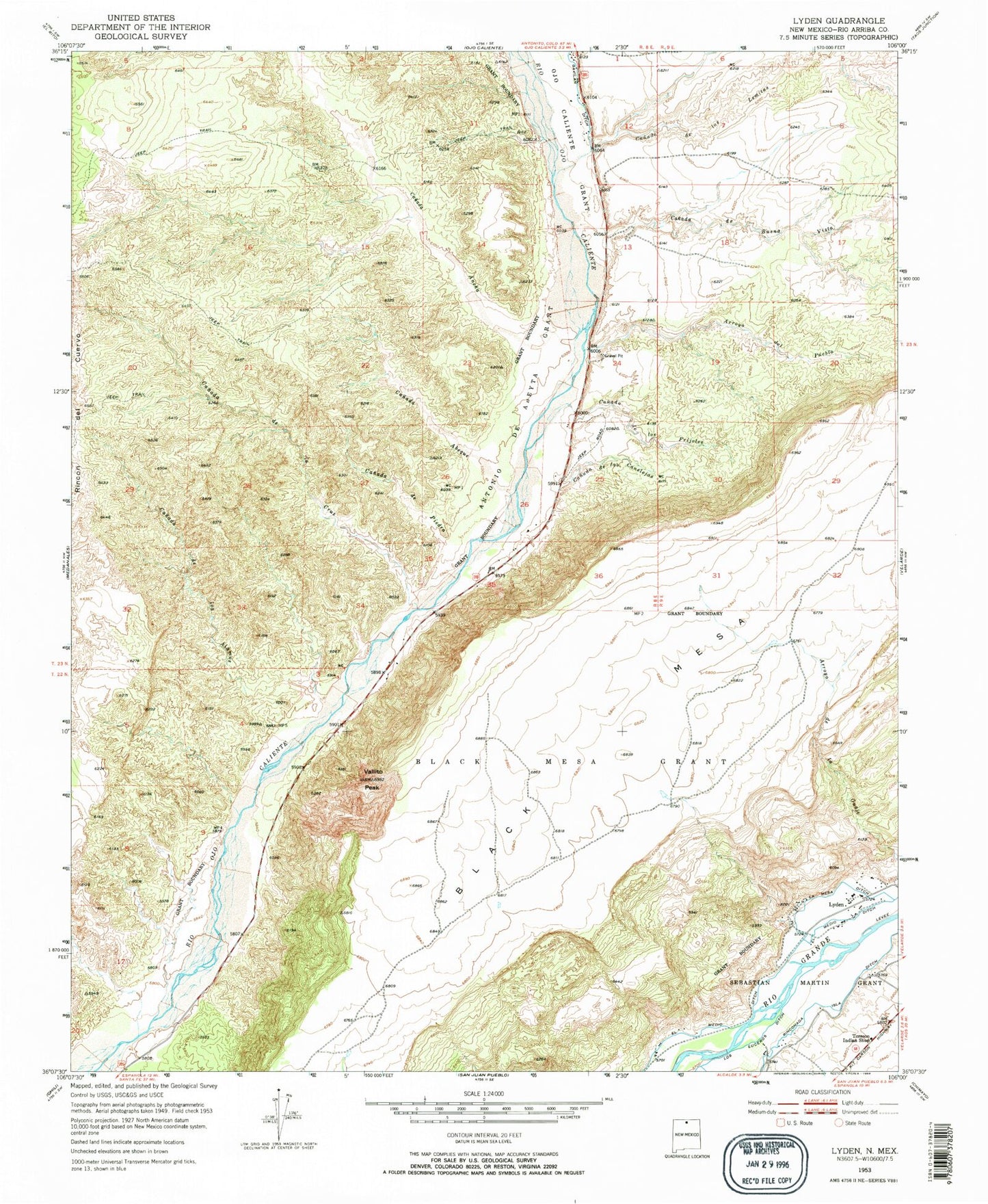
Classic USGS Lyden New Mexico 7.5'x7.5' Topo Map
Couldn't load pickup availability
Historical USGS topographic quad map of Lyden in the state of New Mexico. Map scale may vary for some years, but is generally around 1:24,000. Print size is approximately 24" x 27"
This quadrangle is in the following counties: Rio Arriba.
The map contains contour lines, roads, rivers, towns, and lakes. Printed on high-quality waterproof paper with UV fade-resistant inks, and shipped rolled.
Contains the following named places: Antonio de Abeyta Grant, Arroyo del Pueblo, Black Mesa Grant, Canada Abeque, Canada Ancha, Canada de Buena Vista, Canada de la Canelejas, Canada de la Cruz, Canada de Piedra, Canada las Lemitas, Canada los Alamos, Canada los Frijoles, El Medio Ditch, La Mesa Ditch, Layden Bentonite Deposit, Lyden, Lyden Census Designated Place, Lyden Post Office, RG-10052 Water Well, RG-10089 Water Well, RG-17833 Water Well, RG-19131 Water Well, RG-19887 Water Well, RG-22670 Water Well, RG-25763 Water Well, RG-32076 Water Well, RG-5626 Water Well, RG-7879 Water Well, RG-9894 Water Well, Rinconada Isla Ditch, Sandlin Arroyo, Torreon Indian Shop, Vallito Peak, ZIP Codes: 87549, 87582