MyTopo
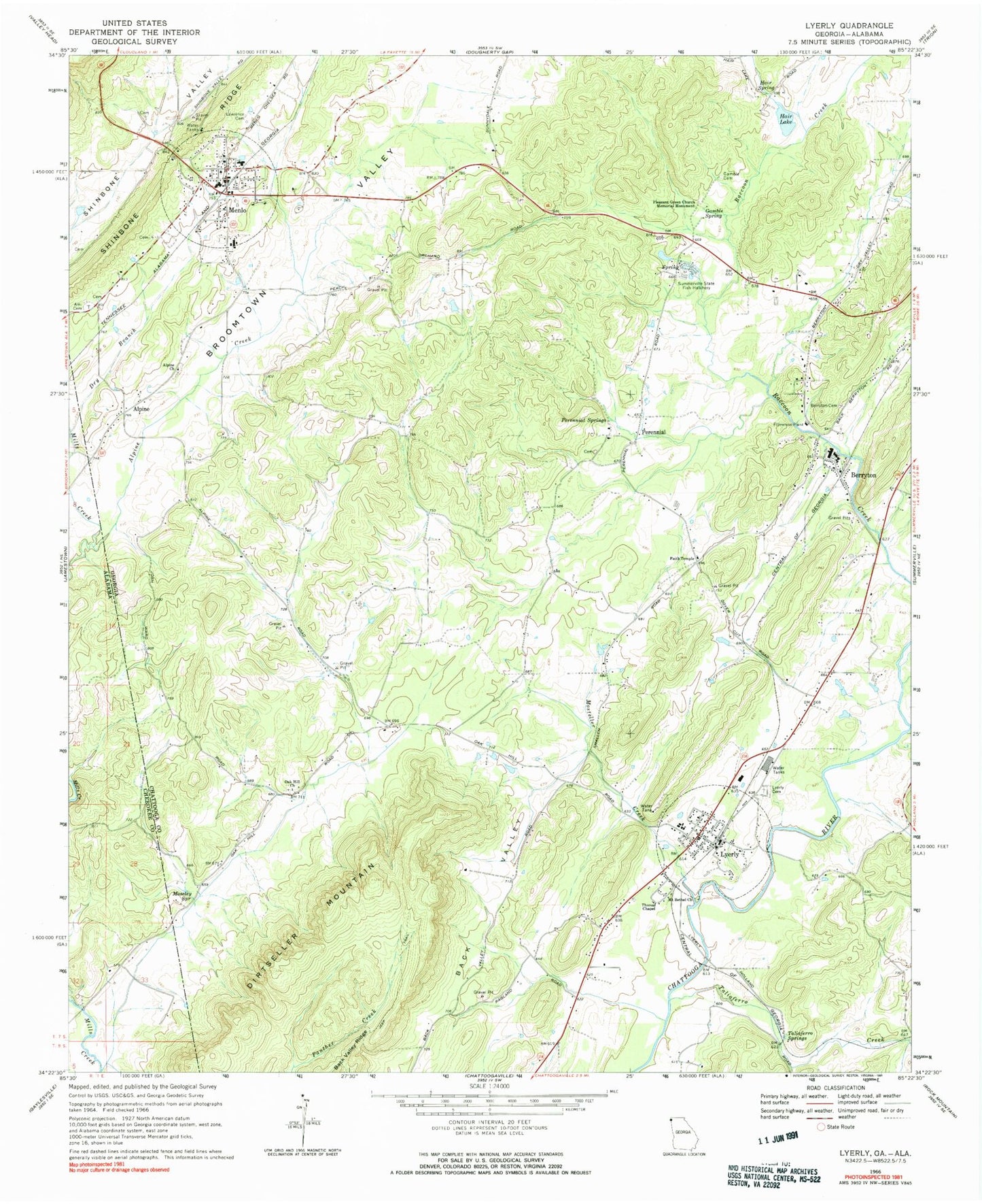
Classic USGS Lyerly Georgia 7.5'x7.5' Topo Map
Couldn't load pickup availability
Historical USGS topographic quad map of Lyerly in the states of Georgia, Alabama. Map scale may vary for some years, but is generally around 1:24,000. Print size is approximately 24" x 27"
This quadrangle is in the following counties: Chattooga, Cherokee.
The map contains contour lines, roads, rivers, towns, and lakes. Printed on high-quality waterproof paper with UV fade-resistant inks, and shipped rolled.
Contains the following named places: Alpine, Alpine Church, Alpine Creek, Ami Cemetery, Angus McLeod Park, Berryton, Berryton Baptist Church, Berryton Cemetery, Berryton Church of God, City of Menlo, Clarks Creek, Dirtseller Mountain, Dry Branch, Fairview, Faith Temple, First Baptist Church of Lyerly, Fosters Store, Gamble Cemetery, Gamble Spring, Hair Lake, Hair Lake Dam, Hair Spring, Jones Chapel, Lawrence Cemetery, Lyerly, Lyerly Cemetery, Lyerly City Hall, Lyerly Elementary School, Lyerly High School, Lyerly Post Office, Lyerly Volunteer Fire Department, Menlo, Menlo Cemetery, Menlo Elementary School, Menlo Park, Menlo Post Office, Menlo Volunteer Fire Department, Mineral Springs, Moseley Springs, Mosteller Creek, Mount Bethel Church, Oak Hill Church, Perennial, Perennial Springs, Perrennial Springs Baptist Church, Pleasant Green Church Memorial Monument, Pleasant Green Presbyterian Church, Starkville, Summerville State Fish Hatchery, Taliaferro, Taliaferro Creek, Taliaferro Springs, Thomas Chapel, Town of Lyerly