
MyTopo
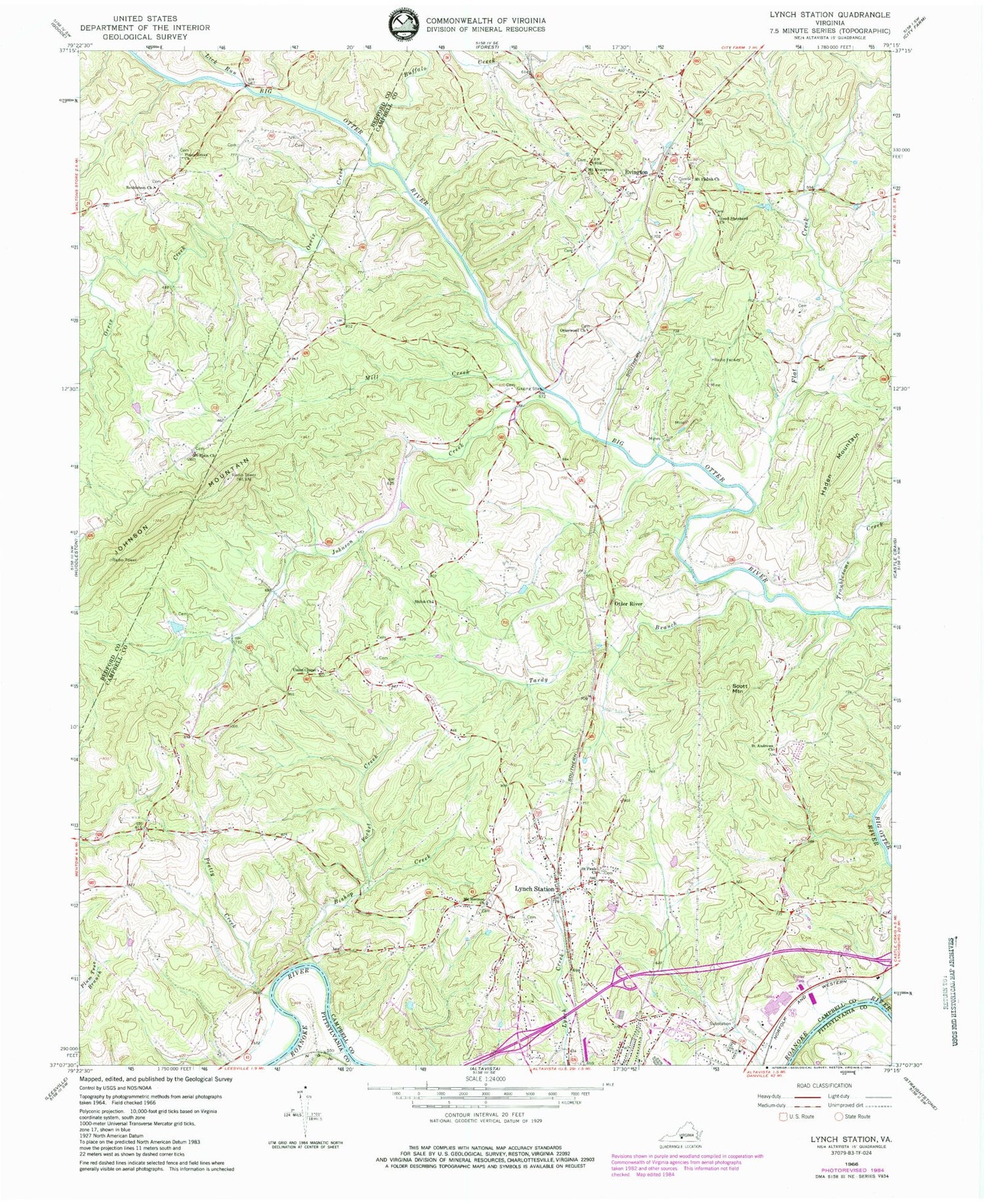
Classic USGS Lynch Station Virginia 7.5'x7.5' Topo Map
Couldn't load pickup availability
Historical USGS topographic quad map of Lynch Station in the state of Virginia. Typical map scale is 1:24,000, but may vary for certain years, if available. Print size: 24" x 27"
This quadrangle is in the following counties: Bedford, Campbell, Pittsylvania.
The map contains contour lines, roads, rivers, towns, and lakes. Printed on high-quality waterproof paper with UV fade-resistant inks, and shipped rolled.
Contains the following named places: Bethlehem Baptist Church, Bishop Creek, Buffalo Creek, Flat Creek, Good Shepherd Church, Johnson Creek, Johnson Mountain, Lick Run, Lynch Station, Mill Creek, Mount Evergreen Church, Mount Hermon Church, Mount Pisgah Church, Mount Plain Church, Orrix Creek, Otter River, Otterwood Church, Piney Grove Church, Pocket Creek, Pretty Creek, Saint Andrews Church, Saint Pauls Church, Shiloh Church, Tardy Branch, Troublesome Creek, Union Chapel, Big Otter River, Evington, Haden Mountain, Scott Mountain, WRVL-FM (Lynchburg), Altavista Elementary School, Lynch Station Baptist Church, Lakewood, Campbell County Industrial Park, Mount Hermon Cemetery, Vaughn Cemetery, Seminole Ridge, Town of Altavista Industrial Park, Valley View Heights, Altavista District, Lynch Station Post Office, White Oak Springs Dairy Farm, Evington Volunteer Fire Department Station 1 Headquarters, Altavista Emergency Medical Services, Evington Post Office


